Colorado Historic Markers


Denver Area - Mile-High city

Denver County

Click on thumbnails to see larger images.


Auraria
Denver County
Denver - Northeast corner of 14th and Market, west edge of Lower Downtown.
N 39°44'53" W 105°00'05"
photos taken 12/1/07
           
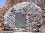
This tablet is the property of the State of Colorado. Auraria. On November 1, 1858, the center of this stream was designated the east boundary of Auraria, first duly located and platted town at the mouth of Cherry Creek. This 1,200 acre settlement, with Indian row and "Uncle Dick" Wootton's store, was the definite beginning of Denver. The town was named for Auraria, Georgia, meaning "gold". William Green Russell and his brothers discovered the first gold in paying quantity in Colorado, inciting the gold rush of 1859. Auraria was the cradle of Colorado's pioneer business and political development. On April 5, 1860,a ratification meeting was held by moonlight, on the Larimer Street bridge one block south, at which Auraria and Denver consolidated under the name Denver. Erected by the State Historical Society of Colorado from the Mrs. J. N. Hall Foundation and by the Peace Pipe Chapter, Daughters of the American Revolution. 1959.

Camp Weld
Denver County
Denver - Northeast corner of W 8th Ave and Vallejo St. Because of barriers along 8th Ave, north on Wayandot St, east on W Mulberry St, south on Vallego St to 8th.
N 39°43'46" W 105°00'46"
photos taken 12/21/07
        
This tablet is the property of the State of Colorado. This is the southwest corner of Camp Weld established September 1861 for Colorado Civil War volunteers. Named for Lewis L. Weld, first secretary of Colorado Territory. Troops leaving here Feb. 22, 1862, won victory over Confederate forces at La Glorieta, New Mexico. Saved the southwest for the Union. Headquarters against Indians 1964-65. Camp abandoned 1865. Erected by the State Historical Society of Colorado from the Mrs. J. N. Hall Foundation and by the city and county of Denver. 1934.

Elephant Corral
Denver County
Denver - Southeast corner of 14th and Blake, west edge of Lower Downtown.
N 39°44'55" W 105°00'07"
photos taken 12/1/07
           
This tablet is the property of the State of Colorado. Immediately north-east of this point and covering much of block 18 East Denver stood the famous Elephant Corral camp ground, immigrant headquarters and stock yards of pioneer Denver. Begun early in 1859 by Blake & Williams with their Denver House, the first hotel in Denver City. Horace Greeley was a guest here and addressed the pioneers June 6, 1859. During the 1860s the Corral was surrounded by an eight-foot wall having loopholes for Indian defense. Placed by the State Historical Society of Colorado from the Mrs. J. N. Hall Foundation and by the city and county of Denver. 1935.

Elephant Corral - Original Location
Denver County
Denver - 1400 block of Wazee St in Lower Downtown.
N 39°44'59" W 105°00'06"
photos taken 12/1/07
           

Gold Was Discovered
Denver County
Denver - Inspiration Point Park, northwest corner of Sheridan Blvd and 49th St, a short walk west of parking lot.
N 39°47'14" W 105°03'33"
photos taken 12/1/07
           
This tablet is the property of the State of Colorado. One mile north of this point gold was discovered on June 22, 1850 by a party of California-bound Cherokees. The discovery was made by Louis Ralston whose name was given the creek (a branch of Clear Creek). Reports of the find brought the prospecting parties of 1858, whose discoveries caused the Pikes Peak Gold Rush of 1859, which resulted in the permanent settlement of Colorado. Erected by the State Historical Society of Colorado from the Mrs. J. N. Hall Foundation and by the city and county of Denver. 1941.

Manhattan Beach
Denver County
Denver - Sloan's Lake Park, north side of lake, south of Byron Pl and Oak St, south side of stone boat house.
N 39°45'09" W 105°02'53"
photos taken 12/1/07
              
This tablet is the property of the State of Colorado. On the northwest shore of Sloan's Lake was Manhattan Beach. Popular amusement park of the gay nineties, with a theater, boating, dancing, and specialties. Opened on June 27, 1891. The theater burned Dec. 26, 1908. Some amusement features continued to 1914. Erected by the State Historical Society of Colorado from the Mrs. J. N. Hall Foundation and by American Pioneer Trails Association and the city administration of Denver. 1953.

Overland Park
Denver County
In Denver, west of Santa Fe Blvd, just north of Jewell St. and Huron St., on the the south side of the Overland Park golf building.
N 39°40'58" W 104°59'51"
photos taken 4/3/08
              
This tablet is the property of the State of Colorado. Overland Park. Most historical of Denver's municipal parks. Created in 1882. This site was homesteaded in 1862 by "Potato" Clark. Jim Beckwourth, mulatto "daredevil" erected a home in 1860 .6 mile northeast. Sam Brown's toll bridge of 1859 located 4 miles south. Gold discovered during July 1858 .2 mile southwest by Green Russell's party from Georgia. That fall log cabins of Montana City were built about .5 mile south of this spot. Gold traces were found at Spanish Diggings 2 miles north in 1857. Erected by the State Historical Society of Colorado from the William A. Braiden Foundation and by Sons of the American Revolution, American Pioneer Trails, and the western history students of South High School, 1948.

Platte River Trail
Denver County
Denver - Southwest corner of Brighton Blvd and York St, NE of Denver National Western.
N 39°47'29" W 104°57'34"
photos taken 12/1/07
           
This memorial is the property of the State of Colorado. Commemorating the route of the Platte River Trail . Principal route of Colorado pioneers. Trail of Major S.H. Long in 1820. Trappers' trail of 1830s and 1840s. The 1858-59 route of goldseekers with pick and pan, homeseekers in covered wagons, bullwhackers with ox teams, stagecoaches with treasure and mail. The path that became an empire. Erected by the State Historical Society of Colorado from the Mrs. J. N. Hall Foundation and by state civil service employees of Colorado. 1932.

The Rocky Mountain News
Denver County
Denver - Northeast corner of 14th and Market, west edge of Lower Downtown.
N 39°44'53" W 105°00'05"
photos taken 12/1/07
           
This tablet is the property of the State of Colorado. On this site stood the original home of the Rocky Mountain News, first newspaper established in the "Pikes Peak Gold Region," founded by Wm. N. Byers, April 23, 1859, champion of law and order in "Jefferson Territory;" advocate of faith in emerging Colorado. Located on neutral ground between pioneer towns, Denver and Auraria. Building and press lost in Great Cherry Creek Flood, May 19, 1864. Erected by the State Historical Society of Colorado from the Mrs. J. N. Hall Foundation commemorating the 75th anniversary of the founding of Colorado's first newspaper. April 23, 1934.

Smoky Hill Trail
Denver County
Denver - The Pioneer Monument, northwest corner of Broadway and Colfax, one block west of State Capitol.
N 39°44'25" W 104°59'16"
photos taken 12/1/07
              
This tablet is the property of the State of Colorado. Here was the end of the famous Smoky Hill Trail immigrant and stage road extending from the Missouri River to Denver. Traversed by pioneers in 1858. Surveyed by W.G. Russell in 1860. Route of Butterfield's Overland Despatch and Wells-Fargo Express. The trail took its human toll - death by thirst and Indian raids. Placed by the State Historical Society of Colorado from the Mrs. J. N. Hall Foundation and by the city and county of Denver. 1936.

Street Cars
Denver County
Denver - Southwest corner of Broadway and Colfax, one block west of State Capitol. Along the north edge of Civic Center Park.
N 39°44'26" W 104°59'19"
photos taken 1/26/08
        
This tablet is the property of the State of Colorado. This plaque was presented to the city of Denver by the Colorado State Historical Society and the American Pioneer Trails Assocation on June 3, 1950, the day street cars were retired and the city's transit system was converted to rubber-tired vehicles. The plaque commemorates the passing of the street car which served the city's transit needs for nearly 80 years starting with the horse car December 17, 1871. The plaque was placed here near the site at the corner of Colfax and Broadway of the large cable house which provided power for transit lines during the era when the Welton Street line was one of the longest street car cable lines in the world 65,600 feet. Placed by the State Historical Society of Colorado through the Mrs. J. N. Hall Foundation. 1950.


Back to Colorado Historic Markers page
Back to Pass Bagger page

© 2008-12 Randy Bishop
Last modified: January 8, 2012