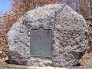
Bronze Plaques Located at Colorado Mountain Passes
Click on thumbnails to see larger images.
Berthoud Pass
Clear Creek County
US-40 north of Empire
N 39°47'54.1" W 105°46'33.6" == 39.798370N 105.775987W
Photos from 5/21/2005 and 9/20/2008 showing old and new monument at the summit.
This memorial is the property of the State of Colorado. Berthoud Pass. Across the Continental
Divide between South Platte and Colorado River drainages. Altitude 11,314 feet. Discovered by
Capt. E. L. Berthoud, Colorado pioneer, May 12, 1861. Surveyed by Berthoud and Jim Bridger July,
1861. Toll road opened 1874. Improved highway opened 1923. Erected by the State Historical
Society of Colorado from the Mrs. J. N. Hall Foundation and by the State Highway Department and
the U.S. Forest Service, 1929.
Cameron Pass
Larimer County
At Cameron Pass on north side of CO-14. The bronze plaque is missing from the boulder.
N 40°31'15.9" W 105°53'32.1" == 40.521087N 105.892240W
photos taken 8/1/2009
Bronze plaque read:
This memorial is the property of the State of Colorado. Cameron Pass. Across the Continental Divide between Cache la Poudre and
Michigan rivers. Altitude 10,285. Discovered 1870 by R.A. Cameron, founder of Fort Collins. Used as an early mail and freight route.
Improved highway opened 1926. Erected with the U.S. Forest Service, 1929.
Cochetopa Pass
Saguache County
County Road NN14 west of Saguache. A recent photo shows the bronze plaque is missing from the boulder.
N 38°09'46.8" W 106°36'01.6" == 38.163009N 106.600435W
photos taken 7/5/2007
photos by John Meyer, 10/16/2016
This memorial is the property of the State of Colorado. Cochetopa Pass. Across Continental Divide
between Rio Grande and Gunnison River drainages. Altitude 10,032 feet. The "buffalo gate" of the
Utes. On early pack trail to California. Surveyed by Gunnison and by Fremont for railroad route,
1853. Toll road built 1869. Improved highway opened 1914. Erected by the State Historical Society
of Colorado from the Mrs. J. N. Hall Foundation and by the State Highway Department and the U.S.
Forest Service, 1929.
Please contact History Colorado (the state of Colorado's history musuem) if you know the
current location of the missing 1929-vintage bronze marker.
It needs to be returned to that scenic back road so others can enjoy it and learn a bit of Colorado history. Thank you.
Cumbres Pass
Conejos County
CO-17 west of Antonito
N 37°01'9.1" W 106°26'55.2" == 37.019181N 106.448665W
photos taken 7/15/2006
This memorial is the property of the State of Colorado. Cumbres Pass. Near Continental Divide
between the waters of the Rio Grande and the San Juan. "Cumbres" is Spanish for "summits".
Altitude 10,022 feet. Railroad built 1880. Toll road built 1881. Improved highway opened 1923.
Erected by the State Historical Society of Colorado from the Mrs. J. N. Hall Foundation and by
the State Highway Department and the U.S. Forest Service, 1929.
Fremont Pass
Lake County
CO-91 east of Leadville
N 39°22'05.8" W 106°11'19.0" == 39.368275N 106.188621W
photos taken 8/6/2005
This memorial is the property of the State of Colorado. Fremont Pass. On Continental Divide
between Arkansas and Blue River drainages. Altitude 11,316 feet. Western boundary of the
Louisiana Purchase of 1803. Named in honor of John C. Fremont, famous western explorer. Erected
by the State Historical Society of Colorado from the Mrs. J. N. Hall Foundation and by the Mount
Massive Chapter, Daughters of the American Revolution, of Leadville. 1930.
Gore Pass
Grand County
CO-134 northwest of Kremmling. On south side of CO-134 at entrance to former National Forest Service Gore Pass Camp Ground.
N 40°04'28.7" W 106°33'36.4" == 40.074627N 106.560110W
photos taken 6/19/2016
photos taken 8/11/2007
This tablet is the property of the State of Colorado. Gore Pass. Altitude 9,000 feet. Here in
1855 crossed Sir St. George Gore, an Irish baronet bent on slaughter of game and guided by Jim
Bridger. For three years, he scoured Colorado, Montana and Wyoming accompanied usually by forty
men, many carts, wagons, hounds and unexampled camp luxuries. More than 2,000 buffalo, 1,600 elk
and deer, 100 bears were massacred for sport. A trail by 1866, a wagon road by 1874, this modern
highway opened 1956. Erected by the citizens of Routt and Grand counties and the State
Historical Society of Colorado through the Mrs. J. N. Hall Foundation.
Hoosier Pass
Park County
On west side of CO-9 north of Fairplay
N 39°21'42.5" W 106°03'46.3" == 39.361819N 106.062873W
photos taken 8/6/2005
This memorial is the property of the State of Colorado. Hoosier Pass. Across Continental Divide
between South Park and the Blue River. Altitude 11,542 feet. Crossed by Fremont 1844. Named for
Hoosier Gulch. Discovered and worked as a placer camp by Indiana men 1860. Erected by the State
Historical Society of Colorado from the Mrs. J. N. Hall Foundation and by the State Highway
Department and the U.S. Forest Service. 1929.
South Park (at Kenosha Pass)
Park County
On southeast side of US-285 east of Jefferson
N 39°24'12.3" W 105°45'16.1" == 39.403421N 105.754460W
photos taken 4/25/2008
This memorial is the property of the State of Colorado. Spread before you lies the famous
South Park entered by Kenosha Pass, elevation 10,000 feet. The Bayou Salado of early
trappers, favorite Indian hunting ground, and frequent battleground. Visited by Z.M. Pike in
1806. Crossed by J.C. Fremont in 1844. Permanent settlement inaugurated by gold discoveries
in 1859. Erected by the State Historical Society of Colorado from the Mrs. J. N. Hall
Foundation and by State Civil Service Employees of Colorado, 1932.
(Old) La Veta Pass
Huerfano County
Old US-160 west of Alamosa. Stone marker is there, but bronze plaque was missing prior to 1970.
N 37°35'35.0" W 105°12'12.0" == 37.593047N 105.203341W
photos taken 4/23/2005
La Veta Pass. Between the waters of the Arkansas and the Rio Grande. Altitude 9,382 feet. "La Veta" is Spanish for "the vein."
Named for the mineral veins appearing on the mountains. Narrow guage railroad built 1877. Railroad later re-located. Abandoned grade
converted into highway 1921-22. Erected 1929.
(Old) Monarch Pass
Chaffee County
On FR-237 north of Monarch Pass on US-40 west of Poncha Springs. Stone marker is there, but bronze plaque was missing prior to 1970.
N 38°29'52.1" W 106°20'15.6" == 38.497802N 106.337674W
photos taken 6/11/2005
Monarch Pass. Across the Continental Divide between Arkansas and Gunnison River drainages. Altitude 11,386 feet. The Monarch
Mining District, opened in the late seventies, lies east of the pass. Improved highway opened 1921. Erected with the U.S. Forest
Service, 1929.
(Old) Rabbit Ears Pass
Jackson County
On FR-315 north of Rabbit Ears Pass on US-40 southeast of Steamboat Springs
N 40°24'00.0" W 106°37'05.2" == 40.399877N 106.618109W
photos taken 8/12/2007
This memorial is the property of the State of Colorado. Rabbit Ears Pass. Across Continental
Divide between North Park and the Yampa River. Altitude 9,680 feet. Named from Rabbit Ears Peak
which was so called by earliest trappers because of its appearance. Improved highway opened 1919.
Erected by the State Historical Society of Colorado from the Mrs. J. N. Hall Foundation and by
the State Highway Department and the U.S. Forest Service. 1929.
Raton Pass
Las Animas County
On the north-bound (east) side of I-25 between Raton, NM, and Trinidad, CO.
At north end of the pull-out, behind the fence by the large water tank.
Previously was by the stairs leading up to the old picnic area.
N 36°59'40.3" W 104°28'48" == 36.994536N 104.480023W
photos taken 4/23/2005
photos taken 4/16/2009
photos taken 5/15/2017
This memorial is the property of the State of Colorado. Raton Pass. Between Colorado and New
Mexico. Altitude 7,881 feet. "Raton" is Spanish for "mouse." On mountain branch Santa Fe Trail,
crossed by Kearny's Army of the West in the Mexican War and by First Regiment, Colorado
Volunteers in the Civil War. "Uncle Dick" Wootton's toll road built 1865. Railroad constructed
1878. Improved highway built 1919-1922. Erected by the State Historical Society of Colorado from
the Mrs. J. N. Hall Foundation and by the State Highway Department. 1929.
Red Mountain Pass
Ouray County
On west side of US-550 south of Ouray
N 37°53'56.1" W 107°42'43.7" == 37.898940N 107.712140W
photos taken 7/16/2006
This memorial is the property of the State of Colorado. Red Mountain Pass. Across divide between
Uncompahgre and Animas Rivers. Altitude 11,018 feet. "The Million Dollar Highway" toll road built
by Otto Mears 1882. Improved highway opened 1924. Erected by the State Historical Society of
Colorado from the Mrs. J. N. Hall Foundation and by the State Highway Department and the U.S.
Forest Service. 1929.
Tennessee Pass
Lake County
US-24 north of Leadville, on north side of Tennesee Pass Road from the 10th Mountain Division Memorial.
N 39°21'44.3" W 106°18'38.8" == 39.362303N 106.310775W
photos taken 6/3/2008
This memorial is the property of the State of Colorado. Tennessee Pass. Across Continental
Divide between Arkansas and Eagle Rivers. Altitude 10,424 feet. Named from Tennessee Fork
of the Arkansas. Explored by Fremont and Kit Carson 1845. Railroad constructed 1881. Erected
by the State Historical Society of Colorado from the Mrs. J. N. Hall Foundation and by the
State Highway Department and the U.S. Forest Service. 1929.
Ute Pass
El Paso County
Manitou Springs - Plaque is located on the rock wall on the east side of Manitou Avenue at the north edge
of Manitou Springs, right before the underpass to merge onto north-bound US-24.
N 38°52'14.0" W 104°55'32.8" == 38.870559N 104.925782W
photos taken 3/26/2008
This memorial is the property of the State of Colorado. Ute Pass. Named from the Old Ute Trail
which led from South Park through Manitou to the plains. Traversed by the Utes on hunting and
war expeditions. Improved highway built 1916-28. Erected by the State Historical Society of
Colorado from the Mrs. J. N. Hall Foundation and by the State Highway Department and the U.S.
Forest Service. 1929.