Colorado Historic Markers


South Central Colorado - Wide Valleys and Soaring Peaks

Alamosa, Chaffee, Conejos, Costilla, Lake, Mineral, Park, Rio Grande, Saguache, and Summit Counties

Click on thumbnails to see larger images.


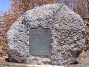
Christmas 1806
Chaffee County
US-285 north of Poncha Springs at milepost 132. Sign was erected in 1964.
N 38°35'32" W 106°05'06"
photos taken 4/25/2008
              
This tablet is the property of the State of Colorado. Christmas 1806. Frustrated in their attempt to climb Pike's Peak on November 27, 1806, Zebulon Pike and his party of 15 trudged on through South Park looking for the Red River, southern boundary of the Louisiana Purchase. After crossing Trout Creek Pass, the explorers came again to the Arkansas River, with food perilously low. On Christmas eve two hunting parties shot eight buffalo, and Christmas day was spent near the mouth of Squaw Creek (one-half mile to the south) feasting on buffalo and repairing equipment. Early in 1807 Pike crossed into the San Luis Valley at the Great Sand Dunes and built a log stockade (reconstructed as a state historical monument) on the Conejos River near present La Jara, where he was taken prisoner by the Spanish. Erected by the State Historical Society of Colorado from the Mrs. J.N. Hall Endowment, the Chaffee County Pioneer and Historical Society, and the State Highway Department.

(Old) Monarch Pass
Chaffee County
FR-237 north of Monarch Pass on US-40 west of Poncha Springs. Stone marker is there, but bronze plaque was missing prior to 1970.
N 38°29'52.1" W 106°20'15.6" == 38.497802 -106.337674
photos taken 6/11/2005
        
According to The Colorado Magazine, Volume 47, Number 3, Summer 1970. "Tales Told with Markers" article, plaque read:
Monarch Pass. Across the Continental Divide between Arkansas and Gunnison River drainages. Altitude 11,386 feet. The Monarch Mining District, opened in the late seventies, lies east of the pass. Improved highway opened 1921. Erected with the U.S. Forest Service, 1929.

Poncha Springs
Chaffee County
In Poncha Springs behind the visitor center, on NW corner of US-50 and US-285.
N 38°31'17.0" W 106°04'51.2" == 38.521385N 106.080895W
photos taken 9/21/2012
              
Crossroads of the Rockies - Cities in the Wilderness - The Roof of the Rockies - Poncha Springs Country

photos of new historical sign taken 6/15/2021


Antonito
Conejos County
In Antonito, across US-285 from Cumbres & Toltec station.
N 37°04'16.8" W 106°00'41.9" == 37.071326N 106.011639W
photos taken 10/5/2009
                 
The Horse and the Indian - The Cumbres & Toltec - Welcome to Colorado - Antonito Country

Conejos County Memorial
Conejos County
Just north of Romeo, on west side of US-285.
N 37°10'41.4" W 105°59'12.9" == 37.178156N 105.986940W
photos taken 10/5/2009
        
In Honor and Memory of the Citizens of Conejos County Who Served in World War I and World War II

Cumbres Pass
Conejos County
CO-17 west of Antonito
N 37°01'9.1" W 106°26'55.2" == 37.019181 -106.448665
photos taken 7/15/2006
     
This memorial is the property of the State of Colorado. Cumbres Pass. Near Continental Divide between the waters of the Rio Grande and the San Juan. "Cumbres" is Spanish for "summits". Altitude 10,022 feet. Railroad built 1880. Toll road built 1881. Improved highway opened 1923. Erected by the State Historical Society of Colorado from the Mrs. J. N. Hall Foundation and by the State Highway Department and the U.S. Forest Service, 1929.

La Jara Consolidated School
Conejos County
In La Jara, at northeast corner of Main and Poplar Streets.
N 37°16'29.0" W 105°57'27.7" == 37.274709N 105.957681W
photos taken 10/5/2009
                 
This tablet is the property of the State of Colorado. The La Jara Consolidated School District Number 1 organized January 25, 1915, for the betterment of rural education. The first consolidated school in the San Luis Valley. Monument erected by the State Historical Society of Colorado from the William A. Braiden Foundation and by the students and Board of Education of this consolidated school. 1950.

Board of Education, John W. Shawcroft, James P. McKelvey, W. S. Mount. County Superintendent of Schools, Fred T. Christensen. Contractor, Erick G. Peterson.

Plaque by old train station: Howsam Park. Bob Howsam was born February 28, 1918 in Denver, Colorado. His parents, Lee and Mary, moved the family to La Jara in 1926 to produce honey. Bob was an All Valley basketball player for the La Jara Wildcats in 1936. He attended the University of Colorado and served in WWII as a Navy test and delivery pilot. He married Janet Johnson in 1939 and they raised two sons, Robert Jr. and Edwin, who were born in Alamosa. Bob, Lee, and his brother Earl bought the Denver Bears in 1947. The Bears set minor league records annually, even outdrawing several major league teams. Bob brought professional football to Denver in 1959 as a founding member of the American Football League. He sold the Broncos in 1961. Bob was the general manager of the St. Louis Cardinals when the team won the World Series in 1964. He was president and general manager of the Cincinnati Reds when the "The Big Red Machine" won two consecutive world series in 1975 and 1976. He was inducted into the Colorado Sports Hall of Fame in 1971 and the Cincinnati Reds Hall of Fame in 2004. Although Bob Howsam's career took him far from La Jara, he never forgot his home in the valley, his many friends, and the experiences that helped shape his life. The Howsam family thanks La Jara Rotary Club for the dedication of this park. Erected by La Jara Rotary Club 2004.

Mormon Pioneers
Conejos County
In Manassa, on CO-142 northeast across from Dempsey Park.
N 37°10'26.8" W 105°56'04.6" == 37.174120, -105.934600
photos taken 10/5/2009
              
This memorial is the property of the State of Colorado. Mormon Pioneers. In 1878, Mormon pioneers came from the southern states and Utah, settling first at Los Cerritos. In 1879, they organized the town of Manassa, built homes, a school house, and place of worship from native logs. Settlements of Ephraim (1879) and Richfield (1881) and others having been made, the San Luis Stake was organized June 9, 1883. Erected by the State Historical Society of Colorado from the Mrs. J. N. Hall Foundation and by Daughters of L.D.S. Pioneers, 1963.

Our Lady of Guadalupe
Conejos County
West of US-285 in Conejos, at entrance to grounds of Our Lady of Guadalupe Church.
N 37°05'18.0" W 106°01'10.9" == 37.088336N 106.019707W
photos taken 10/5/2009
        
This tablet is the property of the State of Colorado. D. O. M. June 10, 1958. This tract was selected by Bishop Machebeuf, for the first permanent church in Colorado. Here was built a jacal (picket) church, later replaced by a larger church. The first parish of Colorado was erected 100 years ago with Our Lady of Guadalupe as patron by John B. Lamy, first bishop of Santa Fe. Father Monano was the first pastor. The finished church, dedicated by Bishop Lamy on Dec. 12, 1863, was under the Jesuit Fathers 1871-1920. Since 1920, it has been under the Theatine Fathers. Fire destroyed the church on Ash Wednesday, 1926. John Henry Tihen, third bishop of Denver, dedicated a new church Dec. 12, 1927. In 1948 this church was enlarged and embellished with its towers by the Rev. Michael Pascual, C.R., pastor. The Most Rev. Joseph C. Willging, first bishop of Pueblo, dedicated an addition to the church on Aug. 7, 1948. Placed by the State Historical Society of Colorado through the William A. Braiden Fund.

Pike's Stockade
Conejos County
From La Jara, CO-136 east past Sanford to Rd 20. North on Rd 20, east on Rd Y for 4.6 miles to gate.
Bronze marker is about 1/4 mile south and 1/2 mile east of gate.
Gate = N 37°17'53.0" W 105°49'10.9" == 37.298043N 105.819698W
Marker = N 37°17'37.8" W 105°48'36.9" == 37.293823N 105.810238W photos taken 05/13/2011


This tablet is the property of the State of Colorado. On this ground stood Pike's Stockade. Erected in February, 1807, by Capt. Zebulon Montgomery Pike, U.S.A., first official American explorer of Colorado and the Southwest. First U.S. fort on Colorado soil. Site acquired by the state, 1926. Erected by the State Historical Society of Colorado from the Mrs. J.N. Hall Foundation and by the the Historical Association of the Adams State Teachers College, 1936.


Fort Garland
Costilla County
In Fort Garland, just south of US-160 on CO-159.
N 37°25'26.9" W 105°25'53.9" == 37.424127N 105.431646W
photos taken 10/5/2009
        
This memorial is the property of the State of Colorado. Fort Garland. United States military outpost to protect settlers from hostile Indians. Named for Brig. Gen. John Garland commander of this district in 1858. Established 1858. Abandoned 1883. Commanded by Col. Kit Carson 1866-67. Erected by the State Historical Society of Colorado from the Mrs. J. N. Hall Foundation and by the Huajatolla Chapter, Daughters of the American Revolution, of Walsenburg, 1930.

  
This tablet is the property of the State of Colorado. Fort Garland State Historical Monument. This property was presented to the State Historical Society by the Fort Garland Historical Fair Association, which saved the fort for posterity. Established November 30, 1945, as a memorial to the first Colorado settlers, and the U.S. Army troops who protected them. Erected by the State Historical Society of Colorado from the William A. Braiden Marker Fund, 1949.

        
Fort Garland - Buffalo Soldiers

  
(On outside wall of theater building.) Alfred M. Collins Hall. Named in appreciation of services in the reconstruction of Fort Garland, 1950.

Fort Garland
Costilla County
In Fort Garland, at southwest corner of US-160 and CO-159.
N 37°25'36.4" W 105°25'52.4" == 37.426773N 105.431234W
photos taken 10/5/2009
           
San Luis Valley - Fort Garland - San Luis Country - Buffalo Soldiers

San Luis People's Ditch
Costilla County
In San Luis, on CO-159 at the south city limits.
N 37°11'42.0" W 105°25'42.8" == 37.194999N 105.428568W
photos taken 10/5/2009
           
This tablet is the property of the State of Colorado. Commemorating the San Luis People's Ditch. The oldest continuously used ditch in Colorado, with court decree priority No. 1, and dating from April 10, 1852. Dug by the pioneer settlers of Colorado. Colorado's greatness is built upon irrigation. Erected by the State Historical Society of Colorado, the heirs of the pioneers, and the Irrigation Centennial Commission. April 10, 1952.

Original water rights decreed to Dario Gallegos, Donaciano Gallegos, Juan A. Trujillo, Maria Rosa Vigil, Jose Ylario Valdez, F. Jaramillo, Rumalda Gallegos, Eulogia Gallegos, Rafaela Sanchez, Juan Martinez, Francisco Valdez, Manuel Vigil, Fusebio Bargas, Juan Valdez, Soledad Pacheco, Francisco Barela, Isabel Pacheco, Roberto Allen, Mariano Pacheco,Juan Pacheco, Juan Antonio Baca, A. A. Salazar, Eulogia Herrera, Juanita Herrera, Antonio Pacheco, Miguel Martinez, Rumaldo Martinez, Donaciano Martinez, Francisco Sanchez.

San Luis Valley
Costilla County
In San Luis, on east side of CO-159 on county courthouse grounds.
N 37°11'55.1" W 105°25'34.4" == 37.198638N 105.426233W
photos taken 10/5/2009
        
This tablet is the property of the State of Colorado. San Luis Valley. Commemorating the historical importance of the pioneers who were responsible for the first permanent settlement in Colorado, 1851. Erected by the State Historical Society of Colorado, from the Mrs. J. N. Hall Foundation and by the citizens of the San Luis Valley. 1951.

San Luis
Costilla County
In San Luis, on west side of CO-159 just north of intersection with CO-142.
N 37°12'02.6" W 105°25'33.7" == 37.200713N 105.426033W
photos taken 10/5/2009
        
San Luis - Hispano Folkways - Acequias - San Luis Valley Country

Colorado's Earliest Settlements
Costilla County
In San Luis, on east side of CO-159 just north town by entrance to school.
N 37°12'31.2" W 105°25'29.1" == 37.208653N 105.424744W
photos taken 10/5/2009
                    
Colorado's Earliest Settlements. Hispano pioneers founded Colorado's first permanent settlements. Settlers began pushing northward from Taos toward present Colorado in the early 1800s, and in 1844 the Mexican government gave the Sangre de Cristo land grant to two Taos residents. The Costilla area of the grant was permanently colonized in 1849. Farther north on the grant San Luis was founded in 1851, other settlements soon occurring nearby. Because of hostile Utes and Apaches, houses were built in defensive plazas with windowless exterial walls. Fort Massachusetts (1852) and its successor Fort Garland (1858) were established by the U.S. Army to protect these villages, many of which were developed into towns that survive today. When gold was discovered in Colorado in 1858, the well-established farms of the San Luis Valley provided produce for the new supply-starved camps. Today the valley is an important agricultural area of the state. Erected by the State Historical Society of Colorado and the Colorado Department of Highways through the Robert S. Ellison Memorial Fund, 1972.


Dexter Cabin
Lake County
In Leadville, on southeast corner of Harrison Ave and E 10th St
N 39°15'06.2" W 106°17'33.3" == 39.251725N 106.292576W
photos taken 4/25/2008
        
Dexter Cabin. Erected in 1879 by James Viola Dexter, pioneer Leadville mining man. Purchased in 1936 by the Leadville Historical Society, through a gift of Phyllis Campion Webster, and presented to the state in 1947. Restored by the State Historical Society of Colorado as a memorial to perpetuate the name of James V. Dexter, through bequest of Roland G. Parvin, his son-in-law. The William A. Braiden Marker Fund, 1950.

Fremont Pass
Lake County
CO-91 east of Leadville
N 39°22'05.8" W 106°11'19.0" == 39.368275N 106.188621W
photos taken 8/5/2005 and 6/3/2008


This memorial is the property of the State of Colorado. Fremont Pass. On Continental Divide between Arkansas and Blue River drainages. Altitude 11,316 feet. Western boundary of the Louisiana Purchase of 1803. Named in honor of John C. Fremont, famous western explorer. Erected by the State Historical Society of Colorado from the Mrs. J. N. Hall Foundation and by the Mount Massive Chapter, Daughters of the American Revolution, of Leadville. 1930.

Granite Country
Lake County
On east side of US-24 about 10 miles south of Leadville and 5 miles north of Granite.
N 39°06'14.9" W 106°17'53.8" == 39.104130N 106.298274W
photos taken 7/12/2015
           
Mountain Transportation - Trails - Colorado Counties - Granite Country

Healy House
Lake County
In Leadville, on southeast corner of Harrison Ave and E 10th St. Erected in 1948.
N 39°15'06.6" W 106°17'33.7" == 39.251840N 106.292688W
photos taken 4/25/2008
              
Property of the State of Colorado. Healy House. A regional state museum. Erected 1878 by August R. Meyer, builder of Leadville's first reduction works. Given to the Leadville Historical Association 1936, by Nellie Healy, agent for the heirs of Daniel Healy. Presented to the State of Colorado by said association, 1947, and established as a monument to the silver mining era of the state, by the State Historical Society of Colorado and the Leadville Historical Association. Tablet from the William A. Braiden Marker Fund.

Leadville
Lake County
In Leadville, US-24 at corner of Harrison Ave and Elm St. Erected in 1960.
N 39°14'37.2" W 106°17'24.1" == 39.243663N 106.290017W
photos taken 6/18/2016
        
photos taken 4/25/2008
                       
Entering the cloud city. Altitude 10,152 ft. Leadville. Here on the roof-top of the nation flourished 1877 the most famous silver mining camp in the world. Perhaps 30,000 fortune hunters made this town about 1890 the second largest city of Colorado. Here grew fabulous fortunes - among many that of H.A.W. Tabor. A gay and cultivated social life, violent labor contests, ambitious projects like the ice palace marked the city. In 1860, gold was discovered nearby in California Gulch but soon exhausted. The miners scattered. Seventeen years later a heavy sand discarded by prospectors as a nuisnace in the pine woods here abouts was found to be silver carbonate. Westward loom Mount Elbert, Colorado's highest peak, and Mount Massive. The Sawatch (Blue Earth) range to the west and the Mosquito to the east contain several of the loftiest mountains in North America. Healy House and Dexter Cabin State Museum, Harrison Avenue and East Tenth Street, depicts life in Pioneer Leadville.

Tennessee Pass
Lake County
US-24 north of Leadville, on north side of Tennesee Pass Road from the 10th Mountain Division Memorial.
N 39°21'44.3" W 106°18'38.8" == 39.362303N 106.310775W
photos taken 6/3/2008
           
This memorial is the property of the State of Colorado. Tennessee Pass. Across Continental Divide between Arkansas and Eagle Rivers. Altitude 10,424 feet. Named from Tennessee Fork of the Arkansas. Explored by Fremont and Kit Carson 1845. Railroad constructed 1881. Erected by the State Historical Society of Colorado from the Mrs. J. N. Hall Foundation and by the State Highway Department and the U.S. Forest Service. 1929.


Fairplay
Park County
Fairplay, northeast corner of Main St and 5th St
N 39°13'29.5" W 106°00'07.3" == 39.224852N 106.002018W
photos taken 4/25/2008
              
This tablet is the property of the State of Colorado. Fairplay. Named by the pioneer miners in expression of their determination for equal opportunity and fair dealing. Site visited by Captain John C. Fremont and Kit Carson in 1844. Fairplay diggings organized and mining laws enacted in April, 1860. Seat of Park County since 1867. Stone courthouse erected in 1874. Erected by the State Historical Society of Colorado, the South Park Historical Society, the American Pioneer Trails Association, Lions Club, and school children of Fairplay, and Dr. Nobie Mumey, 1946.

Hoosier Pass
Park County
On west side of CO-9 north of Fairplay
N 39°21'42.5" W 106°03'46.3" == 39.361819N 106.062873W
photos taken 8/6/2005
     
This memorial is the property of the State of Colorado. Hoosier Pass. Across Continental Divide between South Park and the Blue River. Altitude 11,542 feet. Crossed by Fremont 1844. Named for Hoosier Gulch. Discovered and worked as a placer camp by Indiana men 1860. Erected by the State Historical Society of Colorado from the Mrs. J. N. Hall Foundation and by the State Highway Department and the U.S. Forest Service. 1929.

South Park (at Kenosha Pass)
Park County
On southeast side of US-285 east of Jefferson
N 39°24'12.3" W 105°45'16.1" == 39.403421N 105.754460W
photos taken 4/25/2008
              
This memorial is the property of the State of Colorado. Spread before you lies the famous South Park entered by Kenosha Pass, elevation 10,000 feet. The Bayou Salado of early trappers, favorite Indian hunting ground, and frequent battleground. Visited by Z.M. Pike in 1806. Crossed by J.C. Fremont in 1844. Permanent settlement inaugurated by gold discoveries in 1859. Erected by the State Historical Society of Colorado from the Mrs. J. N. Hall Foundation and by State Civil Service Employees of Colorado, 1932.

Tarryall Diggings
Park County
On US-285 4.8 miles west of Jefferson.
N 39°19'58.3" W 105°52'02.1" == 39.332860N 105.867257W
photos taken 4/25/2008
              
This memorial is the property of the State of Colorado. Extending up this creek to the mountains were the Tarryall Diggings discovered in July, 1859. Towns of Hamilton and Tarryall (2 miles west) thrived in 1860s. A newspaper and numerous business houses flourished. The towns have long since disappeared. Large trees now grow in the sluice tailings on the bluff 1/2 mile west. The diggings have produced $2,000,000 in gold. Erected by the State Historical Society of Colorado from the Mrs. J. N. Hall Foundatation and by Foster Cline, 1933.


John C. Fremont
Rio Grande County
In downtown Monte Vista, on NW corner of Grand Ave (US-160) and Oak St.
N 37°40'43.7" W 106°21'07.3" == 37.678804N 106.352033W
photos taken 9/21/2012
        
This memorial is the property of the State of Colorado. Near this spot John C. Fremont camped on his disastrous attempt to cross the mountains December, 1848. Erected by the State Historical Society of Colorado from the Mrs. J. N. Hall Foundation and by the Del Norte Community Club, 1928.

South Fork
Rio Grande County
About 5 miles east of South Fork at CDOT rest area on north side of US-160.
N 37°40'50.1" W 106°32'43.7" == 37.680587N 106.545460W
photos taken 9/21/2012
           
Traveling to South Fork - Gateway of the Rio Grande - Explorers - South Fork Country


Cochetopa Pass
Saguache County
County Road NN14 west of Saguache
N 38°09'46.8" W 106°36'01.6" == 38.163009N 106.600435W
photos taken 7/5/2007
        

photos by John Meyer, 10/16/2016
  
This memorial is the property of the State of Colorado. Cochetopa Pass. Across Continental Divide between Rio Grande and Gunnison River drainages. Altitude 10,032 feet. The "buffalo gate" of the Utes. On early pack trail to California. Surveyed by Gunnison and by Fremont for railroad route, 1853. Toll road built 1869. Improved highway opened 1914. Erected by the State Historical Society of Colorado from the Mrs. J. N. Hall Foundation and by the State Highway Department and the U.S. Forest Service, 1929.

Please contact History Colorado (the state of Colorado's history musuem) if you know the current location of the missing 1929-vintage bronze marker.
It needs to be returned to that scenic back road so others can enjoy it and learn a bit of Colorado history. Thank you.

Saguache
Saguache County
In Saguache at the Saguache County courthouse, 3 blocks south of US-285, at southwest corner of 4th St and Christy Ave.
N 38°05'08.0" W 106°08'13.2" == 38.085563N 106.137009W
photos taken 8/7/2010
     
This tablet is the property of the State of Colorado. Saguache. Name derived from the Indian word meaning "blue water." Gov. Anza passed near here 1779. On a branch of Old Spanish Trail. Antoine Robidoux, fur trader, took wagons past here in 1841. The explorers J. C. Fremont and G. W. Gunnison passed here in 1853. Often visited by Ouray and Chipeta. Col. Fauntleroy had a battle with the Utes near here in 1855. Saguache County created in 1866. Town founded, 1867; incorporated, 1874. Erected by the State Historical Society of Colorado from the William A. Braiden Foundation and by the American Legion of Saguache 1947

Saguache Country
Saguache County
In Saguache at southeast corner of 8th St (US-285) and Christy Ave.
N 38°05'07.6" W 106°08'30.7" == 38.085451N 106.141870W
photos taken 8/7/2010
              
Saguache - Saguache Country

Old Spanish Trail North Branch. This sign marks an important junction of the old Spanish Trail. Both forks, east and west, of the North Branch of this Trail converged at Saguache before continuing west over Cochetopa Pass and on to Los Angeles. The Old Spanish Trail was the principle mule pack route for explorers and traders until 1848, evolving into a wagon road and currently a modern highway. The purpose of this sign is twofold: first, to note the 4th Annual Conference of the Old Spanish Trail Association that convened at Saguache, Colorado, on June 21-22, 1997; and second, to celebrate the vital contribution of the early trails, before which, all life was limitation.
Contributors: Saguache County Chapter OSTA, Town of Saguache, County of Saguache, Great Outdoors Colorado.
Photos: Early Pathfinders of the Trail. Juan Batista de Anza 1736-1788, Antoine Robidoux 1794-1860, Christopher "Kit" Carson 1809-1868, John W. Gunnison 1812-1853, John C. Fremont 1813-1890, Ute Chief Ouray 1833-1880, John Lawrence 1835-1908.
Maps: The Old Spanish Trail, The Old Spanish Trail - North Branch Saguache County.

Villa Grove
Saguache County
At north edge of Villa Grove, on west side of US-285.
N 38°15'05.6" W 105°57'04.8" == 38.251548N 105.951326W
photos taken 9/21/2012
        
San Luis Valley Gateway - Villa Grove Country


Colorado's Mechanical Miners
Summit County
Northeast of Breckenridge, along Tiger Road about 2.4 miles from CO-9. Approximately 30 ft north of road.
N 39°31'49.4" W 105°59'55.5" == 39.530393N 105.998746W
photos taken 8/3/2008
              
Colorado's Mechanical Miners. These rock piles were left by nine gold dredging boats, the first to operate in the state brought here by Ben Stanley Revett. The earliest boats began dredging near the mouth of the Swan in 1898 and moved along the Swan and Blue Rivers and French Gulch. Much like the old time prospector sluicing a creek bed the mechanical miners dredged up these glacial rocks and separated them from the finer gravels from which they washed the gold weighing as much as five hundred tons. The boats floated on ponds they created while dredging the river beds to depths of fifty feet in a swath some two hundred feet wide. The massive dredges continually threatened to invade Breckenridge itself until one finally succeeded in cutting its way through the mining town. The last boat ceased operations in 1942. Erected by the Summit Historical Society, the State Historical Society of Colorado from the Mrs. J. N. Hall Endowment, and the State Highway Department.

Vail Pass
Summit County
At Vail Pass rest area on I-70 west of Copper Mountain.
N 39°31'39.1" W 106°13'05.0" == 39.527537N 106.218064W
photos taken 6/29/2009
              
Vail - The 10th Mountain Division - Mount of the Holy Cross - Vail Pass Country


Back to Colorado Historic Markers page
Back to Pass Bagger page

© 2008-21 Randy Bishop
Last modified: October 5, 2021