Colorado Historic Markers


Southwest Colorado - Trail of the Padres

Archuleta, Delta, Gunnison, Hinsdale, La Plata, Mesa, Montezuma, Montrose, Ouray, San Juan, and San Miguel Counties

Click on thumbnails to see larger images.


Pagosa Springs
Archuleta County
On north side of US-160 about 3.5 miles west of Pagosa Springs' San Juan Mountain & Golf Resort.
37°13'53.2"N 107°06'25.3"W == 37.231444N 107.107028W
photos taken 9/21/2012
                 
Pagosa Springs - Chimney Rock - The Old Spanish Trail - Pagosa Springs Country
Erected in 2001


Paonia
Delta County
On north side of Paonia, on south side of CO-133 at intersection with CO-187 (Grand Ave).
38°52'48.9"N 107°35'49.9"W == 38.880250N 107.597194W
photos taken 7/21/2017
                    
North Fork Valley - When Coal Was King - Theodore Roosevelt - West Elk Country
Erected in 1997


Gunnison
Gunnison County
On the southeast corner of US-50 (E Tomichi Ave) and Adams St,
on the grounds of the Pioneer Museum, on the southeast side of the main building.
38°32'37.5"n 106°55'03.5"W == 38.543738N 106.917650W
photos taken 7/31/2019
           
This tablet is the property of the State of Colorado.
Capt. John W. Gunnison
explored this region for the United States government in 1853, seeking a trans-continental railroad route.
He and others in his party were killed in eastern Utah by Indians on October 26, 1853. The river, county
and city perpetuate his name in Colorado.
Erected by the State Historical Society of Colorado from the Mrs. J. N. Hall Foundation and by the Pioneer
Society of Gunnison County. 1946.

Gunnison
Gunnison County
On north side of US-50 (E Tomichi Ave) in Legion Park between N Teller St and Loveland St.
38°32'40.6"n 106°55'16.2"W == 38.544611N 106.921167W
photos taken 8/26/2016
                 
Ho for the Gunnison! - Two Great Trains - King Coal - Gunnison Country

Marble
Gunnison County
South of Redstone on east side of CO-133 at intersection with CR-3 (to Marble).
39°06'56.3"N 107°16'14.3"W == 39.115639N 107.270639W
photos taken 7/19/2017
                       
Marble - John C. Osgood - Redstone - Redstone Country


Lake City
Hinsdale County
Near the north edge of Lake City on the southwest corner of CO-149 (Gunnison Ave) and Henson St.
38°02'04.0"N 107°18'43.0"W == 38.034444N 107.311944W
photos taken 8/26/2016
                       
The Mountain People - Roads into the Mountains - Metropolis of the San Juans - Silver Thread Country
Erected in 1997


Fruita
Mesa County
At I-70 Exit 19, Colorado Welcome Center (rest area) on southeast corner of I-70 Frontage Road and CO-340.
39°09'13.2"N 108°44'11.6"W == 39.153663N 108.736553W
photos taken 7/7/2019
              
Mountain Biking - Colorado National Monument - Adventures in McInnis Canyons NCA - One Riverfront

Butch Cassidy in the Grand Valley
Reportedly, in October 1899 Butch Cassiday and serveral members of the Wild Bunch, also known as the Hole-in-the-Wall
gang, traveled through the Grand Valley from 1899 to 1904. This band of desperadoes thrilled local citizens and
terrified many merchants and lawmen with their brazen bank, train and stagecoach robberies in the Western Slope Region
of Colorado. George "Butch" Cassidy, the legendary outlaw leader was also known as the "Robin Hood of the West" because
of his practice of robbing from the rich and giving to the poor. To date, his final disposition remains a mystery and a
subject of much debate. Did he die in South America, or did he return to the United States and live ouit his remaining
years as a law abiding citizen? Although their presence resulted in no criminal activity it reinforced the myth, legend
and lore of the Grand Valley as being part of the Western Frontier during the last days of the Wild, Wild West.

Colorado River Highway
Mesa County
East of Grand Junction, on east/south side of I-70 at exit 47 by truck stop. Similar to, but not a Colorado Historical Society marker.
39°09'31"N 108°17'59"W == 39.158611N 108.299722W
photos taken 6/25/2009
           
First plaque reads:
Colorado River Highway. Dedicated to the pioneers of the mountains and the valleys of western
Colorado by Grand Junction Lodge No. 575 B.P.O.E. June 14, 1931.
Second plaque reads:
Governor William H. Adams. State Highway Advisory Board, Peter Seerie, William Weiser, B.B. Allen,
E.G. Middelkamp, J. Hayes-Davis, L.C. Moore, Frank H. Blair. State Highway Engineer. Maj. L.D. Blauvelt,
1921 - 1930. Charles D. Vail, 1930 -. Locating Engineer, R.E. Cowden.
Third and fourth plaques are missing.

Lands End
Mesa County
On FR-100, about 11.5 miles west of CO-65 (Grand Mesa Scenic Byway)
39°01'31.9"N 108°13'25.1"W == 39.025528N 108.223639W
photos taken 8/29/2016


A Spectacle of Beauty - Grand Mesa Country


Cortez and Mesa Verde Country
Montezuma County
About 5 1/2 miles east of Cortez, on north side of US-160 at CDOT's Sleeping Ute Mountain rest area.
37°21'11.8"N 108°26'37.5"W == 37.353278N 108.443750W
photos taken 9/28/2013
           
Cortez - Four Corners - Southwest Survival - Mesa Verde Country

Towaoc Country
Montezuma County
About 20 miles south of Cortez, and 29 miles northeast of Four Corners,
on northwest corner of US-160/US-491 and US/160, at Ute Mountain Ute Tribal Park Visitor Center.
37°05'24.1"N 108°43'59.5"W == 37.090028N 108.733194W
photos taken 5/8/2019
                    
Ute Mountain Utes - Ancestral Puebloans - Welcome to Colorado - Towaoc Country


Hanging Flume
Montrose County
About 21.5 miles north of Naturita on west side of CO-141.
38°23'54.3"N 108°48'34.0"W == 38.398417N 108.809444W
photos taken 8/28/2016


Hanging Flume - Hanging Flume Country

Naturita
Montrose County
On northeast corner of CO-141 (W Main St) and W 2nd Ave. Similar to, but not a Colorado Historical Society marker.
38°13'03.7"N 108°34'18.8"W == 38.217694N 108.571889W
photos taken 8/28/2016
                 
Naturita, a Community on the River - Dreams for a Better Life - Unaweep Tabeguache Scenic & Historic Byway

Uravan
Montrose County
About 16 miles north of Naturita on west side of CO-141 near the old town site of Uravan.
38°22'25.1"N 108°44'21.9"W == 38.373639N 108.739417W
photos taken 8/28/2016
                    
Uranium - The "Magic Metal" - Uravan Country


Red Mountain Pass
Ouray County
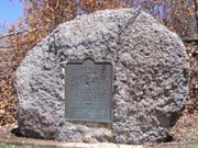
On west side of US-550 south of Ouray on a small boulder to the right of the Red Mountain Pass sign.
37°53'56.1"N 107°42'43.7"W == 37.898917N 107.712139W
photos taken 7/16/2006
     
This memorial is the property of the State of Colorado.
Red Mountain Pass.
Across divide between Uncompahgre and Animas Rivers. Altitude 11,018 feet. "The Million Dollar Highway"
toll road built by Otto Mears 1882. Improved highway opened 1924.
Erected by the State Historical Society of Colorado from the Mrs. J. N. Hall Foundation and by the
State Highway Department and the U.S. Forest Service. 1929.

Ouray Country
Ouray County
About 1 mile south of Ouray on southbound side of US-550, at Switzerland of America Lookout Point.
38°01'00.1"N 107°40'14.9"W == 38.016688N 107.670812W
photos taken 9/8/2022
                    
San Juan Travel - Preserving the Past - Untold Stories - Ouray Country
Erected in 2003

Ridgway
Ouray County
In Ridgway, in Hartwell Park, on north side of CO-62 (Sherman Ave) at intersection with N Railroad St.
38°09'06.2"N 107°45'18.2"W == 38.151722N 107.755056W
photos taken 7/18/2021
              
History of Ridgway - Gateway to the San Juans


Silverton
San Juan County
US-550 south of Silverton
37°48'17.7"N 107°40'33.9"W == 37.804917N 107.676083W
photos taken 9/22/2012
                 
Silverton - Hard Rock Resiliency - Rails into the San Juans - Silverton Country

photos taken 9/8/2022


Back to Colorado Historic Markers page
Back to Pass Bagger page

© 2008-24 Randy Bishop
Last update: October 24, 2024