
Thompson Pass
|
Thompson Pass |
Thompson Pass - Valdez-Cordova County - Alaska - 2,766 feet
On Richardson Highway (AK-4) north of Valdez.
paved - road bike
photos by Randy Bishop, 06/05/2018
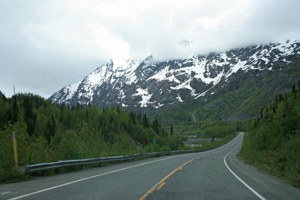
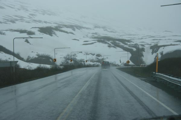
21 minutes north of the summit, looking south. |

19 minutes north of the summit, looking south. |
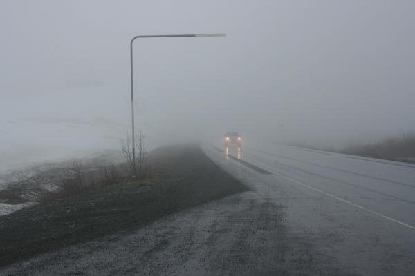
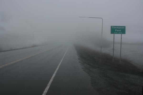
Near the summit, looking south. |
Near the summit, looking south. |
Near the summit, looking south. |
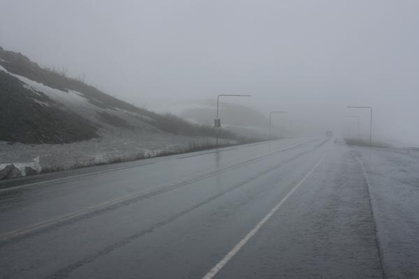
At the summit, looking south. |
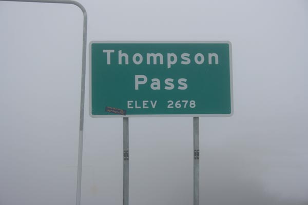
At the summit. |
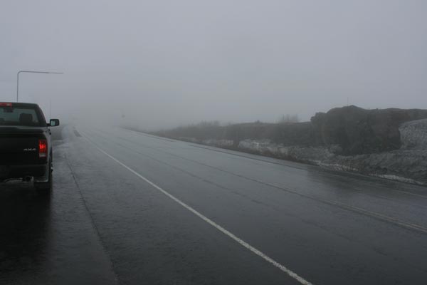
3 minutes south of the summit, looking south. |
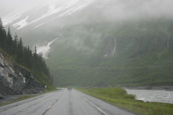
8 minutes south of the summit, looking south. |
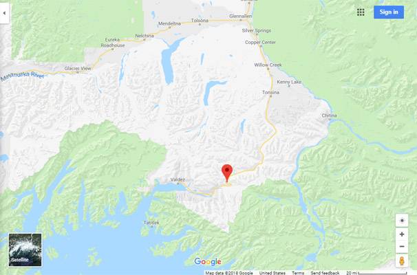
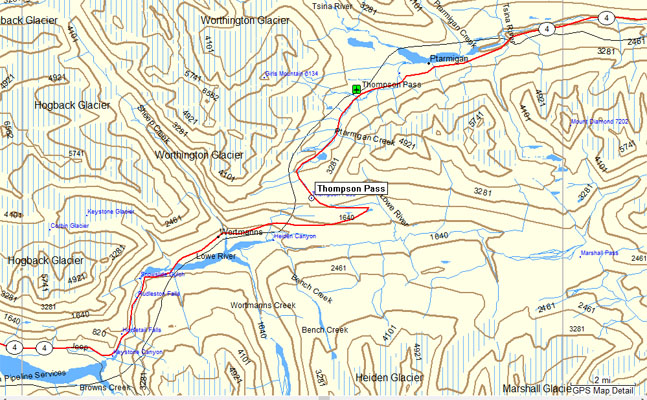
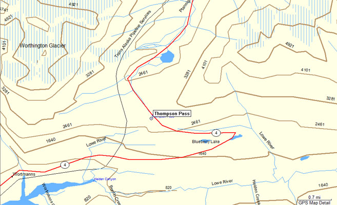
Google Maps |
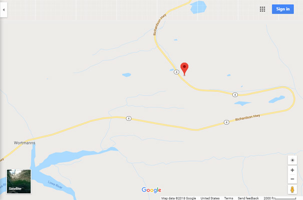
Google Maps |
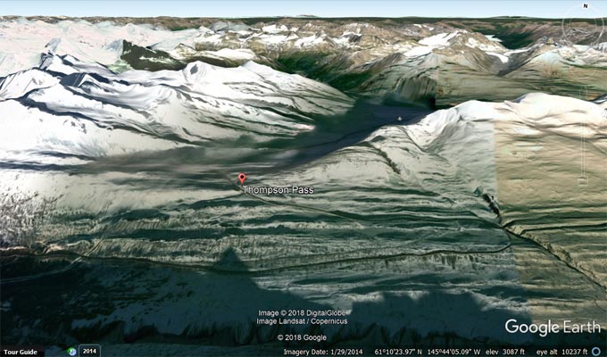
Google Earth, looking north. |
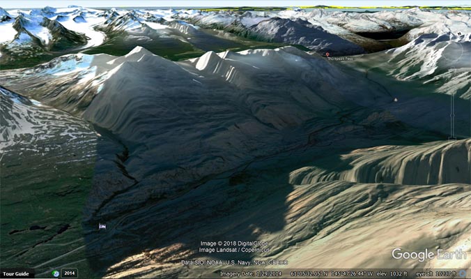
Google Earth, looking south. |
Garmin Mapsource |
Garmin Mapsource |
Note: On June 5, it was 55 degrees and sunny about 30 minutes north of the summit, 32 degrees with drizzle and fog at the summit, and 45 degrees with
drizzle about 8 miles south of the summit. The fog was much worse on our way back over the summit about 3 hours later. But the scenery was awesome!
| Feature Name | ID | Class | County | State | Latitude | Longitude | Ele(ft) | Map | BGN Date | Entry Date |
| Thompson Pass | 1410888 | Gap | Valdez-Cordova (CA) | AK | 610743N | 1454347W | 2766 | Valdez A-5 | - | 31-MAR-1981 |
From Wikipeda:
Thompson Pass is the snowiest place in Alaska, recording 551.5 inches of snow per year on average. In the winter of 1952–1953, 974.1 inches of snow fell,
the most ever recorded in one season at one location in Alaska. It is also the most snow ever recorded in one season at one location anywhere in the fifty
states. The pass also holds the Alaska record for the most snow in a single day: 62 inches (160 cm) fell on December 29, 1955.
From The Milepost:
Alaska’s Highest Highway Passes
Atigun Pass, elev. 4,800 feet, at Milepost J 244.7 Dalton Highway
Maclaren Summit, elev. 4,086 feet, at Milepost P 36.7 Denali Highway
Eagle Summit, elev. 3,685 feet, at Milepost F 107.3 Steese Highway
Eureka Summit, elev. 3,322 feet, at Milepost A 129.5 Glenn Highway
White Pass, elev. 3,292 feet, at Milepost S 14.3 South Klondike Highway
Isabel Pass, elev. 3,280 feet, at Milepost V 197.7 Richardson Highway
Twelvemile Summit, elev. 3,190 feet, at Milepost F 85.5 Steese Highway
Tahneta Pass, elev. 3,000 feet, at Milepost A 122 Glenn Highway
Thompson Pass, elev. 2,678 feet, at Milepost V 25.9 Richardson Highway
Mentasta Summit, elev. 2,434 feet, at Milepost GJ 79.2 Glenn Highway
Cleary Summit, elev, 2,233 feet, at Milepost F 20.5 Steese Highway
NOTE: Chilkat Pass, elev, 3,510 feet/1,070m, at Milepost H 59 Haines Highway, is located just across the border from Alaska in British Columbia.
The highest summit on the Alaska Highway is Summit Pass, elev. 4,250 feet/1,295m, at Milepost DC 373.6 (Historic Milepost 392) near Summit Lake,
British Columbia. The second highest pass on the Alaska Highway, and the highest point on the Alaska Highway between Whitehorse and Fairbanks. is
Bear Creek Summit, elev. 3,294 feet/1,004m, at Milepost DC 1000.1 in Yukon.