
El Capitan Pass (Pinal Pass)
|
El Capitan Pass (Pinal Pass) |
El Capitan Pass (Pinal Pass) - Gila County - Arizona - 4,983 feet
On AZ-77 12 miles south of Globe.
pavement - road bike
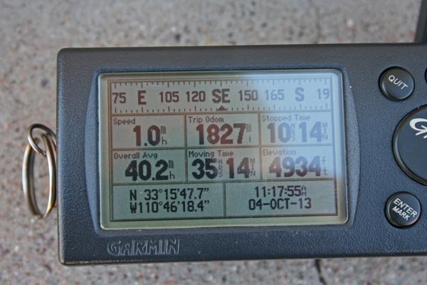
photos by Randy Bishop, 10/4/2013
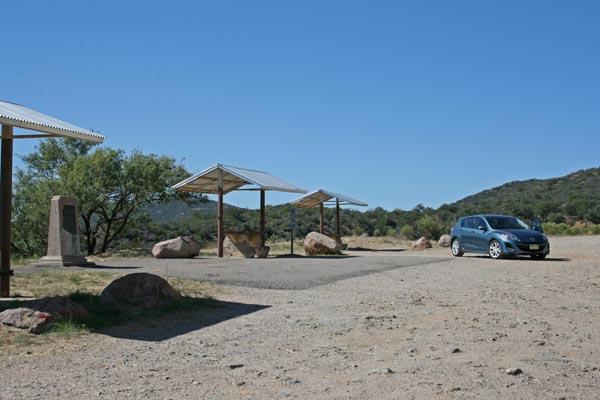
At the summit, looking south. |

At the summit. |
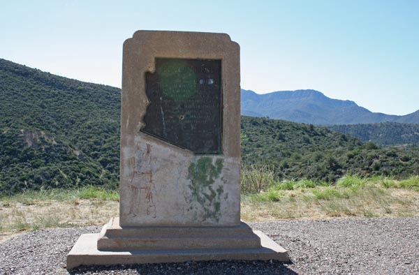
At the summit. El Capitan Pass marker. |
El Capitan Pass marker. |
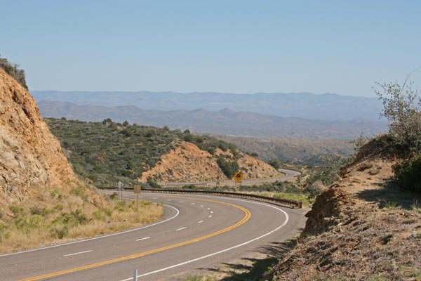
At the summit, looking north. |
At the summit. |
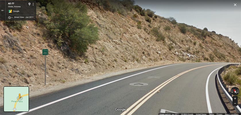
Google Maps, looking north at the Elevation 4983 sign. |
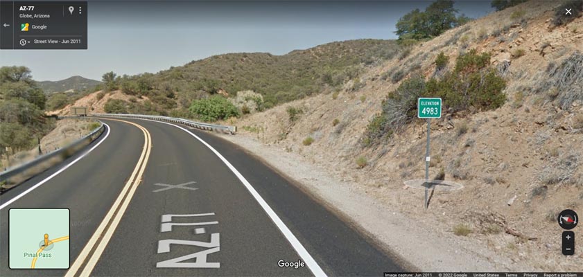
Google Maps, looking south at the Elevation 4983 sign. |
Google Maps |
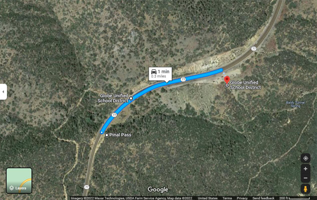
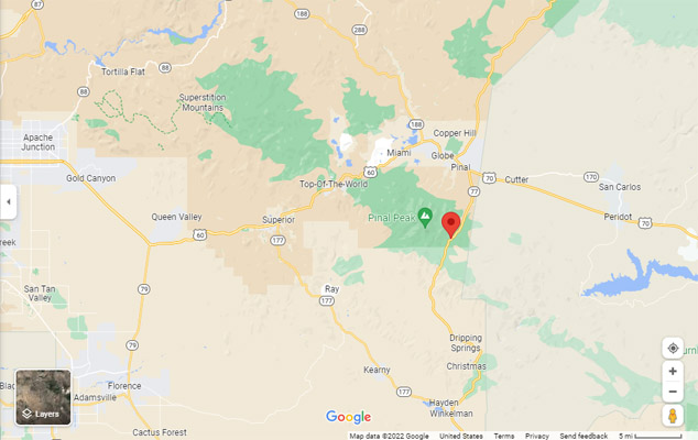
Google Maps, showing the locations of Pinal Pass, the 4983 sign, and the El Capitan marker. |
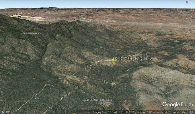
Google Earth, looking north. |
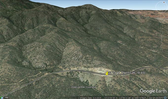
Google Earth, looking northwest. |
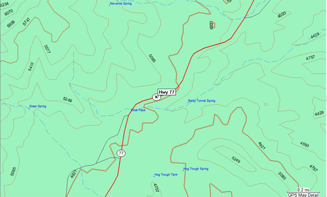
Garmin Mapsource |
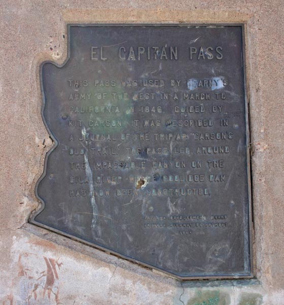
The plaque reads:
El Capitan Pass. This pass was used by Kearny's Army of the West in a march to California
in 1846. Guided by Kit Carson. It was described in a journal of the trip as "Carson's Old Trail".
The pass led around the impassable canyon on the Gila River where Coolidge Dam has now been constructed.
Arizona Development Board, Arizona Highway Department, 1964.
| Feature Name | ID | Class | County | State | Latitude | Longitude | Ele(ft) | Map | BGN Date | Entry Date |
| El Capitan Mountain | 4374 | Summit | Gila | AZ | 331200N | 1104522W | 6575 | El Capitan Mountain | - | 08-FEB-1980 |
| Pinal Pass | 32909 | Gap | Gila | AZ | 331542N | 1104632W | 4961 | Pinal Peak | - | 08-FEB-1980 |
| Pinal Peak | 32910 | Summit | Gila | AZ | 331656N | 1104916W | 7838 | Pinal Peak | - | 08-FEB-1980 |