
Berthoud Pass
|
Berthoud Pass |
Berthoud Pass - Clear Creek / Grand Counties - Colorado - 11,307 feet - On the Continental Divide
Fraser River to west. West Fork of Clear Creek to east.
US-40 south of Winter Park
Paved - road bike
photos by Randy Bishop, 8/5/2017
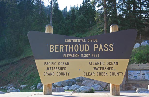
At the summit. |
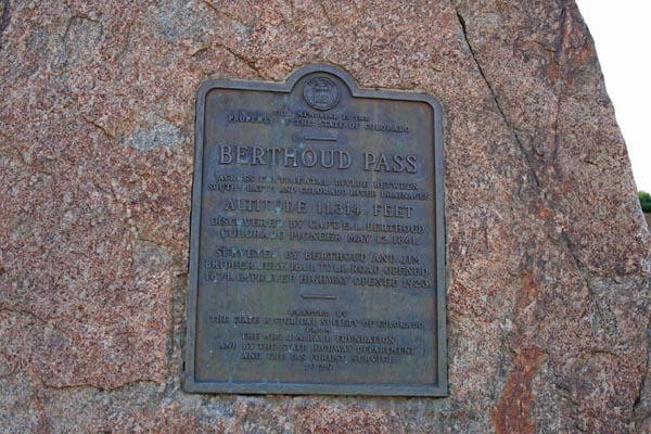
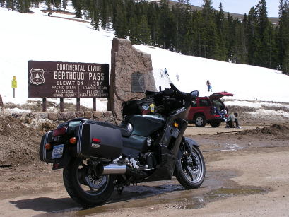
At the summit, vintage 1929 bronze historical marker. |
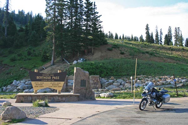
At the summit. 2004 BMW R1150GS |
At the summit. |
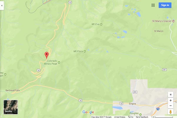
Google Maps |
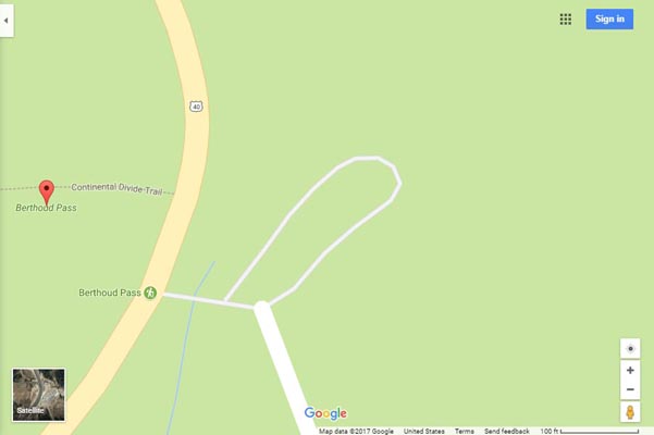
Google Maps |
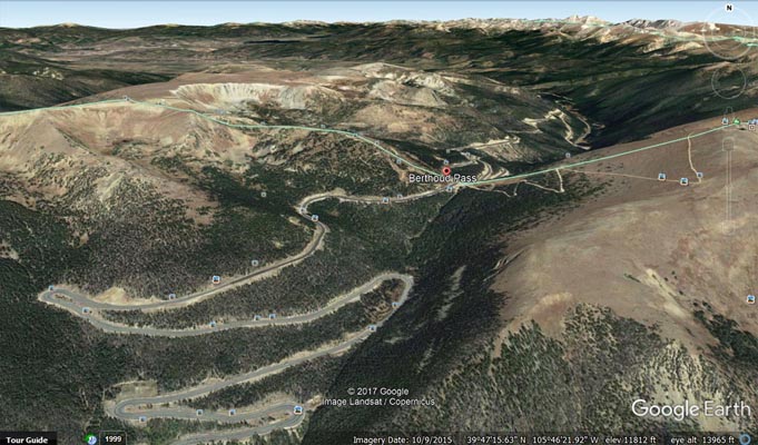
Google Earth |

Google Earth |
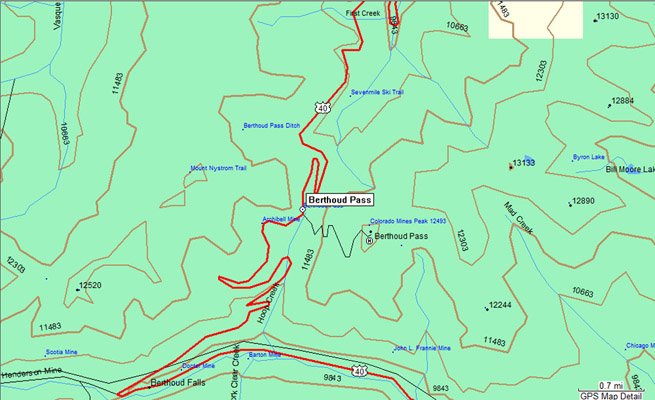
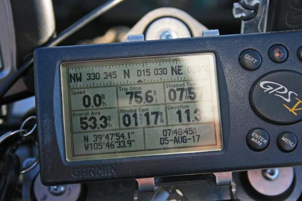
Garmin Mapsource |
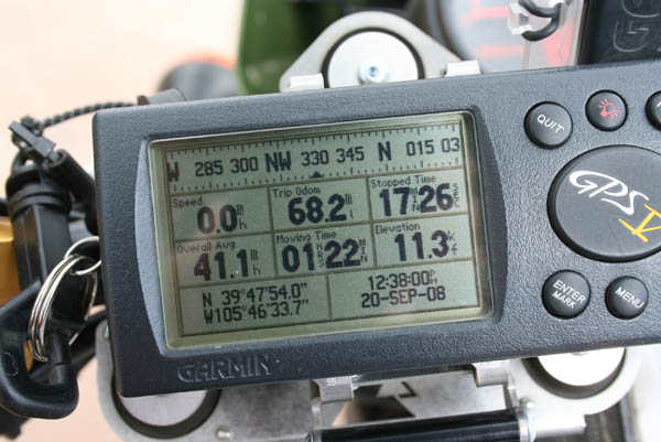
photos by Randy Bishop, 9/20/2008

At the summit. 2002 Kawasaki KLR650 |
At the summit. |
#16 - photos by Randy Bishop, 5/21/2005

At the summit. |
At the summit. 1997 Kawasaki ZG1000 Concours |
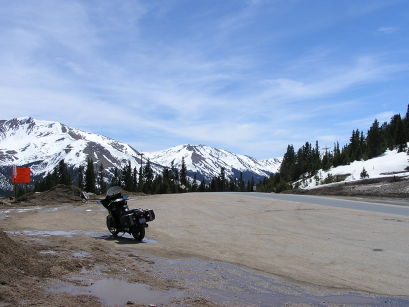
At the summit, looking west. |
At the summit. |
photos by Randy Bishop
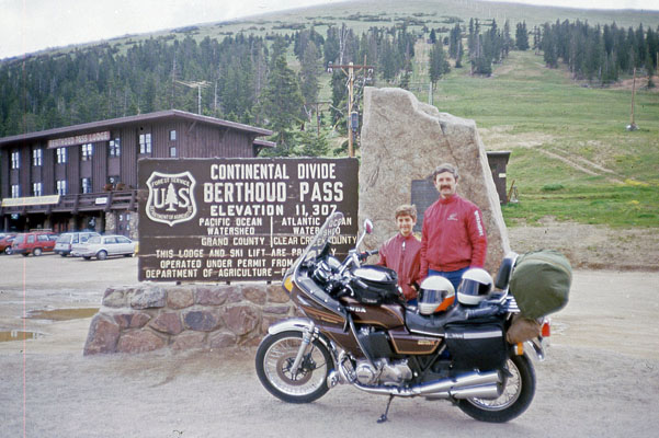
Randy and Phil at the summit. 1981 Honda CB75K 7/2/1986 |
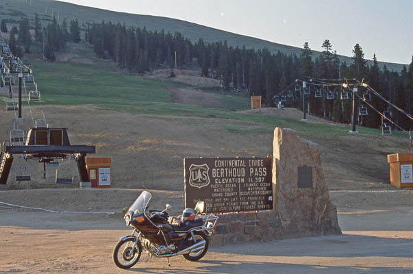
At the summit. 1981 Honda CB75K 6/30/1990 |
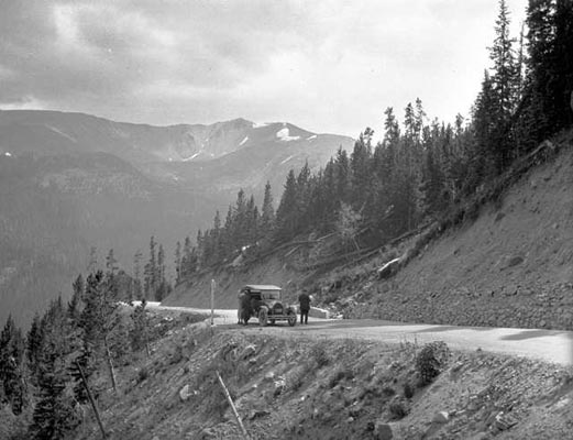
Berthoud Pass in the 1910s or 1920s. |
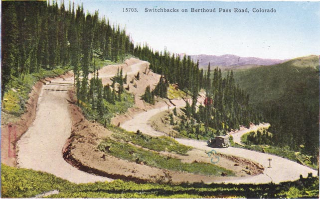
Berthoud Pass in the 1910s or 1920s. |
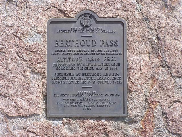
The 1929-vintage
History Colorado (State Historical Society of Colorado) marker reads:
This memorial is the property of the State of Colorado. Berthoud Pass. Across the Continental Divide
between South Platte and Colorado River drainages. Altitude 11,314 feet. Discovered by Capt. E. L. Berthoud,
Colorado pioneer, May 12, 1861. Surveyed by Berthoud and Jim Bridger July, 1861. Toll road opened 1874.
Improved highway opened 1923. Erected by the State Historical Society of Colorado from the
Mrs. J. N. Hall Foundation and by the State Highway Department and the U.S. Forest Service, 1929.
| Feature Name | ID | Class | County | State | Latitude | Longitude | Ele(ft) | Map | BGN Date | Entry Date |
| Berthoud Pass | 181335 | Gap | Clear Creek | CO | 394754N | 1054640W | 11325 | Berthoud Pass | - | 13-OCT-1978 |