
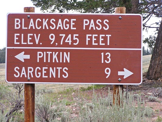
Black Sage Pass
|
Black Sage Pass |
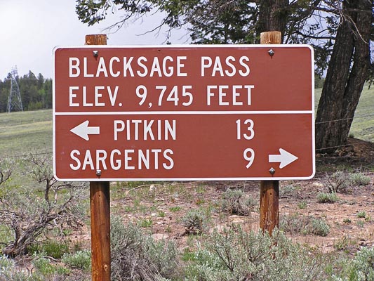
Black Sage Pass - Gunnison County - Colorado - 9,745 feet
Spring Creek to west. Mountain Spring Creek to east.
FR-887 south of Pitkin
gravel - road bike, but dual sport is better
photos by Randy Bishop, 7/7/2007
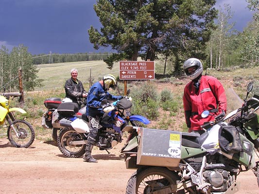
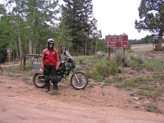
At the summit. |
At the summit. |
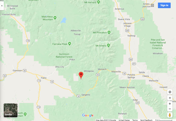
Google Maps |
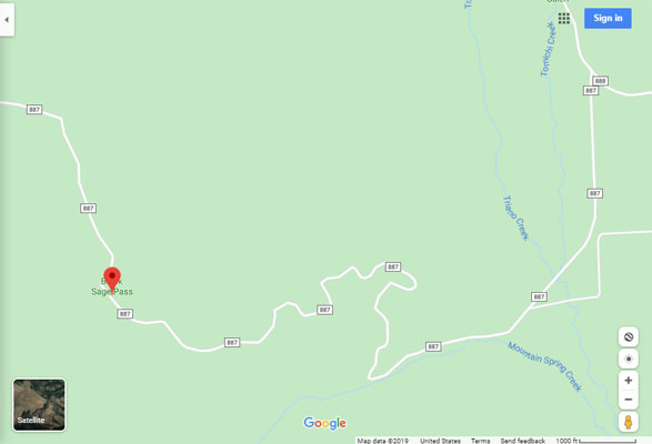
Google Maps |
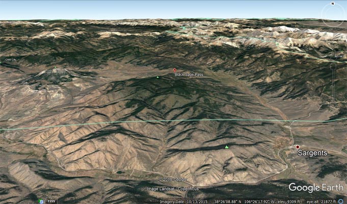
Google Earth |
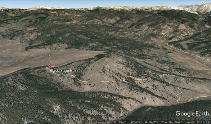
Google Earth, looking west. |

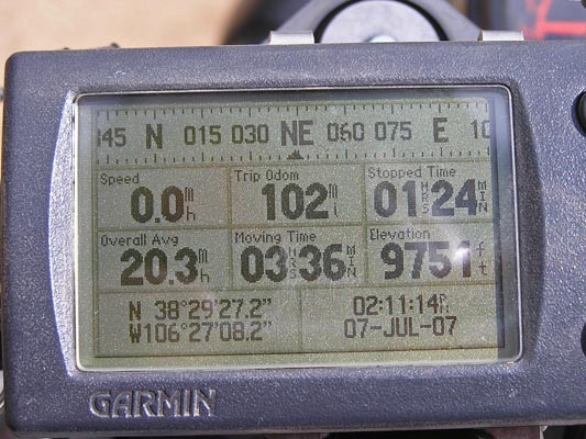
Garmin MapSource |
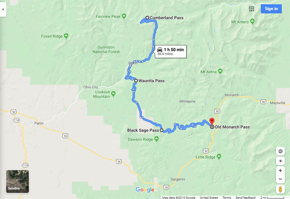
Google Maps, Cumberland to Old Monarch |
#69 - photos by Randy Bishop, 8/12/2006
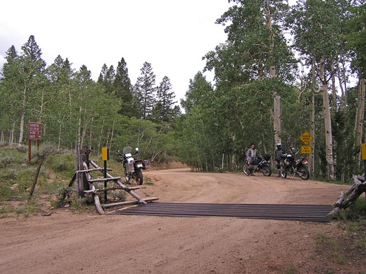
At the summit. |
At the summit. |
At the summit, looking east. |
photos by Randy Bishop, 6/11/2005
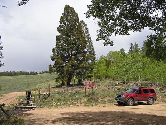
At the summit. |
At the summit. |
At the summit. |
| Feature Name | ID | Class | County | State | Latitude | Longitude | Ele(ft) | Map | BGN Date | Entry Date |
| Black Sage Pass | 189686 | Gap | Gunnison | CO | 382926N | 1062706W | 9721 | Sargents | - | 13-OCT-1978 |