
Bolam Pass
|
Bolam Pass |
Bolam Pass - Dolores / San Miguel Counties - Colorado - 11,340 feet
(other names: Barlow Creek, Hermosa, Hermosa Mountain)
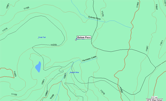
Dolores River to north. Hermosa Creek to south.
On a spur off FR-578 (Hermosa Peak Road), northwest of Purgatory Ski Area, southeast of Cayton.
off-road - dirt bike or dual sport
photos from John Meyer, 9/20/2018
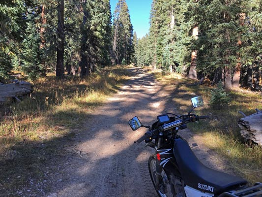
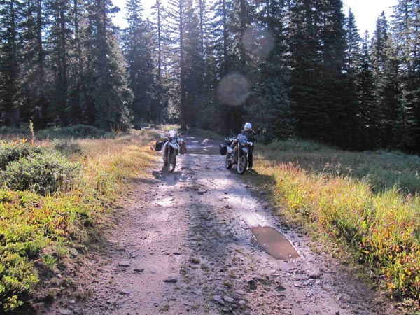
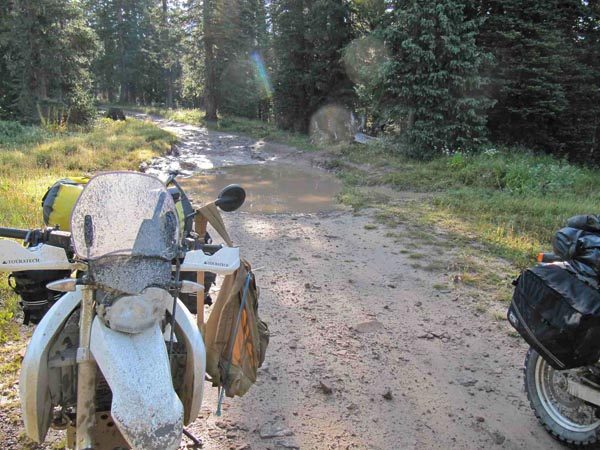
At the summit, on the spur off FR-578. |
At the summit, on the spur off FR-578. |

At the summit, on the spur off FR-578. |
At the summit, on the spur off FR-578. |
At the summit. |
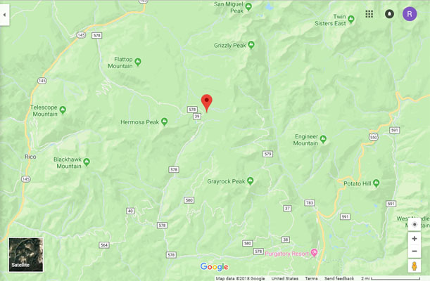
Google Maps |
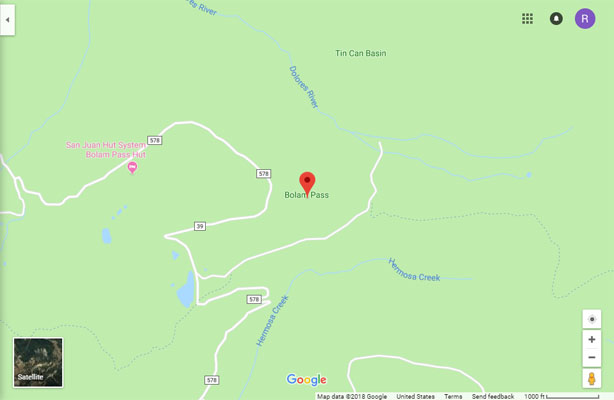
Google Maps |
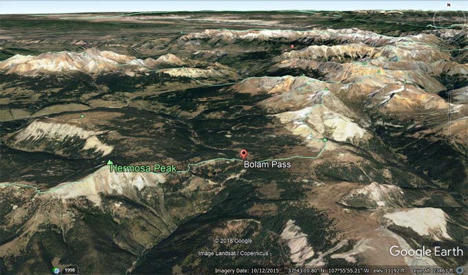
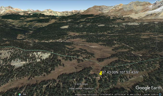
Google Earth, showing location of Bolam Pass. |
Google Earth, showing location of Bolam Pass. |
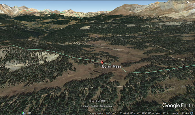
Google Earth, showing location on current alignment of road. |
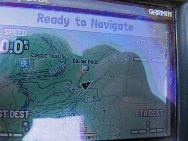
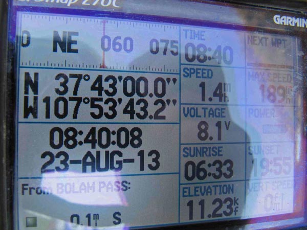
Garmin MapSource |
photos from Karst Postma, 8/23/2013
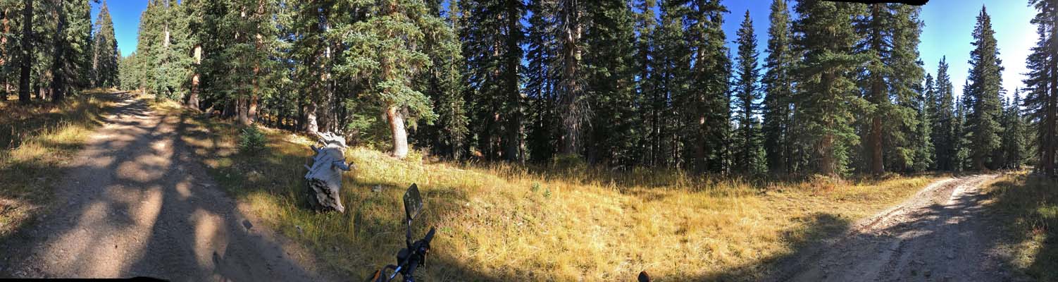
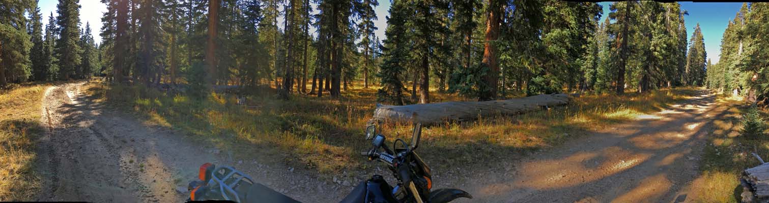
At the summit, on the spur off FR-578. |
At the summit, on the spur off FR-578. |
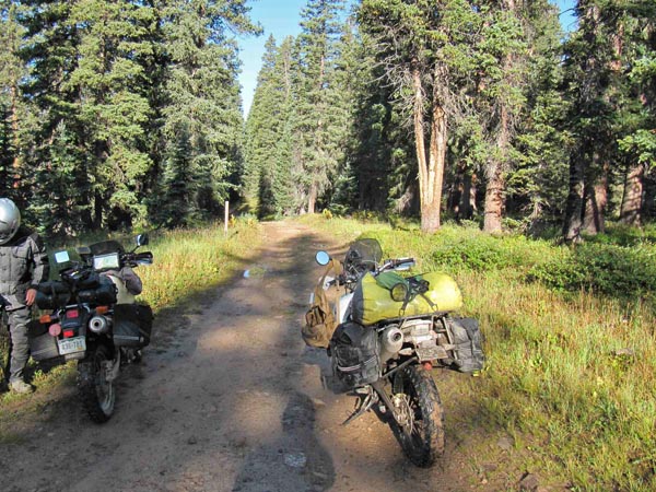
At the summit, on the spur off FR-578. |
At the summit, on the spur off FR-578. |
At the summit, on the spur off FR-578. |
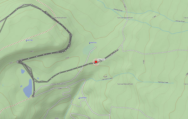
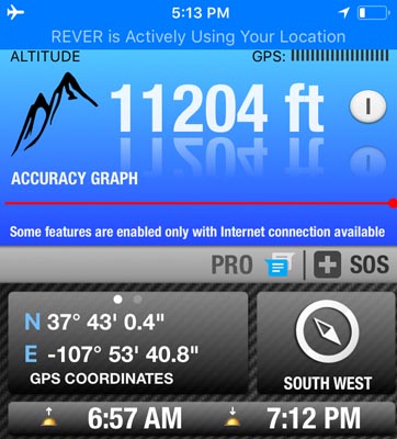
Karst's GPS tracking data. |
photos from Curtis Kohl, 9/20/2005
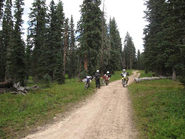
At the summit, on the spur off FR-578. |
View of USGS location of Bolam Pass. |
At high point of FR-578. |
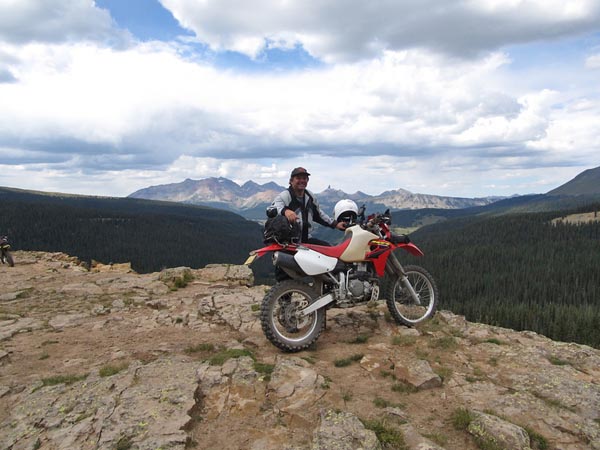
photos from Nick Greear, 9/4/2010

At high point of FR-578, looking NW toward Lizard Head. |
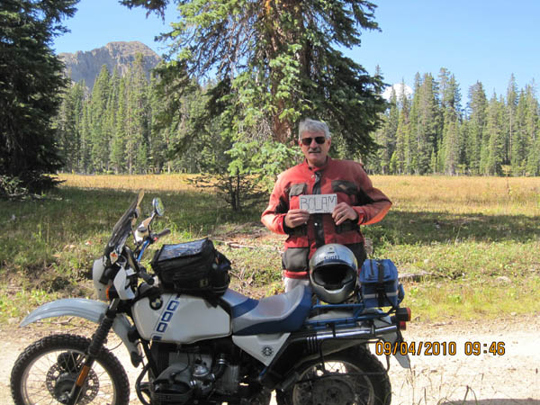
1/2 mile west high point. Hermosa Peak in background. |
photo by Clyde Edmundson, 1962
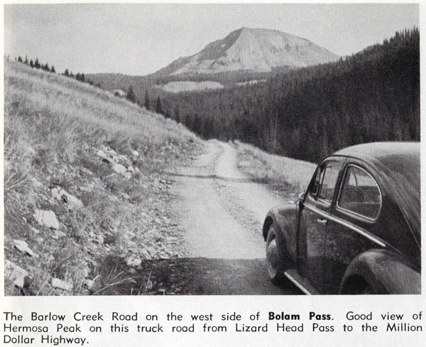
West side of Bolam Pass. |
Notes from Karst:
Coming off CO-145 at the Cayton campground, the first couple of miles are hard-packed road. It then changes into a rocky rough road with
some hairpins and is doable on a big bike with solid intermediate skills. The nearest road to the USGS position of the Pass is 0.1 mile
to the south and is marked "dead end". We believe today's pass should marked on this road at N37 43 00.0 W107 53 43.2, a point whose
elevation correlates with Helmuth’s description. Attached pictures are at that location. Also attached is our track which shows we went
back and forth a few times to find the most likely pass location. Since Nick Greear's picture shows Lizard Head Peak it most likely was
taken near the high point of FR-578.
Notes from Curtis:
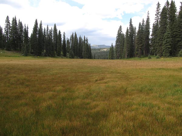
Much like Kennebec Pass, Bolam Pass has two recognized summits with the "official" summit as the one you rode to on the side dead-end road
off of FR-578. If you got off your bikes on that road and walked 0.1 miles north you would have been in a boggy meadow which is the original,
"true" pass summit. However, most people travelling over the pass via FR-578 consider the summit to be at N37 43 18.4 W107 54 06.9 which is
the highest point of the Bolam Pass Road (FR-578) but not actually the true pass summit as recognized by the USGS. The high point is where the
amazing view of Lizard Head Peak and other high peaks in the area can be seen.
Notes from Randy:
According to Helmuth's, Bolas Pass divides the watersheds of the Dolores River to the north and Hermosa Creek to the south. The spur road off
FR-578 is the current alignment of the Bolas Pass road and is now blocked off near the summit, but more recently continued to follow the Dolores
River to the north and dead-ended at 37 44 35N 107 54 37W. Before that it continued along the Dolores River to CO-145.
The current FR-578 crosses a high point on the west side of Bolam Pass, then follows the Barlow Creek drainage to the west.
| Feature Name | ID | Class | County | State | Latitude | Longitude | Ele(ft) | Map | BGN Date | Entry Date |
| Bolam Pass | 187712 | Gap | Dolores | CO | 374307N | 1075346W | 11220 | Hermosa Park | - | 13-OCT-1978 |