
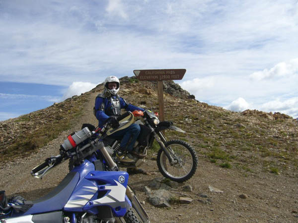
California Pass
|
California Pass |
California Pass - San Juan County - Colorado - 12,960 feet
Uncompahgre River to west. West Fork Animas River to east.
West of Animas Forks, southeast of Lake Como
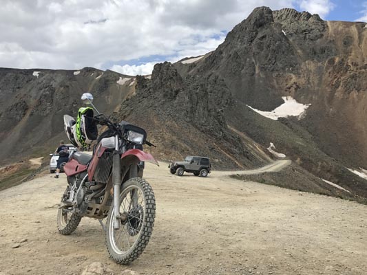
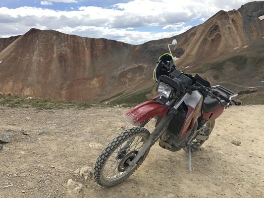
off-road - dirt bike
photos by John Meyer, 9/19/2018
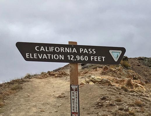
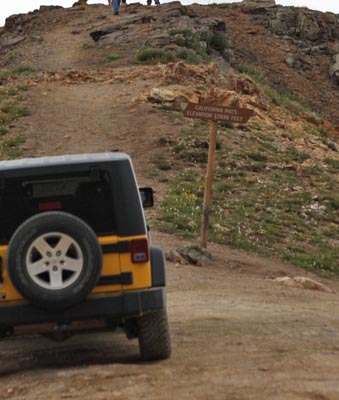
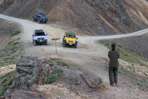
At the summit. |
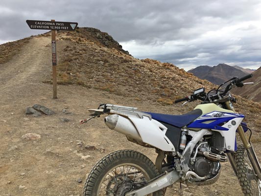
At the summit. |
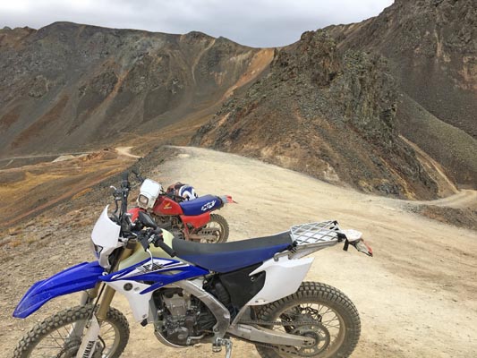
At the summit. |
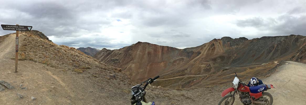
At the summit. |
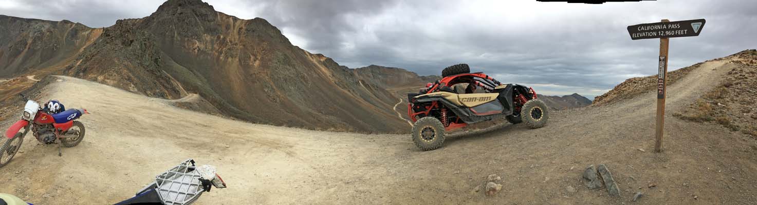
At the summit. |
At the summit. |
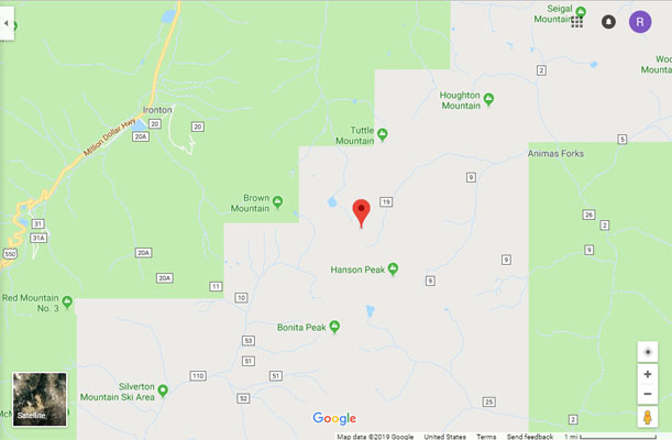
Google Maps |
Google Maps |
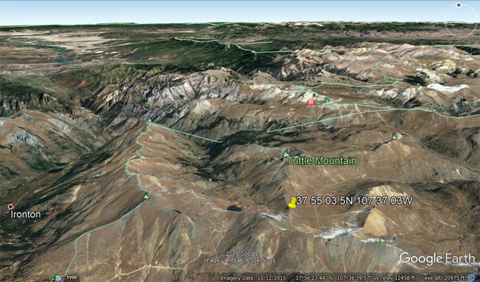
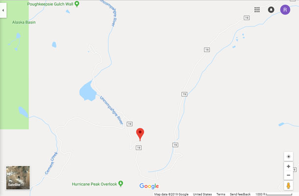
Google Earth |
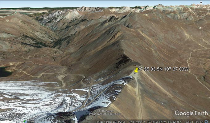
Google Earth |
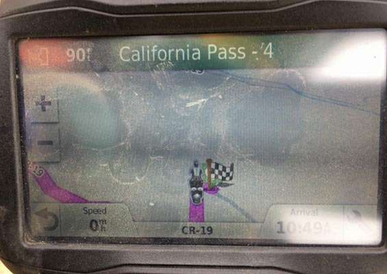
Garmin MapSource |
photos by Scott Westfall, 8/19/2017
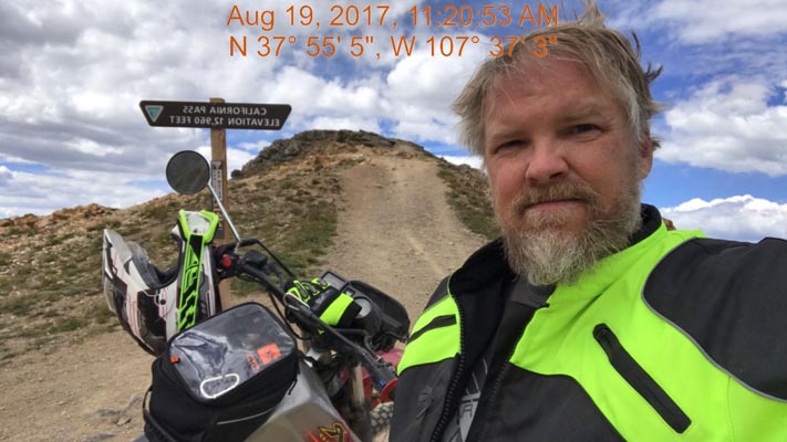
At the summit. |
At the summit. |
At the summit. |
At the summit. |
At the summit. |
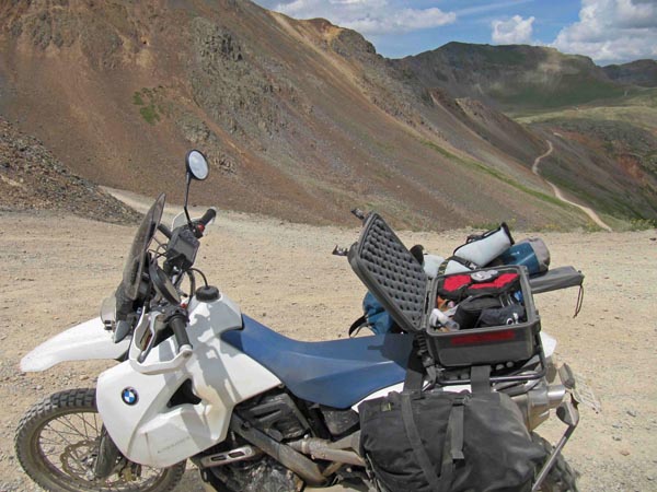
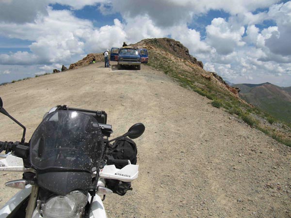
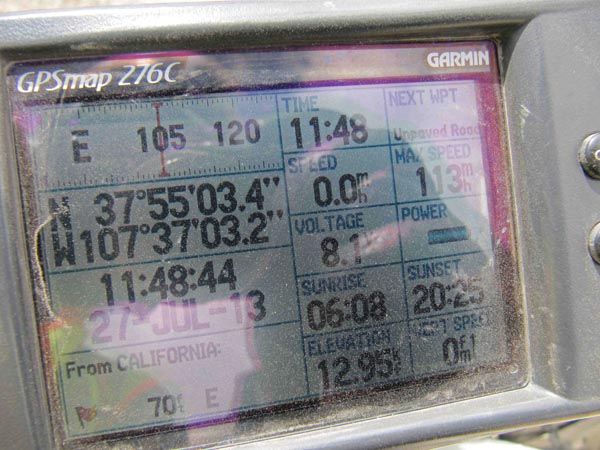
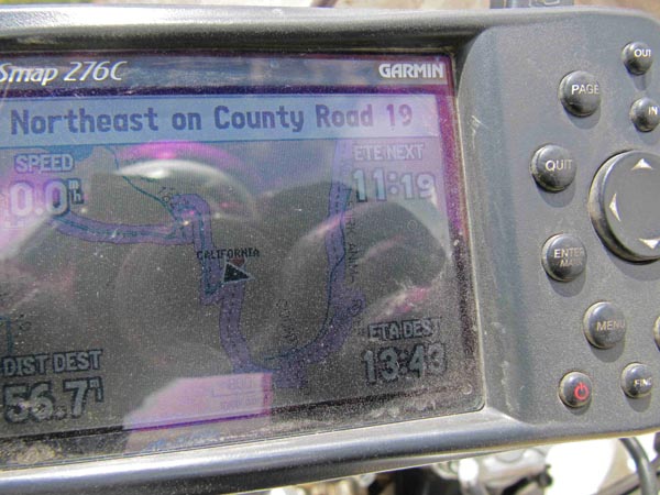
photos by Karst Postma, 7/27/2013

At the summit. |
At the summit. |
At the summit. |
At the summit. |
At the summit. |
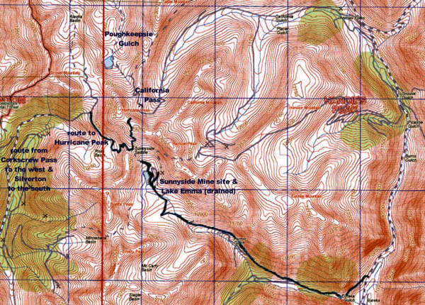
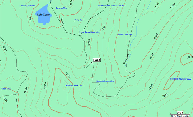
area map |
Note from Karst: This can be done on a big bike, but that will require intermediate skills. You will have to
deal with some steep rocky roads and sharp steep hairpins. No room for those with fear of heights. Much
easier on a smaller bike. Beautiful country!!
photo from Nick Greear, 9/4/2010
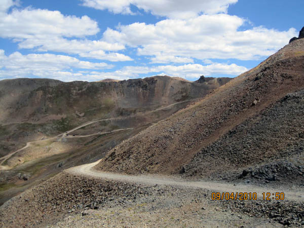
Looking from Hurricane Pass to the west side of California Pass. |
photos by Leif Rudd, 7/23/2010
At the summit. |
At the summit. |
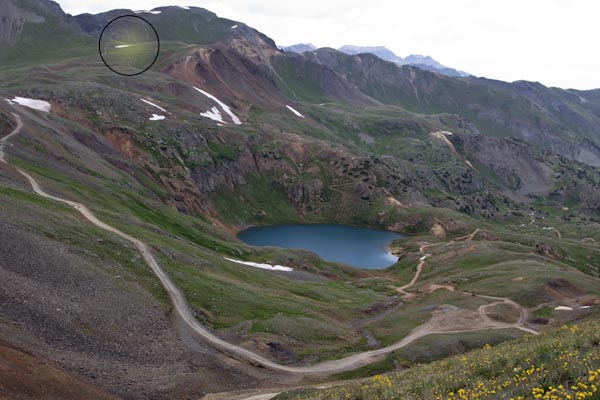
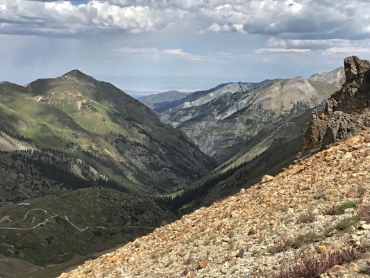
At the summit, looking toward Hurricane Pass (in circle). |
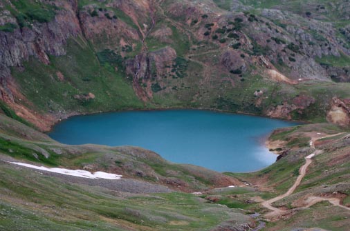
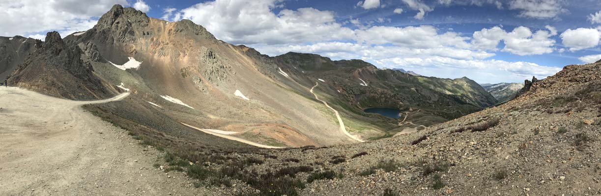
At the summit, looking at Lake Como. |
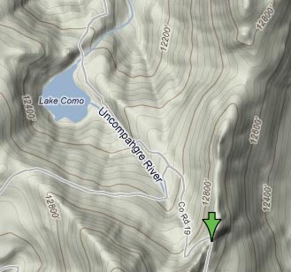
Topo map |
Note from Leif: So if we go by the BLM signage, California and Hurricane are distinct. Now that I've had this revelation, I checked my GPS and indeed
I had it along for California, and marked a waypoint of 37.91750 -107.61760 (37 55 03.0 N 107 37 03.4 W) at the sign. That is (correctly) distinct from
Hurricane at 37.92005556 -107.6270556 (37 55 12.2 N 107 37 37.4 W).
So... wow, a lot of corrections to make, plus I simply don't have California in my list, which I'm a bit embarrassed about. I believe (watch me squirm)
that I didn't add it, thinking that Hurricane was its more official name. Now that we have proof I think we're well on our way toward straightening this
out. Please have a look at one more photo, and let me know if my label is correct. I think I have a photo of Hurricane, from California. I circled and
highlighted what I think is a likely candidate.
photo from Deward Knapp, 8/24/2006
Deward Knapp at the summit. |
| Feature Name | ID | Class | County | State | Latitude | Longitude | Ele(ft) | Map | BGN Date | Entry Date |
| California Gulch | 187359 | Valley | San Juan | CO | 375550N | 1073510W | 11443 | Handies Peak | - | 13-OCT-1978 |
| California Mountain | 187383 | Summit | San Juan | CO | 375456N | 1073623W | 13215 | Handies Peak | - | 13-OCT-1978 |