
Hog Park Pass
|
Hog Park Pass |
Hog Park Pass - Jackson / Routt Counties - Colorado - 9,275 feet - on the Continental Divide
Whiskey Creek to west. South Fork Hog Park Creek to east.
North of Steamboat Springs near Wyoming border, off Forest ATV 11011, near the Continental Divide Trail.
gravel, dirt - dirt bike
photos by Chris Wilder, 9/22/2019 and 10/6/2019
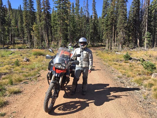
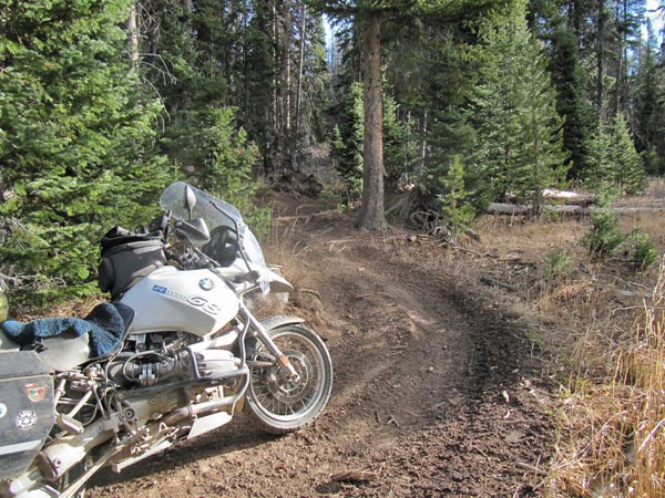
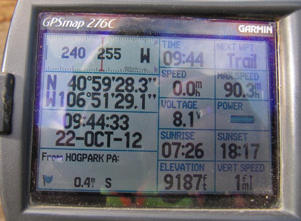
At the summit. |
At the summit. |
At the summit. |
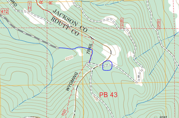
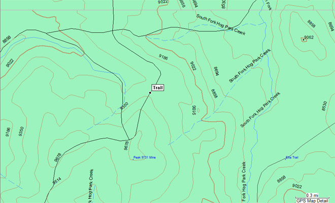
West Fork Lake topo |
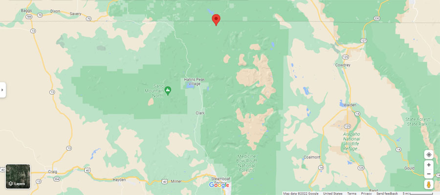
Google Maps |
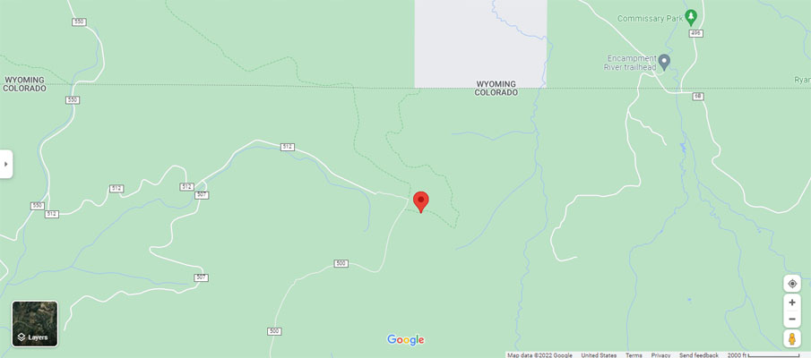
Google Maps |

Google Maps |
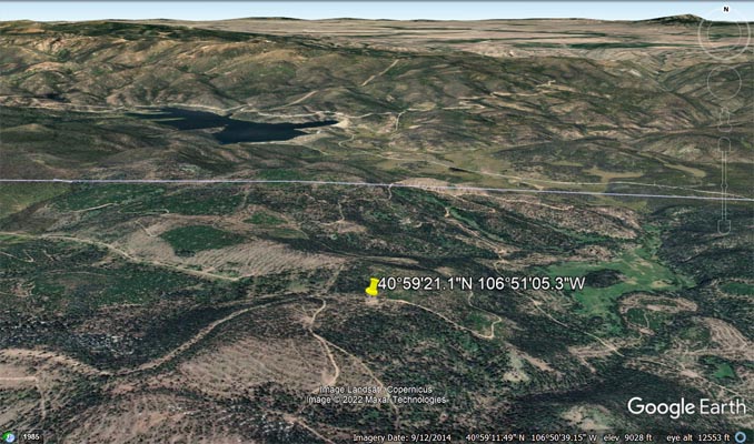
Google Earth |
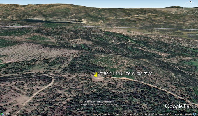
Google Earth |
Garmin MapSource |
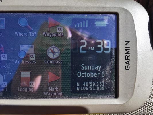
Notes from Chris: I was north of Steamboat lake yesterday and decided to bag Hog Park Pass. I had not
seen the pictures from Karst on your site till this morning. Yes it is about a half mile of ATV trail
but pops out on FR-83 coming from Wyoming. I’m sorry I didn’t take a picture of the GPS since I figured
lots of people have been here. When I take Brandi up for her to bag it, I’ll get the GPS picture for you.
On the West Fork Lake topo map shown above, the blue line is roughly where the awesome ATV trail is
and the circle is where the summit is located.
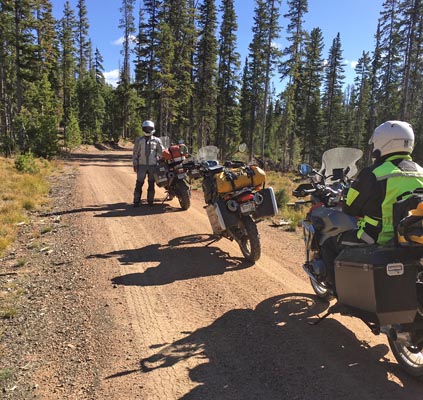
photos by Karst Postma, 10/22/2012

Near the summit. |
Near the summit. |

Near the summit. |
Near the summit. |
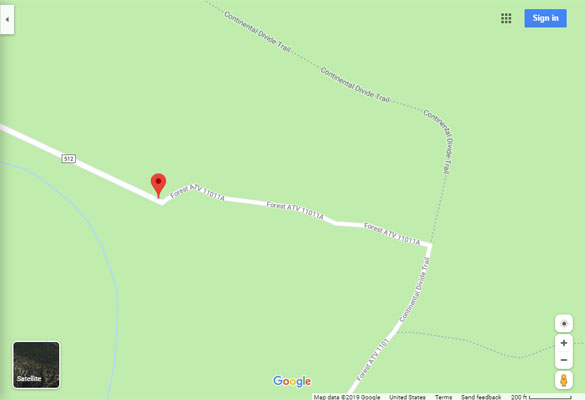
Google Maps at Karst's GPS |
Notes from Karst: I tried to get to this summit from the west. At the end of the parking area there is an ATV
track that heads east for a couple of hundred yards. This section of ATV track is a clutch smeller (as opposed
to a clutch smoker or a clutch burner). It intersects a track, as shown on the topo, that heads in the direction
of the summit. I went up this second track for a bit. Somebody had cut sections out of fallen trees, allowing passage,
but barely. Tires between the tree ends, cylinders hanging over the tree ends. Not too much further I had to stop.
Somebody on a light bike, or with more skills then I have could go further and most likely reach the summit.
| Feature Name | ID | Class | County | State | Latitude | Longitude | Ele(ft) | Map | BGN Date | Entry Date |
| Hog Park Guard Station | 169928 | Locale | Jackson | CO | 405955N | 1064852W | 8412 | West Fork Lake | - | 13-OCT-1978 |
| Hog Park | 1600354 | Park | Carbon | WY | 410211N | 1065301W | 8464 | Solomon Creek | - | 05-JUN-1979 |
| Hog Park Creek | 1600355 | Stream | Carbon | WY | 410152N | 1064040W | 8225 | Dudley Creek | - | 05-JUN-1979 |
| South Fork Hog Park Creek | 169919 | Stream | Carbon | WY | 410123N | 1065043W | 8284 | Dudley Creek | - | 05-JUN-1979 |
| Hog Park Dam | 1605240 | Dam | Carbon | WY | 410206N | 1065138W | 8464 | Dudley Creek | - | 01-SEP-1994 |
| Hog Park Reservoir | 1606241 | Reservoir | Carbon | WY | 410200N | 1065235W | 8464 | Solomon Creek | - | 01-SEP-1994 |