
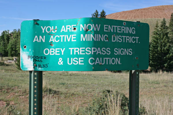
Hoosier Pass
|
Hoosier Pass |
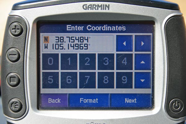
Hoosier Pass - Teller County - Colorado - 10,318 feet
Poverty Gulch to west. Grassy Creek to east.
East of Cripple Creek off CO-67.
1.1 miles from CO-67 via CR-821. Paved, road bike.
0.9 miles from CO-67 via CR-82 (Molly Kathleen Rd), probably the original route of the pass. Gravel, road bike or dual sport.
photos by Randy Bishop, 9/16/2017

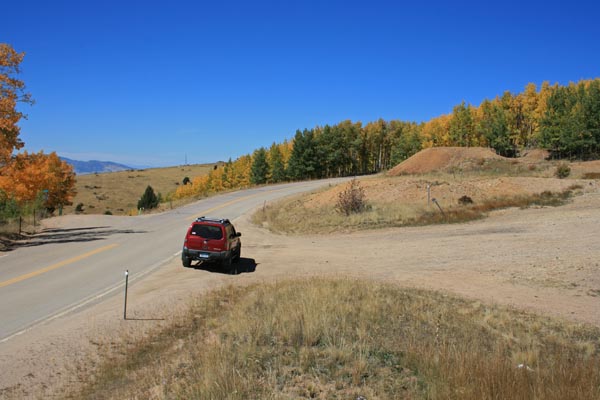
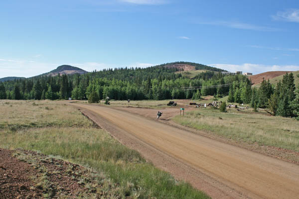
CR-821 north of the summit, looking north toward CO-67. |
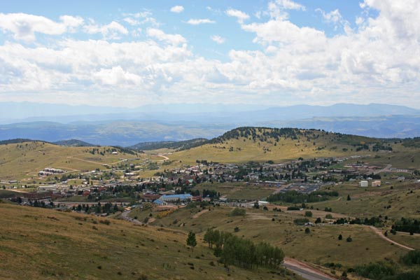
CR-821 north of the summit, looking west toward Cripple Creek. |
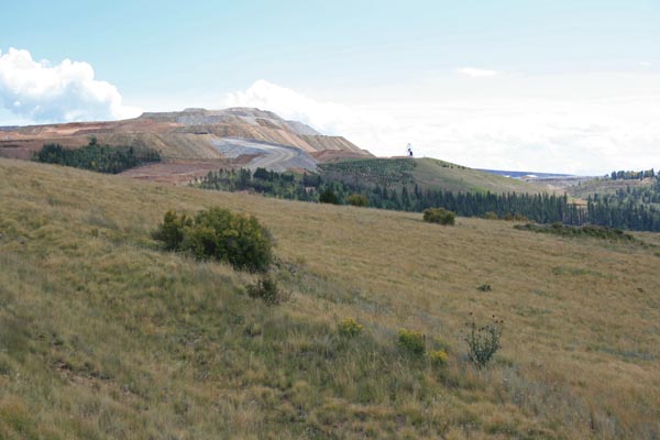
CR-821 north of the summit, looking south toward gold mine. |
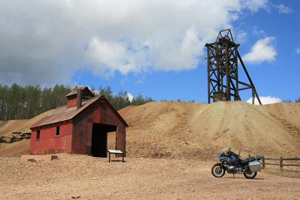
At the summit. |
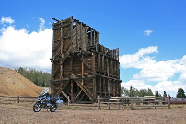
At the summit. |
At the summit. |

At the summit. |
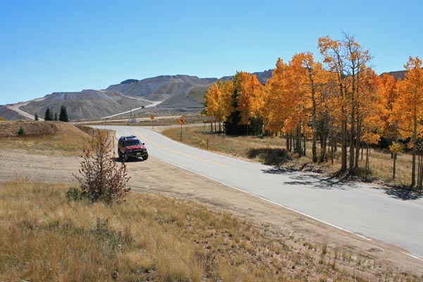
At the summit, looking south toward gold mine. |
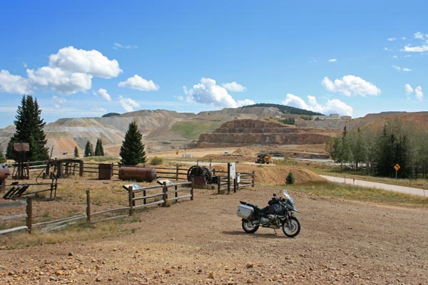
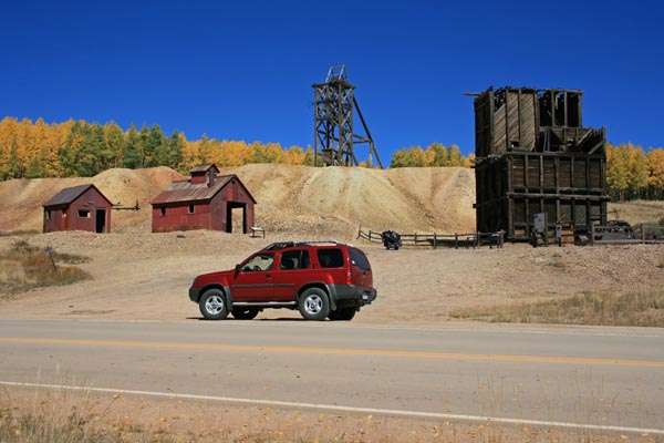
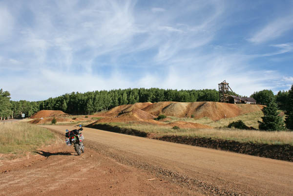
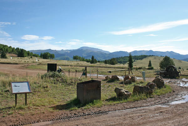
Mine overlook, 0.9 miles east of summit on CR-821. |
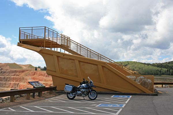
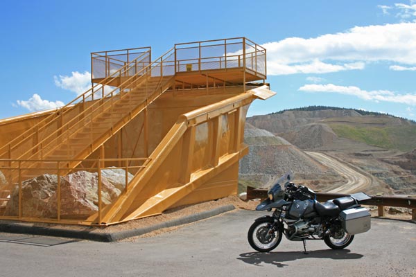
Little bike, big dump truck bed. |
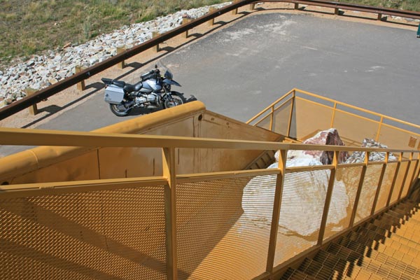
Little bike way down below. |
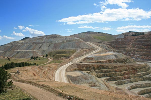
Cripple Creek & Victor Gold Mine, left. |
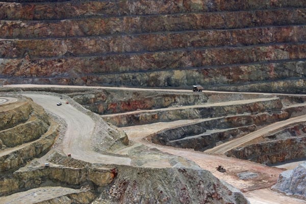
Cripple Creek & Victor Gold Mine, center. |
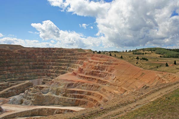
Cripple Creek & Victor Gold Mine, right, with Hoosier Pass in background. |
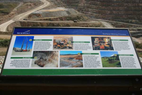
Drilling, blasting, moving rock, leaching, recovery, reclamation. |
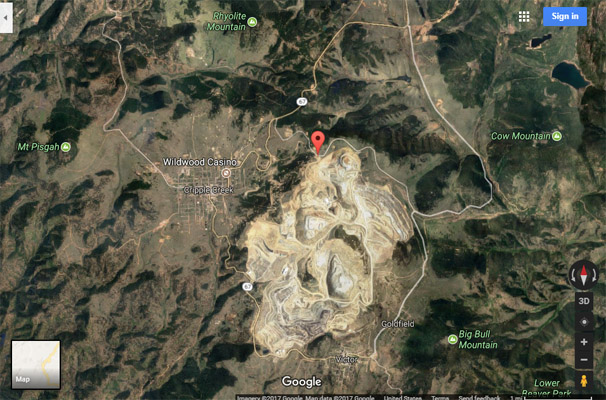
Google Maps |

Google Maps |
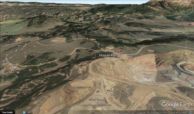
Google Earth |
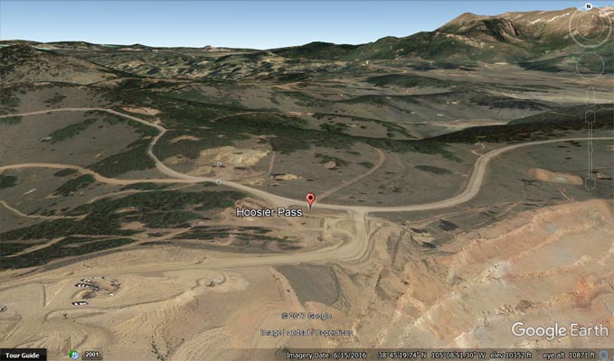
Google Earth |
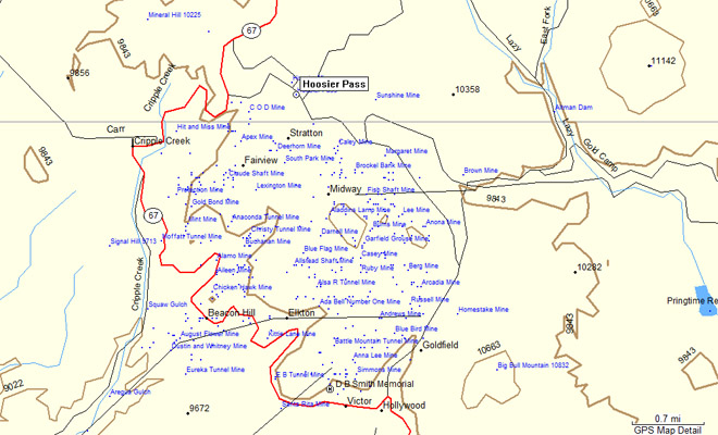
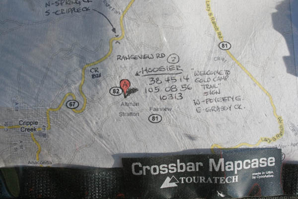
Garmin MapSource |
photos by Randy Bishop, 9/26/2015
At the summit, looking NW. |
At the summit, looking NE. |
At the summit, looking SE. |

At the summit. |

At the summit. |

At the summit. |

At the summit. |
At the summit. |
#114 - photos by Randy Bishop, 7/25/2008
At the summit. |
At the summit, looking NW. |
At the summit, looking SE. |
At the summit. |
At the summit, looking east. |
At the summit. |
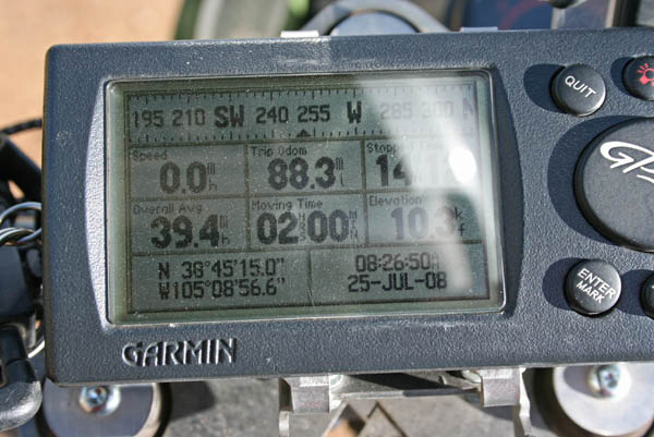
At the summit. |
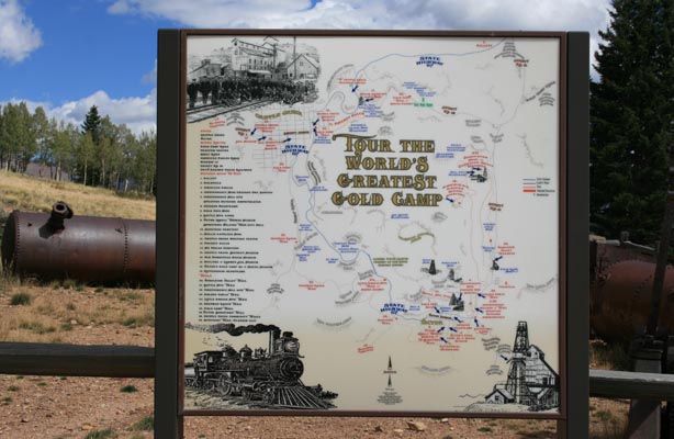
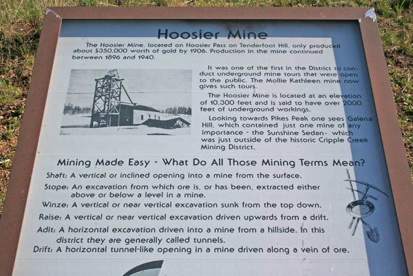
Newmount Cripple Creek & Victor Gold Mine
Newmount Cripple Creek & Victor Gold Mine, Summer Tours from the Lowell Thomas Museum in Victor
Wikipeda, Cripple Creek & Victor Gold Mine
| Feature Name | ID | Class | County | State | Latitude | Longitude | Ele(ft) | Map | BGN Date | Entry Date |
| Hoosier Pass | 191218 | Gap | Teller | CO | 384514N | 1050855W | 10318 | Cripple Creek North | - | 13-OCT-1978 |