
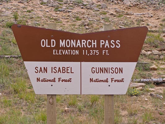
Monarch Pass - Old
|
Monarch Pass - Old |
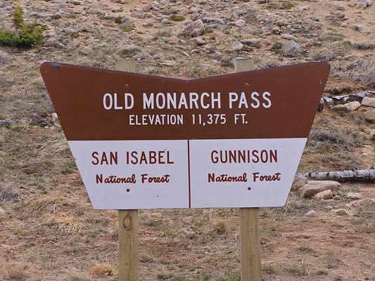
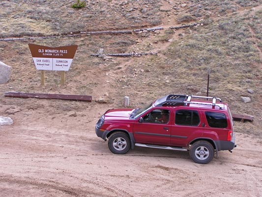
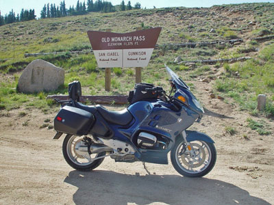
Old Monarch Pass - Chaffee / Gunnison Counties - Colorado - 11,375 feet - On the Continental Divide
Porphyry Creek to west. South Arkansas River to east.
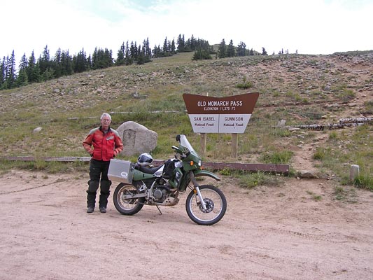
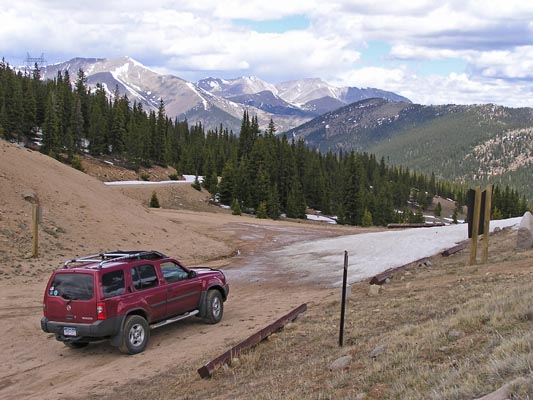
FR-237 north of Monarch Pass
gravel - road bike, but dual sport is better
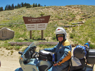
photos by Randy Bishop, 7/7/2007 during the Dirty Dozen ride
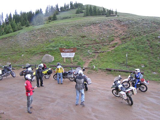
At the summit. |
At the summit. |
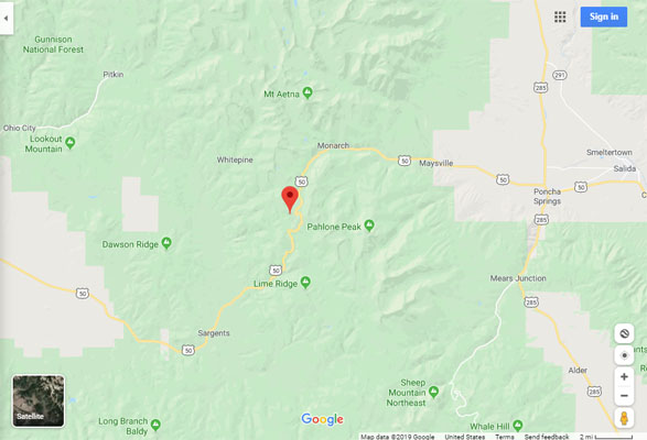
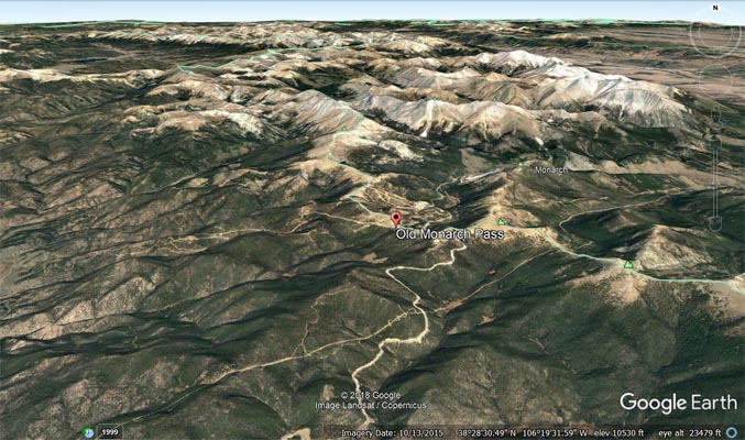
Google Maps |
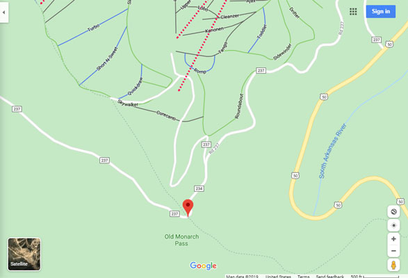
Google Maps |
Google Earth |
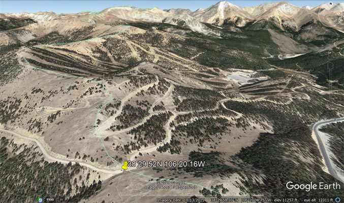
Google Earth |
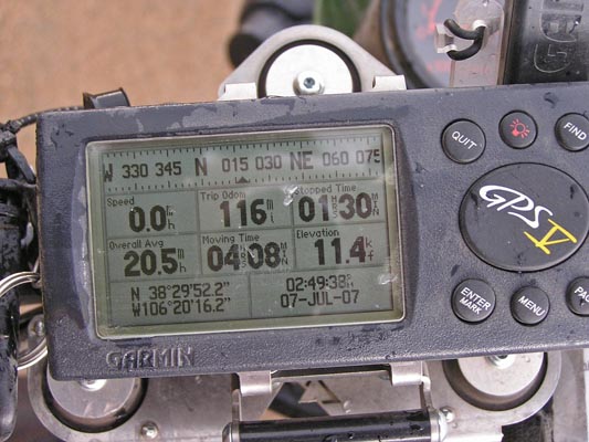
Garmin MapSource |
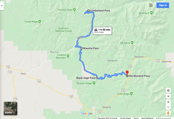
Google Maps, Cumberland to Old Monarch |
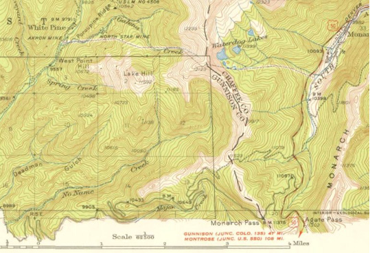
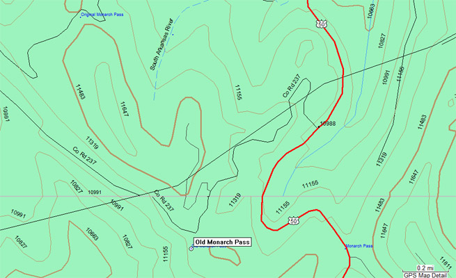
1940s USGS Topographic Map shows current (red/white), old (gray), original (gray dashes) |
#70 - photos by Randy Bishop, 8/12/2006
At the summit. |

At the summit. |
At the summit. |
At the summit. |
#70 - photo by Randy Bishop, 6/11/2005
At the summit. |
At the summit. |
At the summit. |
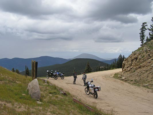
photos by Steve Mallison and Wade
Steve at the summit. |
Wade's bike at the summit. |
The 1929-vintage
History Colorado (State Historical Society of Colorado) marker read:
Monarch Pass. Across the Continental Divide between Arkansas and Gunnison River drainages. Altitude
11,386 feet. The Monarch Mining District, opened in the late seventies, lies east of the pass. Improved
highway opened 1921. Erected with the U.S. Forest Service, 1929.
| Feature Name | ID | Class | County | State | Latitude | Longitude | Ele(ft) | Map | BGN Date | Entry Date |
| Old Monarch Pass | 189721 | Gap | Chaffee | CO | 382948N | 1062017W | 11365 | Pahlone Peak | 01-JAN-1945 | 13-OCT-1978 |
| Feature Name | ID | Class | County | State | Latitude | Longitude | Ele(ft) | Map | BGN Date | Entry Date |
| Original Monarch Pass | 1675537 | Gap | Chaffee | CO | 383041N | 1062049W | 11532 | Garfield | 01-JAN-1996 | 13-OCT-1978 |
| Monarch Pass | 189720 | Gap | Chaffee | CO | 382948N | 1061932W | 11306 | Pahlone Peak | 01-JAN-1945 | 13-OCT-1978 |