
Mosquito Pass
|
Mosquito Pass |
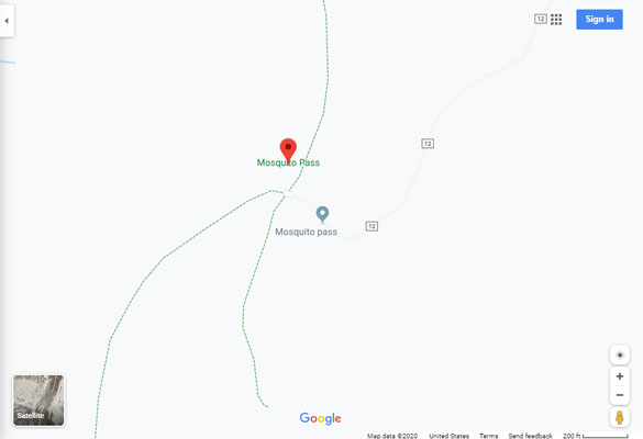
Mosquito Pass - Lake / Park Counties- Colorado - 13,186 feet
Birdseye Gulch to west. South Mosquito Creek to east.
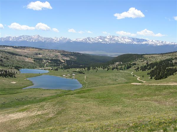
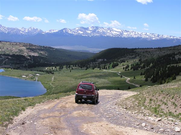
FR-12 between Alma and Leadville
gravel, rock - dual sport
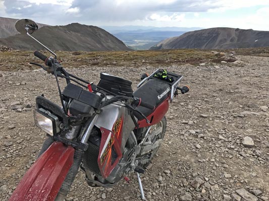
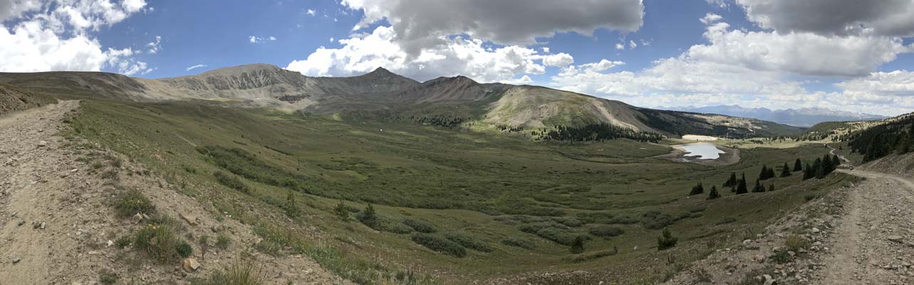
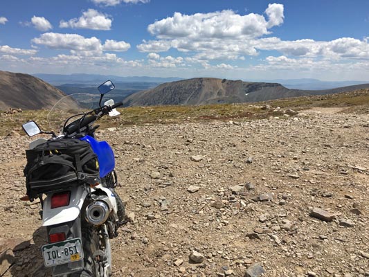
photos by Scott Westfall, 8/27/2017
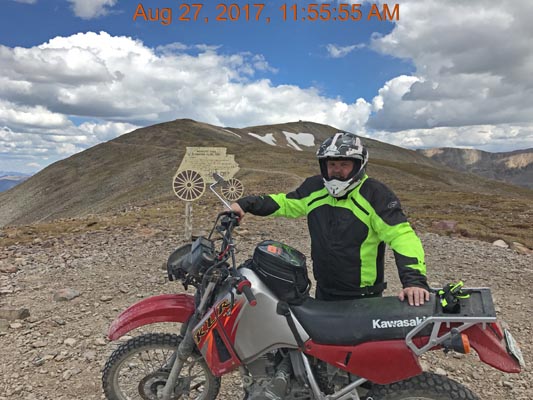
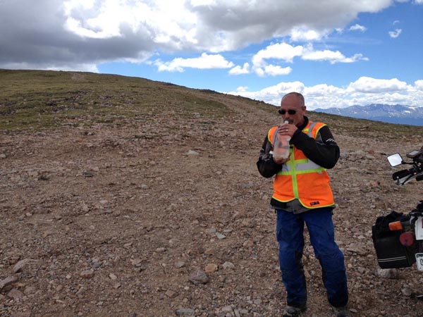
At the summit. |
At the summit. |
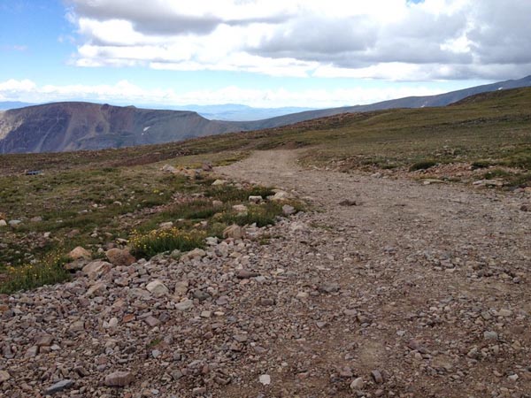
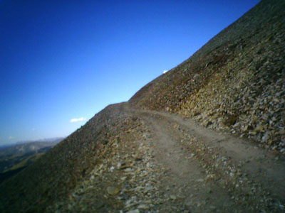
East of the summit. |
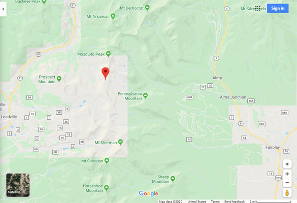
Google Maps |
Google Maps |
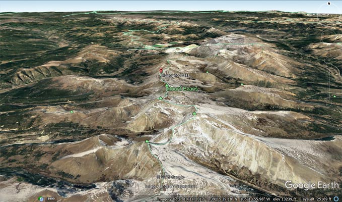
Google Earth, looking north. |
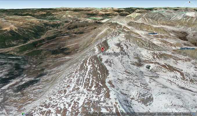
Google Earth, looking north. |
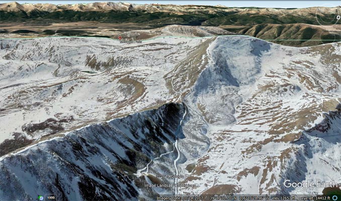
Google Earth, looking west. |
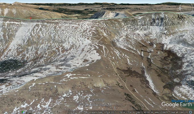
Google Earth, looking east. |
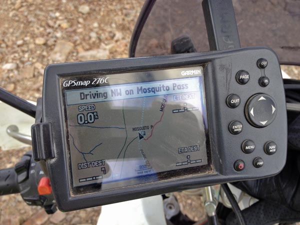
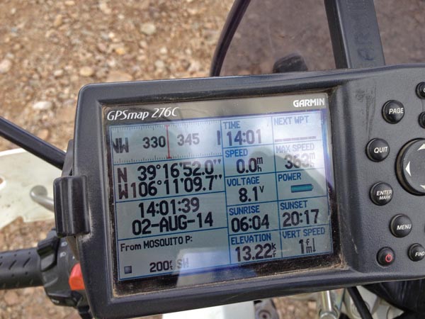
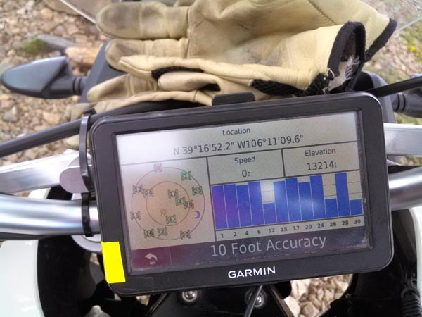
Garmin Mapsource |
photos by John Meyer, 8/18/2017
At the summit. |
At the summit. |
At the summit. |
At the summit. |
At the summit. |
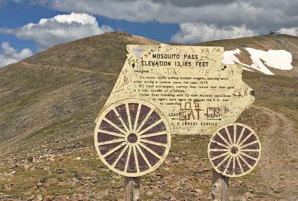
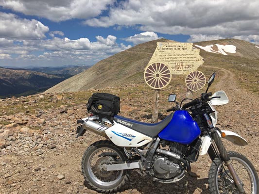
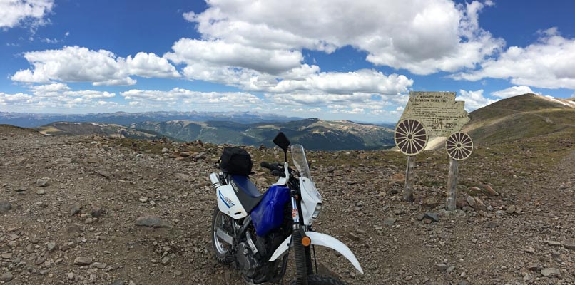
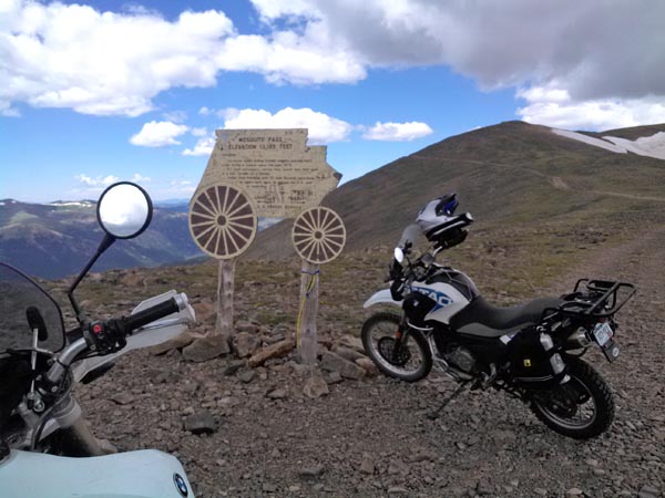
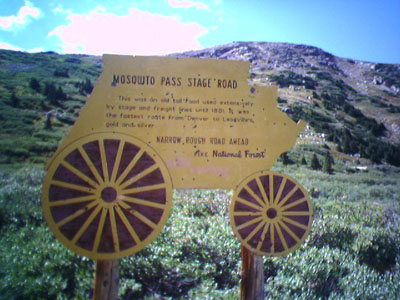
The sign reads: MOSQUITO PASS, ELEVATION 13,185 FEET. Imagine ... Six-horse teams pulling loaded wagons,
passing each other during a summer snow, the year 1878. ... 80 timid passengers, certain they would find
their gold in a halo instead of a hillside. ... Father Dyer traveling with 10-foot Norway snowshoes on
night's hard snow to deliver the U.S. mail to Leadville.
first row, photos by Karst Postma; second row, photos by Jeff Gronski; 8/2/2014
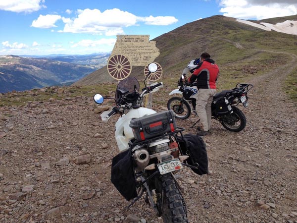
At the summit. |
At the summit. |
At the summit. |

At the summit. |
At the summit. |
At the summit. |
Near the summit. |

At the summit. |
At the summit. |
At the summit. |
Notes from Karst:
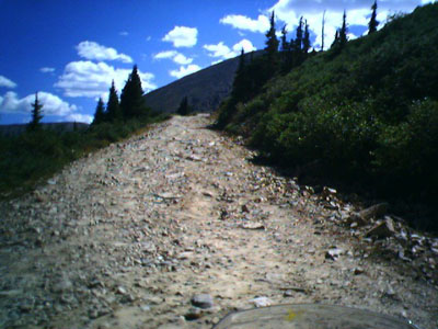
We made it up Mosquito Pass today. The stage was set before we even got to the hard dirt: a pickup truck
along the side of the road with a front wheel that had fallen off. Score: one for Mosquito Pass. Benchmark
Maps says that Mosquito Pass is the highest auto pass in the US.
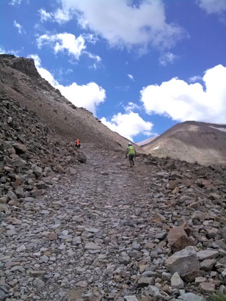
We came up from the east and descended on the west side towards Leadville. The east side is definitely the
more challenging side. I would call this side impassable for big bikes except for the most experienced riders.
You will have your hands full even on a 650 dual sport bike. A smaller dirt bike will make things a bit easier.
There were several sections that we walked to determine a route over the rocky steep sections for our dual
sport 650s. Lots of big rocks, ruts and drop-offs on a steep road the last 3 miles. It probably is critical you
ride with others on the east side to help you get your bike back up in a vertical orientation.
We came down the west side, but it sure looked easier that side for an ascent. There was only one hairpin
that may be a bit challenging. Even then, lots of rocks on a steep road to contend with before you reach the summit.
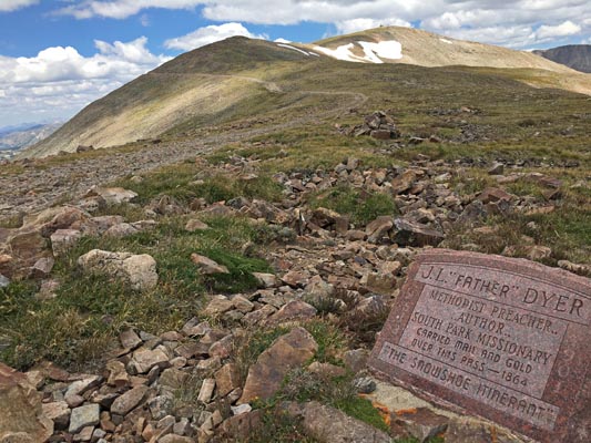
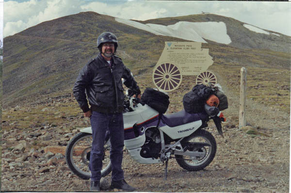
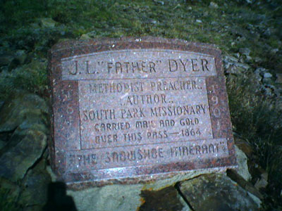
The stone marker reads: J.L. "Father" Dyer. Methodist preacher, author, South Park missionary. Carried mail and
gold over this pass - 1864. "The Snowshoe Itinerant".
photo by Roamin Carloski
At the summit. |
photos from Deward Knapp, 8/30/2005
In the valley west of Alma. |
Heading up toward New London mine. |
At the summit. |

At the summit. |

At the summit. |
At the summit. |
Near the summit. |
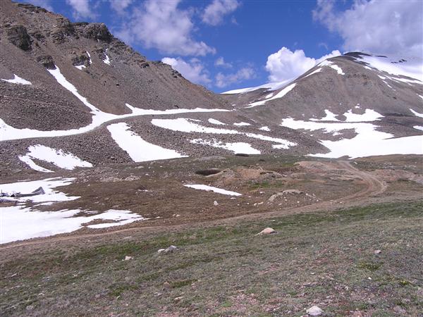
photos by Randy Bishop, 06/19/2004 - east side
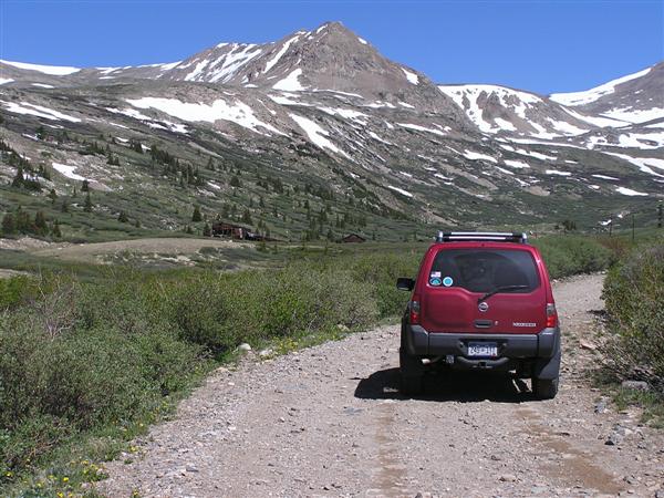
Heading up the valley on the easy part of the road. |
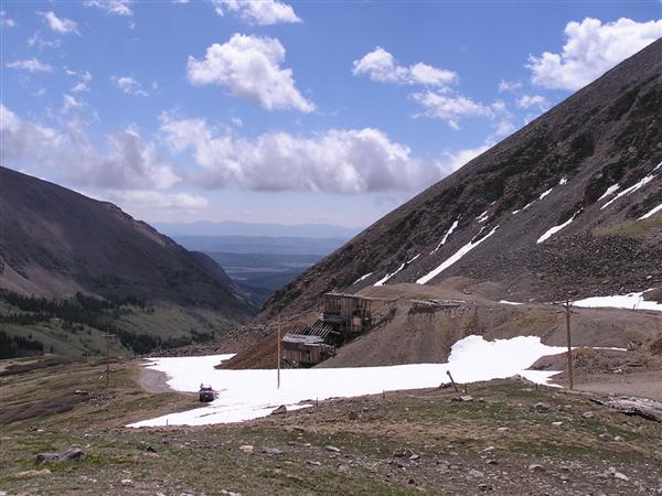
Looking east toward New London Mine and our turn-around point about 1.5 miles from summit. |
Looking north at New London Mine. |
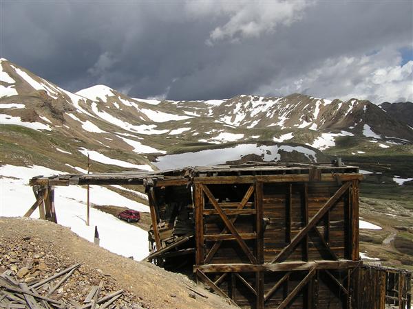
Looking west toward the summit. The road is covered by a long snow bank. |
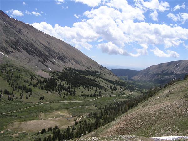
Looking back down to the east and the easy part of the road in the valley. |
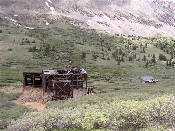
The London Mill along the valley road. |
photos by Randy Bishop, 06/24/2006 - west side

Our turn-around point, about 1 mile from summit. |
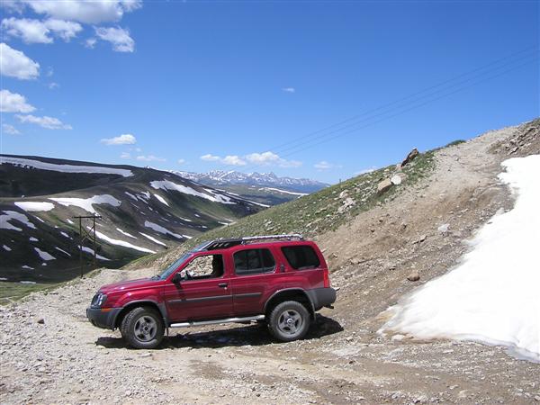
The bypass was steeper than we wanted to drive. |
Looking west toward Leadville. |
Looking west toward Leadville. |
| Feature Name | ID | Class | County | State | Latitude | Longitude | Ele(ft) | Map | BGN Date | Entry Date |
| Mosquito Pass | 179939 | Gap | Lake | CO | 391653N | 1061110W | 13179 | Climax | - | 13-OCT-1978 |