
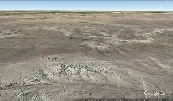
Packers Gap
|
Packers Gap |
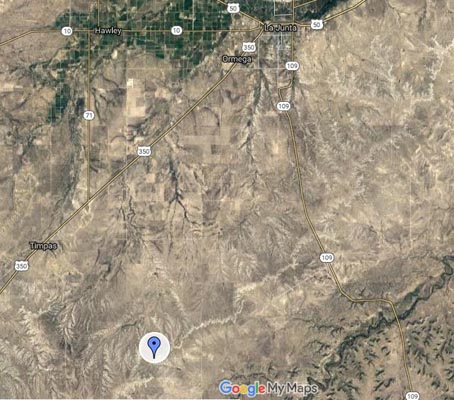
Packers Gap - Otero County - Colorado - 4,705 feet
Crooked Arroyo to west. Jack Canyon to east.
From Timpas on US-350, 5 miles east on CR-N, then 7 miles south and east on CR-21.75.
From CO-109, 8 miles southeast on CR-802, 1 mile south on CR-25, then 2.5 miles west on CR-G.
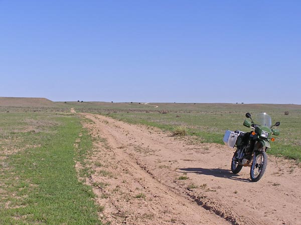
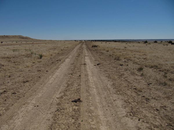
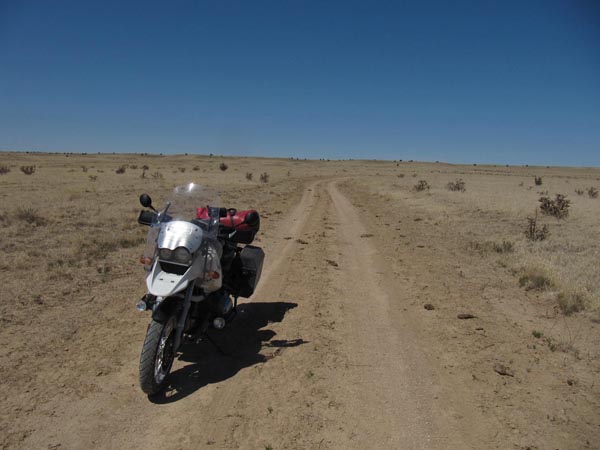
gravel, dirt - dual sport
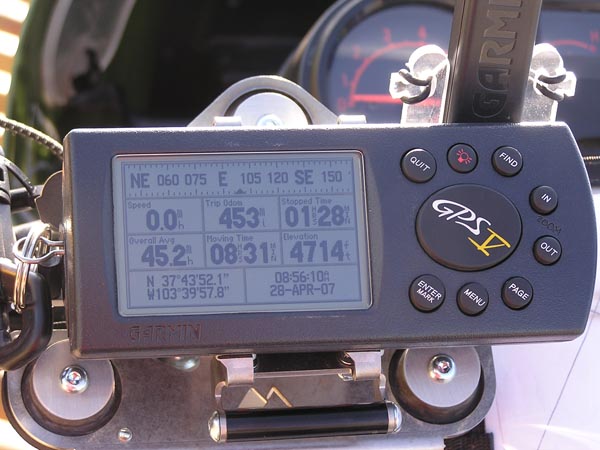
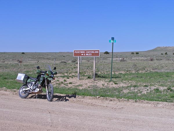
#80 - photos by Randy Bishop, 04/28/2007 (during an IBA SaddleSore 1000)
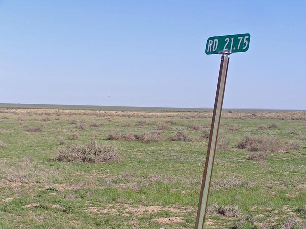
CR-N / CR-21.75, 5 miles east of US-350, and 7 miles north and west of summit. |
At the summit, looking west. |

At the summit, looking east. |
At the summit. |
CR-25 / CR-802, about 3.5 miles east and north of summit, looking west. |
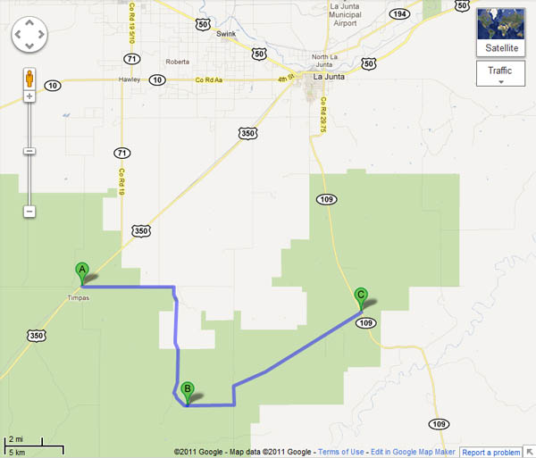
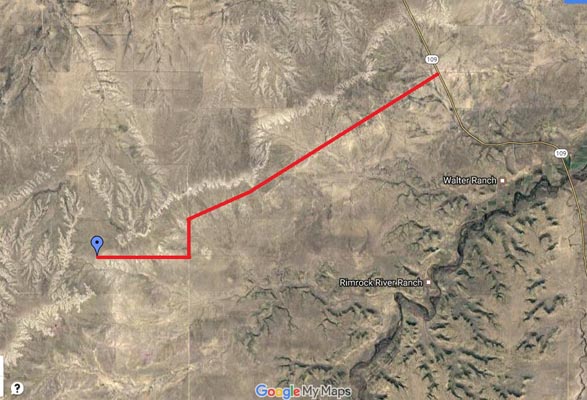
Google Maps, my route, west to east. |

Google Maps, with KLR650 photos! |
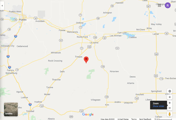
Google Maps |
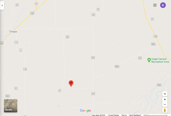
Google Maps |
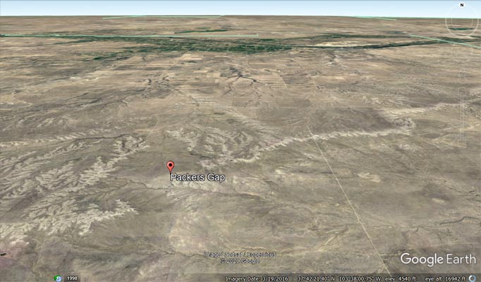
Google Earth |
Google Earth |
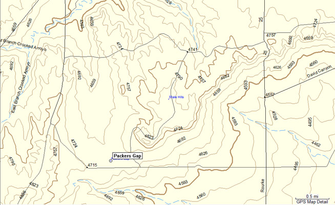
Garmin MapSource |
photos by Karst Postma, 5/3/2011
At the summit, looking east. |
At the summit, looking west. |
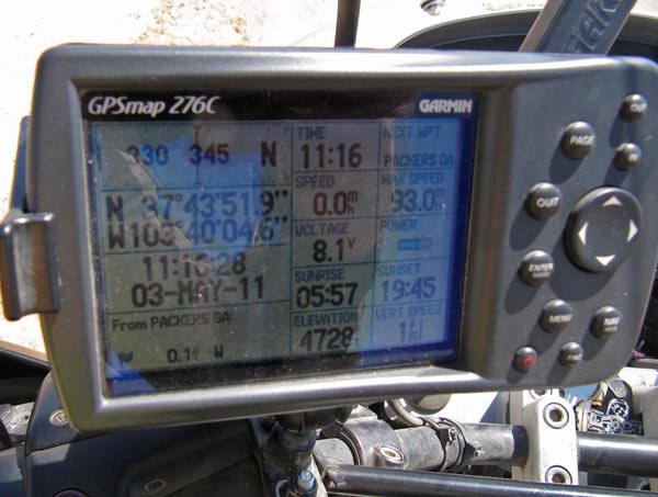
At the summit. |
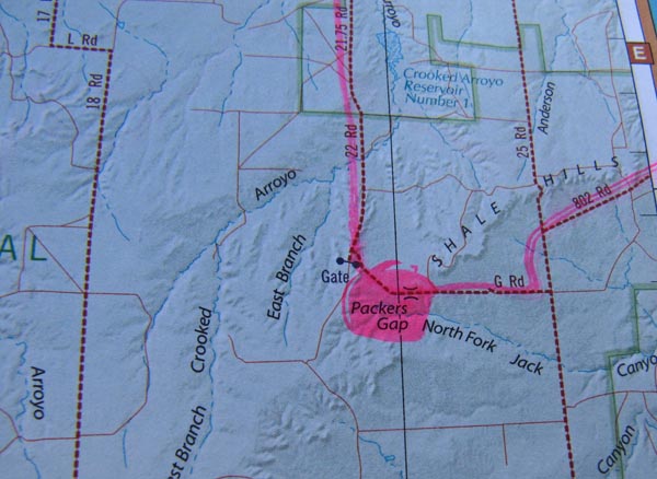
A map. |
Photos and notes from Scott Westfall, 2/10/2017

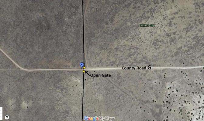
The gate at CR-25 and CR-G, looking west toward Packers Gap. |
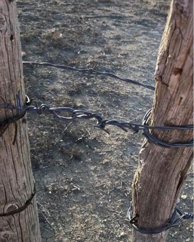
The barbed wire gate fastener. |
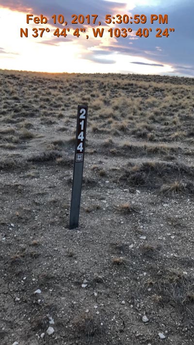
The FS route marker west of the gap where CR-21.75 splits into CR-F and CR-G (facing south, CR-F is to the right and CR-G is to the left towards the gap.) |
high altitude |
medium altitude |
fence view |
detail view |

ranch house |
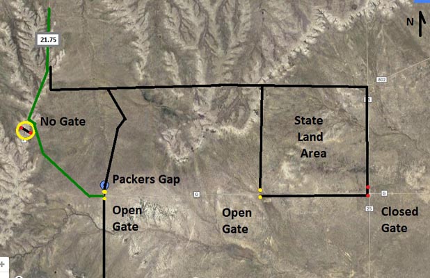
Packers Gap in Otero County south of La Junta cannot currently be approached from the east. The 2015 4th Edition of
Colorado Roads & Recreation Atlas incorrectly shows that Otero CR-G is open west of its intersection with CR-25 all
the way to Packers Gap, which then turns north and becomes CR-21.75. Truth is, CR-G is blocked by a gate (wired shut)
west of CR-25 at the southeast corner of the State Land Area square shown in the CO R&R atlas on page 117 section F 12.
Upon discovering this, I had to go all the way around to the north. I went north on CR-25, west onto CR-N, then south
on CR-21.75 to the fork in the road at CR-F. There it splits into CR-F (to the west) and CR-G (to the east towards
Packers Gap). The atlas shows a gate at this split. But we looked for at least a quarter mile south of the split (also
posted as FR-2144) and saw no gate or fence or cattle guard of any kind. At Packers Gap, CR-G is open east-west through
a cattle guard gate and continues all the way east to CR-25, but is blocked by the closed gate there.
Note: The surface of CR-21.75 south of CR-N is a straight flat improved dirt road for 4 miles before it dips gently out of view
and suddenly becomes a hairpin S-turn in front of a ranch house (with several dogs roaming free). Directly ahead is a creek
bed filled with large slabs of broken concrete debris directly in line with the main road just a few feet from the center of the
hairpin. I managed to avoid both the ditch and the dogs.
Seemed like a simple bag attempt. Turned out to be a little more challenging--on top of all this I popped my rear tire
on the way out, as well.
Shown in "Colorado Road & Recreation Atlas" by Benchmark Maps.
Listed in "The Passes of Colorado" by Ed and Gloria Helmuth.
| Feature Name | ID | Class | County | State | Latitude | Longitude | Ele(ft) | Map | BGN Date | Entry Date |
| Packers Gap | 194826 | Gap | Otero | CO | 374358N | 1033947W | 4705 | Packers Gap | - | 13-OCT-1978 |