
San Francisco Pass (east)
|
San Francisco Pass (east) |
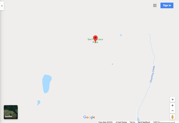
San Francisco Pass (east) - Las Animas County - Colorado - 8,420 feet
(other name - Sugarite)
San Francisco Creek to north. Chicorica Creek in New Mexico to south.
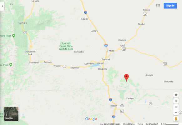
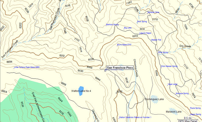
Las Animas County Road 85.5 southeast of Trinidad and east of Raton Pass.
unpaved - dirt bike or dual sport
photos by John Meyer, 9/13/2021
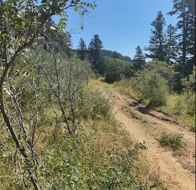
Near the summit. |
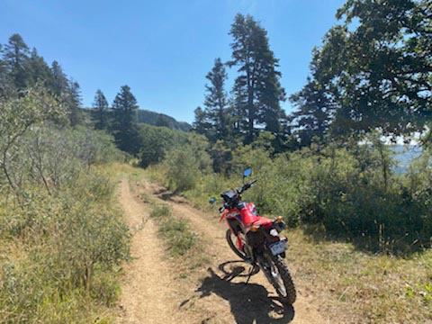
At the summit. |
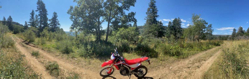
At the summit. |
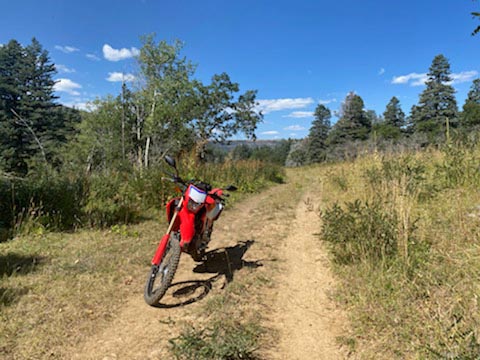
At the summit. |

At the summit. |
At the summit. |

At the summit. |
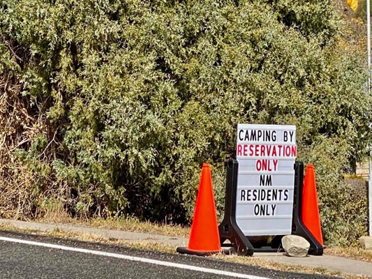
Notes from John: Made it to San Francisco Pass, east of Trinidad. I had planned to do it later this month
and then realized it closes on Sept 15th so I made a mad dash down to do it. I ended up making a loop out
of it (clockwise) entering from the north (Colorado side). The pass was great.
If starting in Trinidad (I used the El Moro Rest Stop on I-25) it was an equal time difference by doing the
pass in a clockwise direction, 58 minutes to the pass and 58 minutes to returning South through New Mexico,
Raton Pass and back to Trinidad, (I did a quick stop for fuel on the way back). The North side had more
difficult sections and would be a challenge or impossible in wet weather. The South side of the summit had
a couple of spots that were challenging, however it was easier than the north.
photos by John Meyer, 10/23/2020
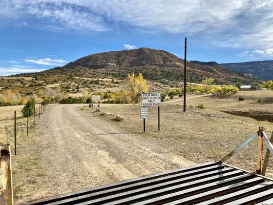
North of summit in Colorado. Four wheel drive vehicles only. Closed to motorized vehicles Sep 15 thru Memorial Day weekend. |
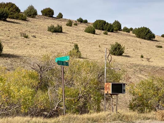
About 3 miles north of summit. Rd 12.5 / Rd 85.5. About 37 05 11N 104 22 00W. |
South of summit in New Mexico on NM-526. About 36 56 24N 104 22 48W. |
South of summit in New Mexico on NM-526. About 36 56 24N 104 22 48W. |

South of summit on NM-526 / Las Animas County Rd 85.5. About 36 59 36N 104 21 59W. |
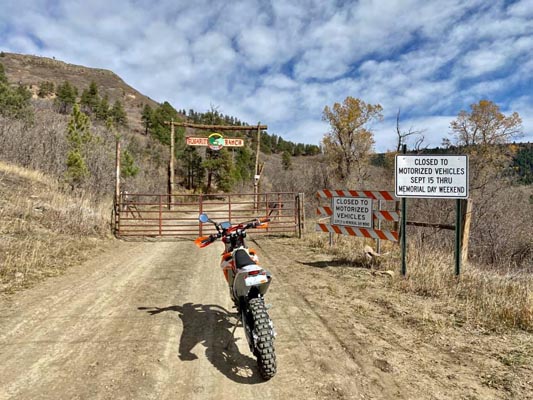
2 miles south of summit on Rd 85.5. Closed to motorized vehicles Sep 15 thru Memorial Day weekend. About 37 00 18N 104 21 12W. |
Google Maps |
Google Maps |
Google Earth |
Google Earth |
Google Earth |
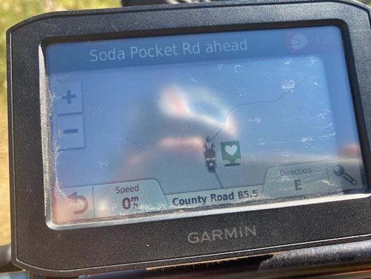
Garmin Mapsource |
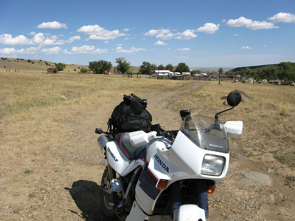
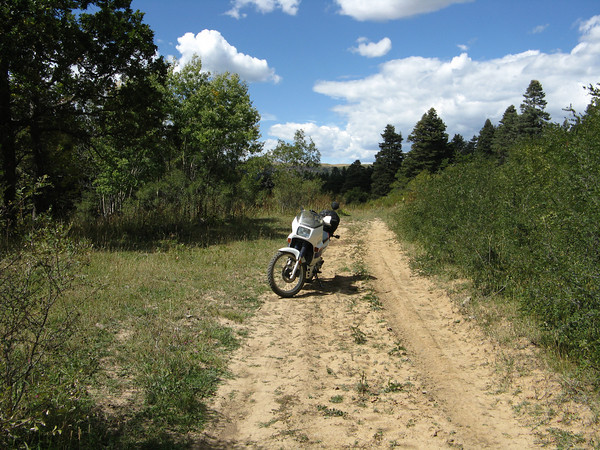
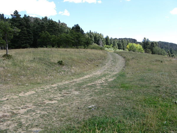
photos by Curtis Kohl, 9/2009

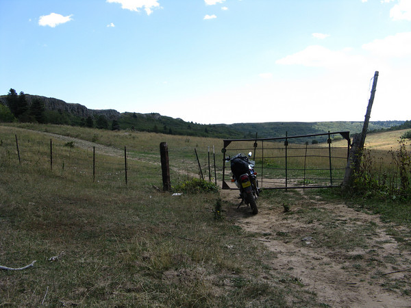
Ranch gate on north side of pass. Looking south. |
View back to ranch from north side gate. Looking north. |
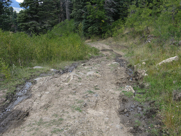
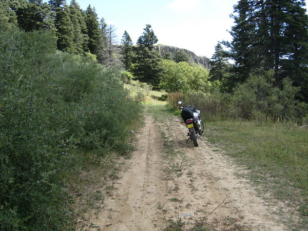
Road just north of pass summit. |

Road just north of pass summit. |

Road just north of pass summit. |
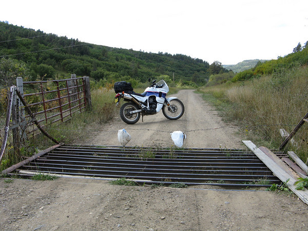
Another unlocked gate just below the summit on north side. |
View from San Francisco Pass summit, looking south. |
View from San Francisco Pass summit, looking north. |
View from San Francisco Pass summit, looking north. |
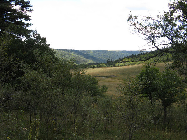
View from San Francisco Pass summit, looking north. |
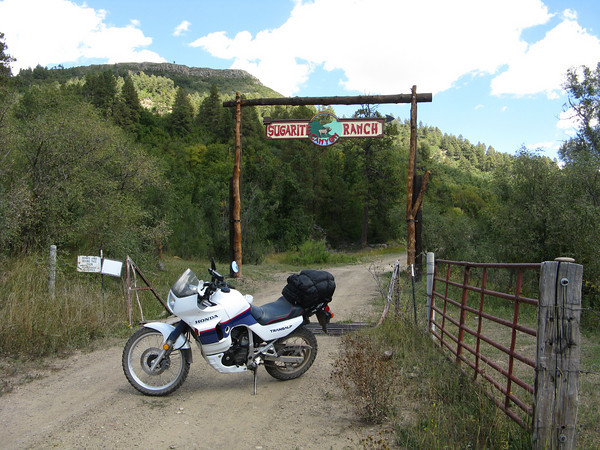
Final Sugarite Canyon Ranch entrance (that I came through from the north). |
Sugarite Canyon Ranch entrance. |

Home free! |
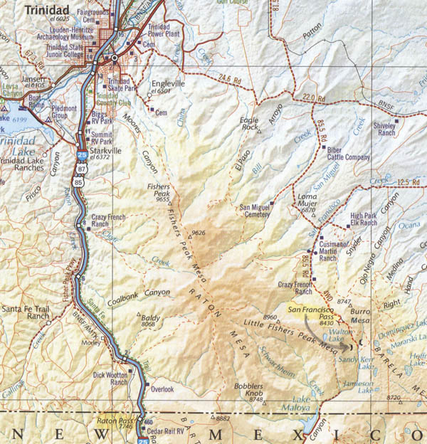
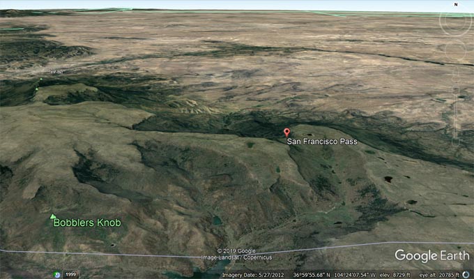
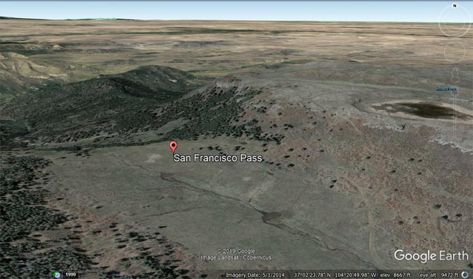
Arrow more accurately points to summit. |
Information from Karst Postma (10/2011) and Curtis Kohl (11/2011).
The Colorado rancher who lives north of the summit verified the road from there is a county road. Signs
along the way state, "please limit hours on the road to 10 AM to 2 PM". The road is a bit steep and rocky
for a lone rider on BMW 1150GS with Tourances but was passable with a Honda Transalp.
The road on the south side of the summit goes through the Sugarite Canyon Ranch, is unmaintained and
rarely traveled, but easier to ride. Since it passes right by the ranch house and comes to the ranch
entrance's closed gate, travel from the south would probably require permission from the owner. South of
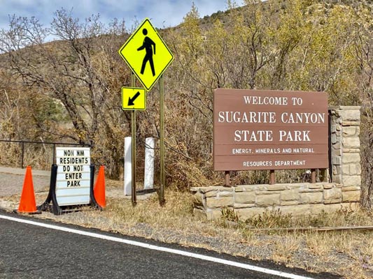
the entrance is paved New Mexico Road 526 and Sugarite Canyon State Park.
| Feature Name | ID | Class | County | State | Latitude | Longitude | Ele(ft) | Map | BGN Date | Entry Date |
| San Francisco Pass | 194907 | Gap | Las Animas | CO | 370220N | 1042106W | 8432 | Barela | - | 13-OCT-1978 |