
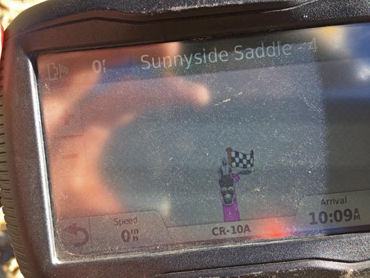
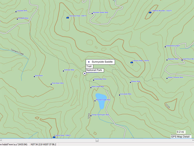
Sunnyside Saddle
|
Sunnyside Saddle |
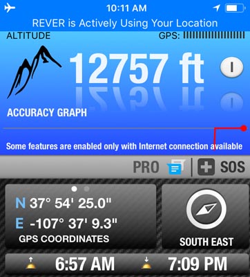
Sunnyside Saddle - San Juan County - Colorado - 12,780 feet
Cement Creek to west. Eureka Gulch to east.
About 1 mile east of FR-10.
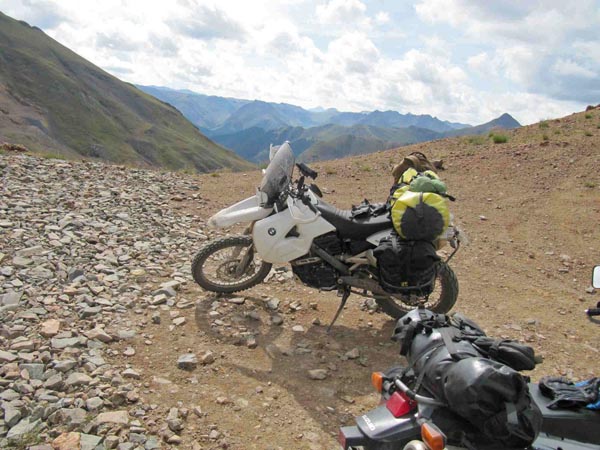
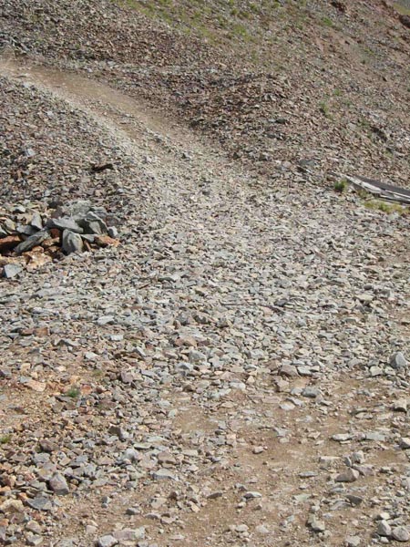
steep, rocky off-road - dirt bike or dual sport
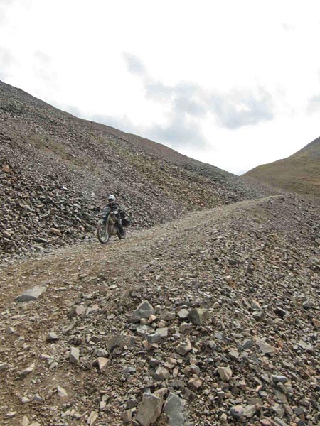
photos by John Meyer, 9/21/2018
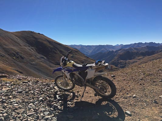
At the summit. |
At the summit. |
At the summit. |
At the summit. |
At the summit. |
At the summit. |
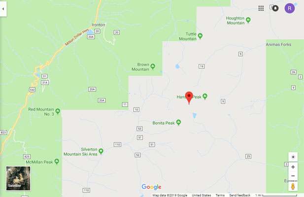
Google Maps |
Google Maps |
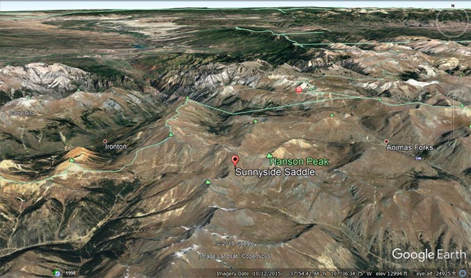
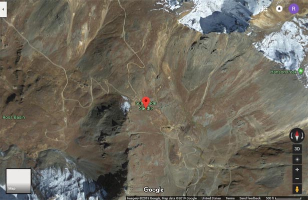
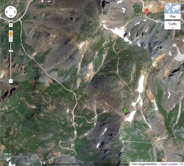
Google Earth |
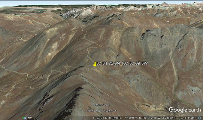
Google Earth |
Garmin MapSource |
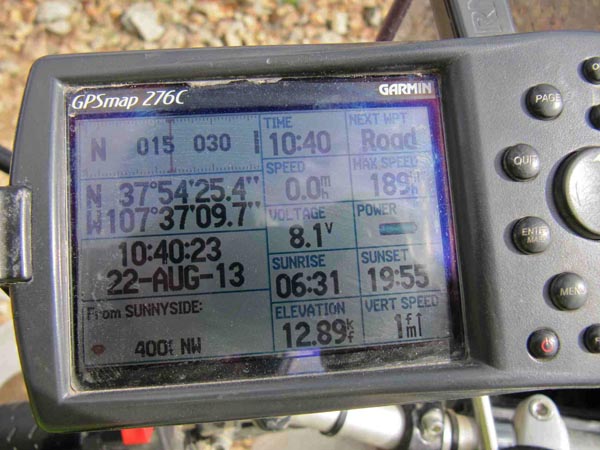
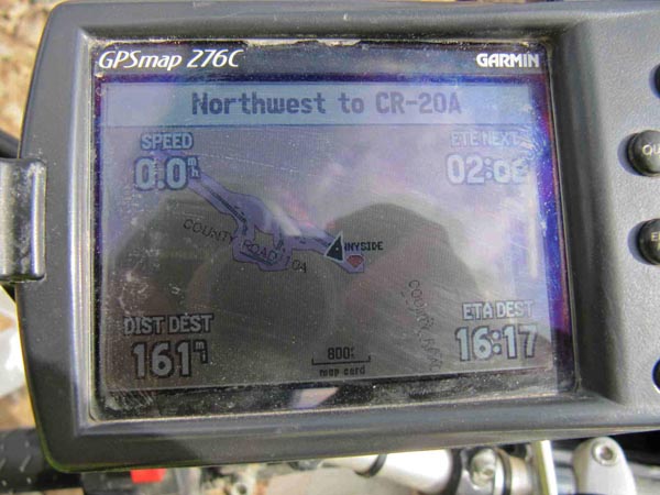
photos by Karst Postma, 7/30/2013
At the summit, looking east. |

At the summit, looking west. |
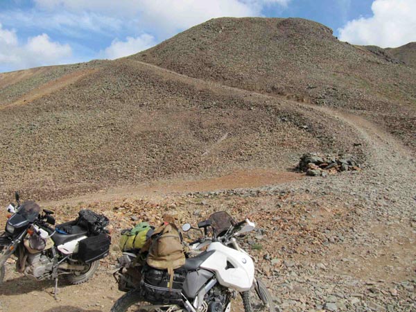
At the summit, looking north. |
Near the summit. |
At the summit. |
Looking down from from the summit. |
Descending from the summit. |
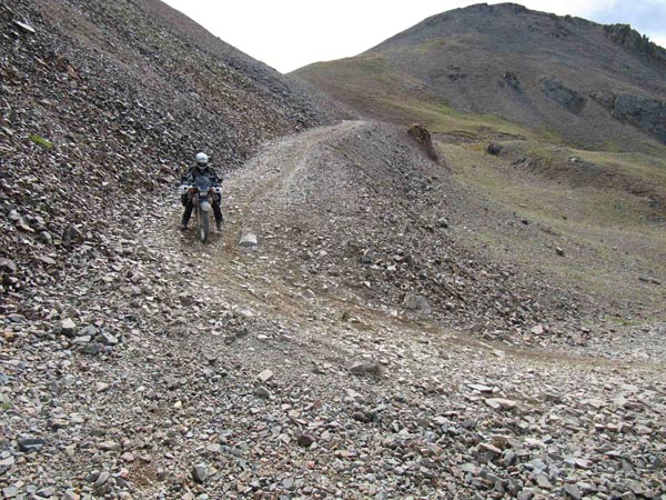
Shu descending from the summit. |
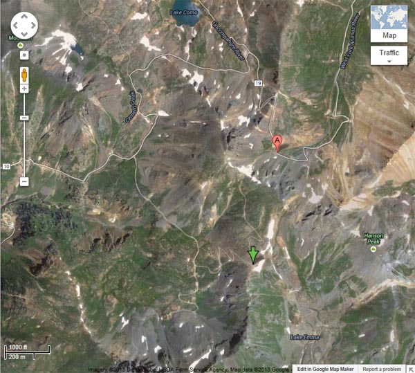
Google Maps, green arrow at Saddle. |
Google Maps, green arrow at Saddle. |
Garmin Mapsource |

Google Earth, looking north. |
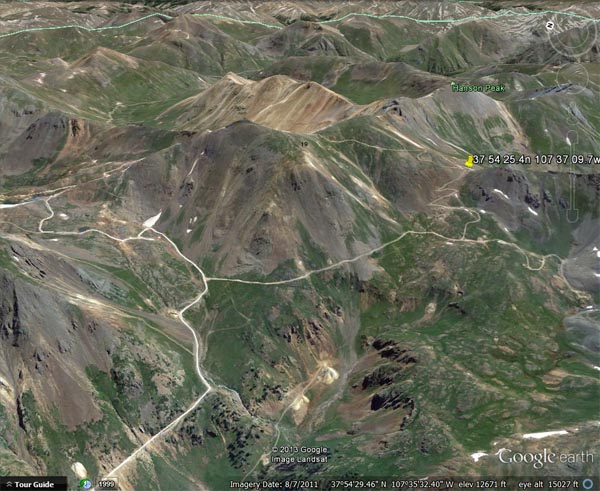
Google Earth, looking east. |
photos by Curtis Kohl, 9/2011
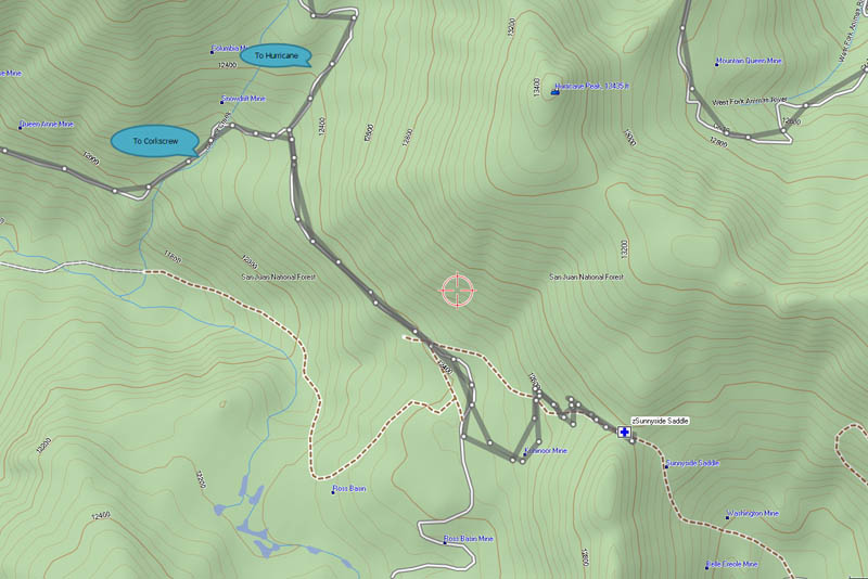
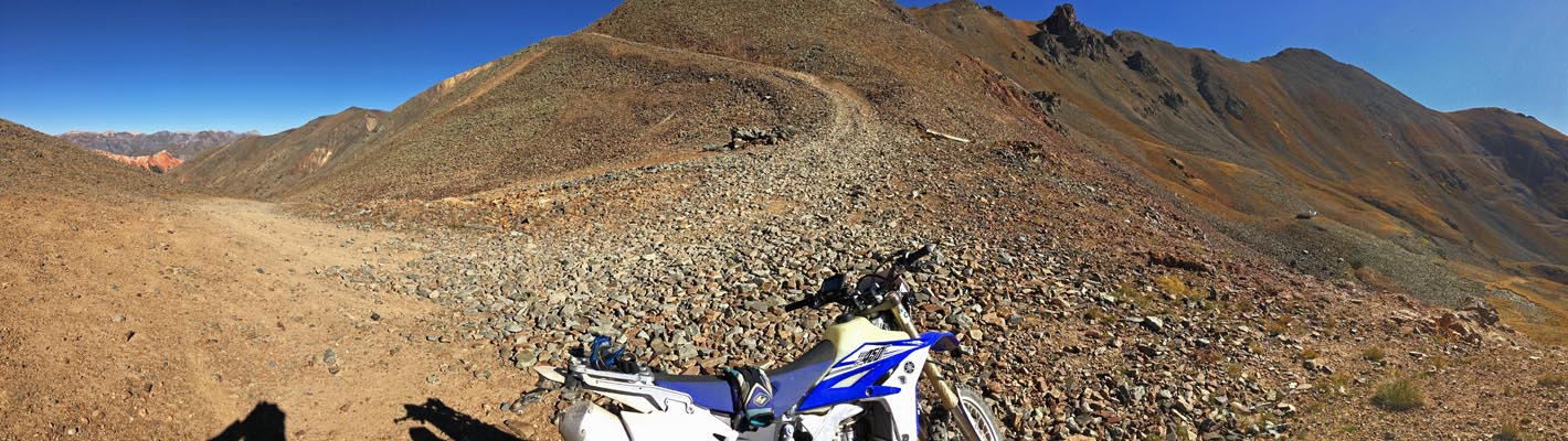
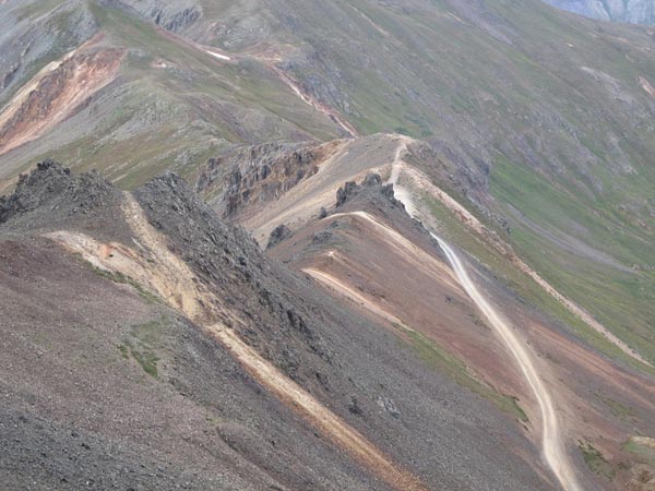
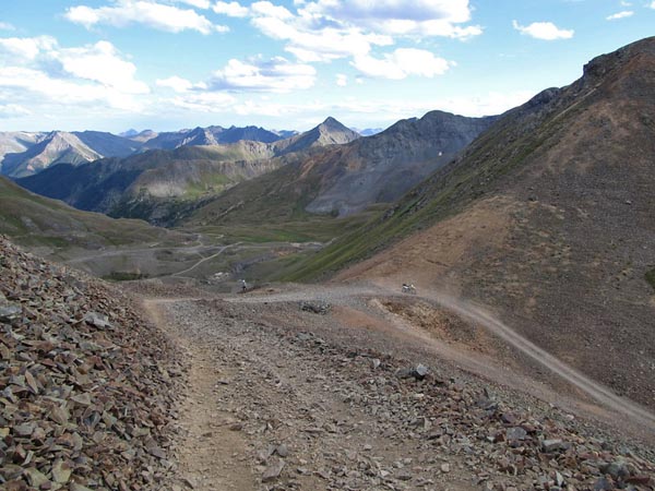
The track from FR-10 to the summit. |
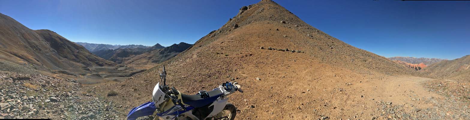
Road ends here on this ridge/saddle with Hurricane Peak behind. |
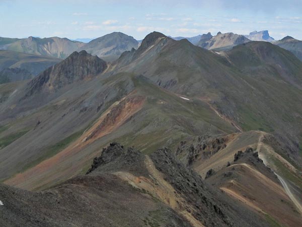
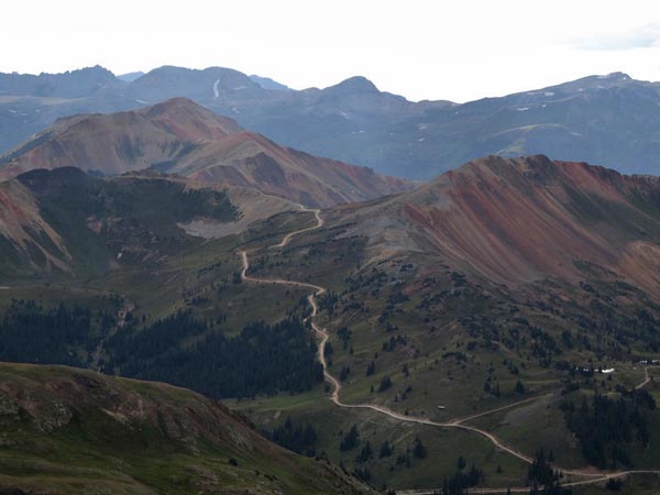
Amazing view off ridge...California Pass on lower right. |
Amazing view off ridge...California Pass on lower right. |
View down California Gulch from top of ridge. In the far distance on the upper left you can barely see Yvonne Pass. |
View from ridge towards Engineer Pass Rd. with Yvonne Pass and road peeling off to the right. |
View from just below ridge of the Corkscrew Road climbing up to Corkscrew Pass above the Hurricane Pass Rd. |
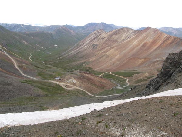
View down on Sunnyside Saddle and the drained Lake Emma in Eureka Gulch. |
photos by Curtis Kohl, 7/2011

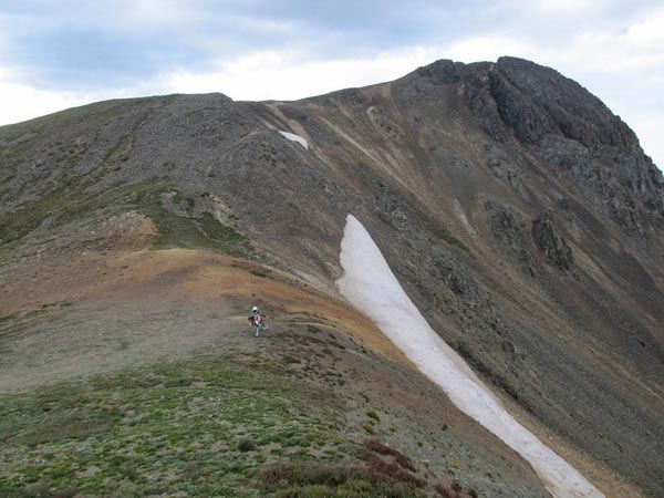
Snow wall on the way to the summit in July. |
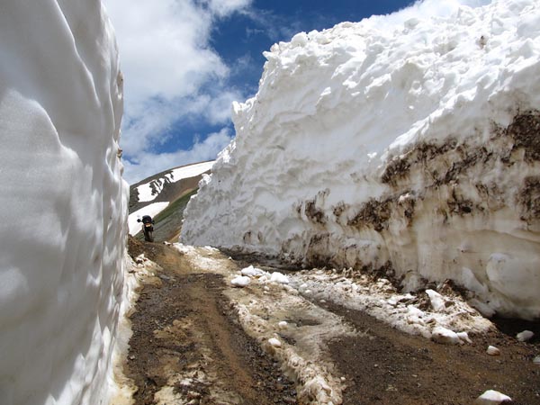
Snow wall on the way to the summit in July. |
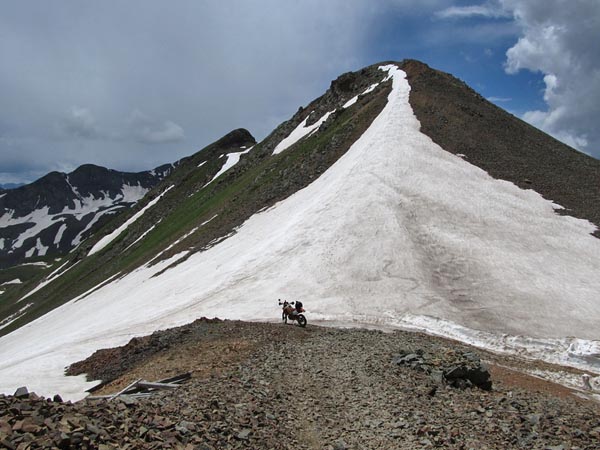
At the summit. |
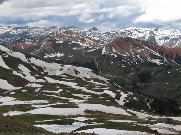
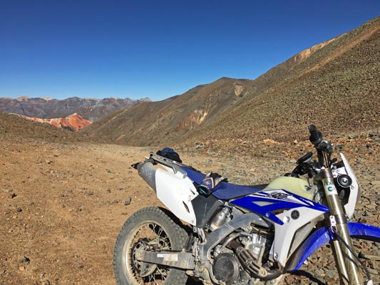
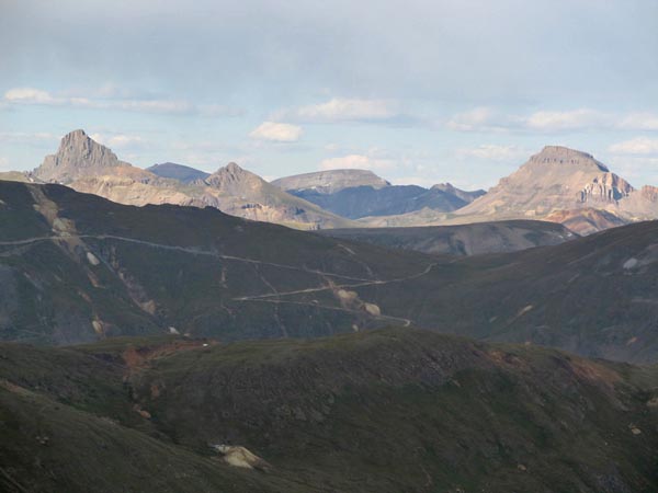
View towards Corkscrew Pass and Red Mountains from Sunnyside Saddle. |
Notes from Karst:
The road to Sunnyside Saddle is to the southeast of FR-10, the road between Hurricane and Corkscrew. It is steep,
very rocky with a couple of worn-out, steep, rocky and tight hairpins. Probably a bad idea for a big bike as there
is no room whatsoever for mistakes. The road continues steeply higher up after the pass to the Hanson Peak ridge, but
I do not know the condition of this road or how far it goes.
Notes from Curtis:
Sunnyside isn't an easy one to access and is usually only open for a month or two each year.
The steep road that climbs above Sunnyside Saddle goes to the top of the ridge next to Hurricane Peak to a point where
it looks steeply right down on California Pass. There is an amazing view from the top and several passes in the area
can be seen from there. The toughest part of that road is the first 100 yards or so above Sunnyside Saddle and the last
100 yards to the ridge (steep, but not as rocky).
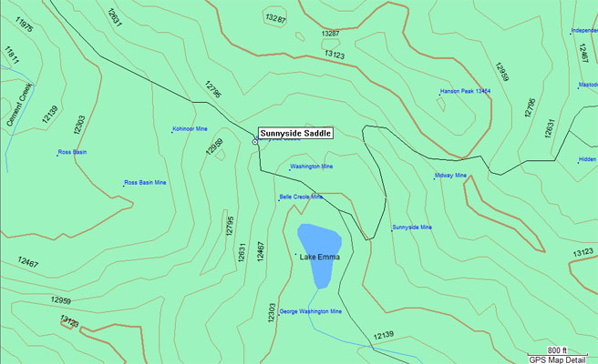
| Feature Name | ID | Class | County | State | Latitude | Longitude | Ele(ft) | Map | BGN Date | Entry Date |
| Sunnyside Saddle | 187384 | Gap | San Juan | CO | 375423N | 1073706W | 12677 | Handies Peak | - | 13-OCT-1978 |