
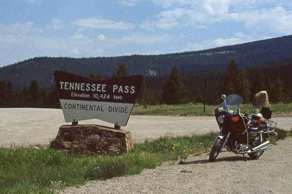
Tennessee Pass
|
Tennessee Pass |
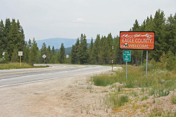
Tennessee Pass - Eagle/Lake Counties - Colorado - 10,424 feet - On the Continental Divide
(other names - Arkansas, Tenth Mountain)
South Fork of the Eagle River to north. Tennessee Creek to south..
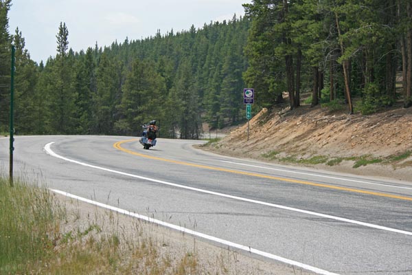
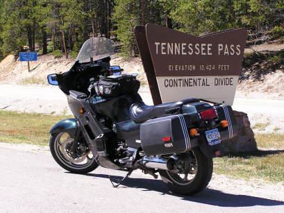
US-24 north of Leadville
pavement - road bike
photos by Randy Bishop, 7/20/2018
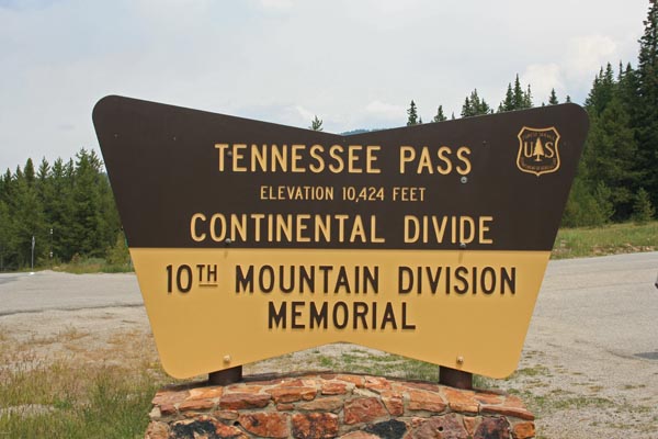
At the summit. |
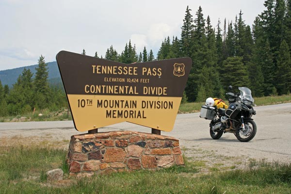
At the summit. 2009 BMW R1200GSA |
At the summit, looking south. |
At the summit, looking north. |
At the summit. |
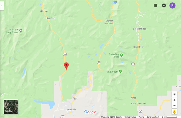
Google Maps |
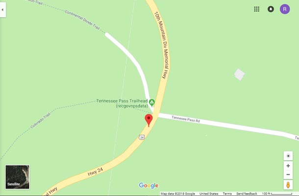
Google Maps |
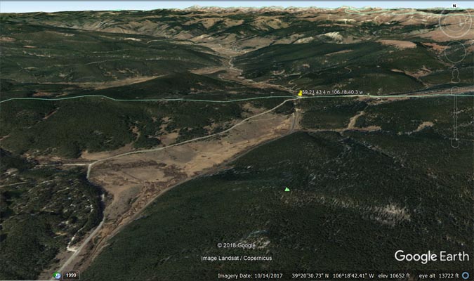
Google Earth |
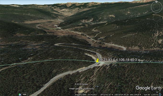
Google Earth |
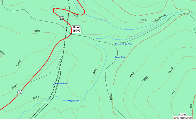
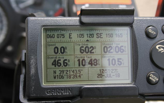
Garmin Mapsource |
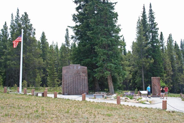
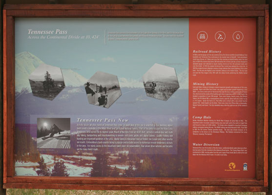
10th Mtn Div |
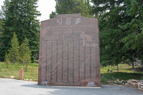
10th Mtn Div |
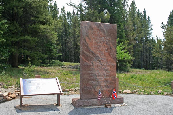
10th Mtn Div |
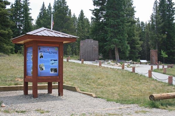
10th Mtn Div |
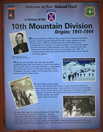
10th Mtn Div |
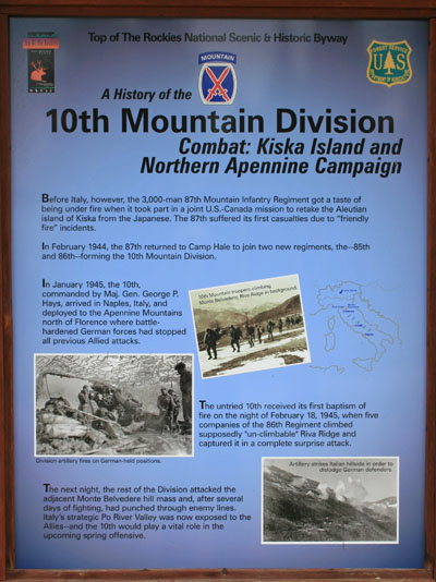
10th Mtn Div |
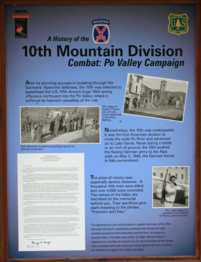
10th Mtn Div |
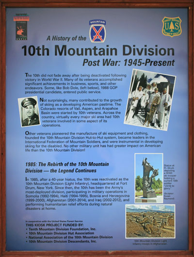
10th Mtn Div |
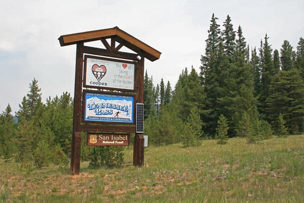
Tennessee Pass |
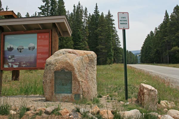
Vintage 1929 marker |
Vintage 1929 marker |
Tennessee Pass |
#32 for BMW Motorcycle Club of Colorado, Pass Bagger 50 - photos by Randy Bishop, 9/8/2005

At the summit. |
At the summit. 1997 Kawasaki ZG1000 Concours. |
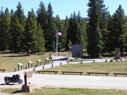
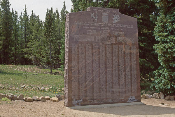
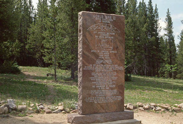
At the summit. 10th Mountain Division Memorial. |
photos by Randy Bishop
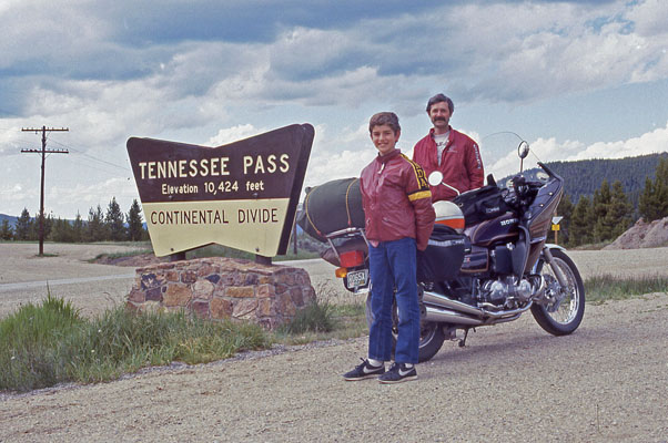
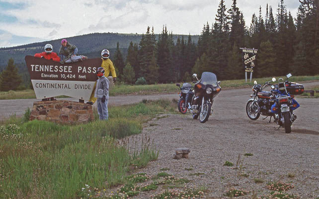
Randy and Phil at the summit. 7/2/1986 |
At the summit. 1981 Honda CB750K. 6/30/1990. |
At the summit, 6/30/1990. |
At the summit, 6/30/1990. |
P105 guys at the summit. 7/21/1990. |
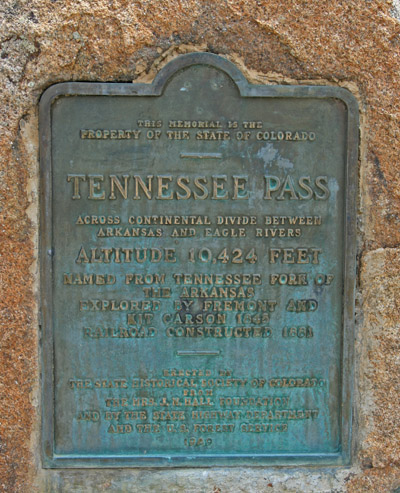
The 1929-vintage
History Colorado (State Historical Society of Colorado) marker reads:
This memorial is the property of the State of Colorado. Tennessee Pass. Across Continental Divide between
Arkansas and Eagle Rivers. Altitude 10,424 feet. Named from Tennessee Fork of the Arkansas. Explored by
Fremont and Kit Carson 1845. Railroad constructed 1881. Erected by the State Historical Society of
Colorado from the Mrs. J. N. Hall Foundation and by the State Highway Department and the U.S. Forest
Service. 1929.
| Feature Name | ID | Class | County | State | Latitude | Longitude | Ele(ft) | Map | BGN Date | Entry Date |
| Tennessee Pass | 179869 | Gap | Eagle | CO | 391917N | 1061840W | 10272 | Leadville North | - | 13-OCT-1978 |