
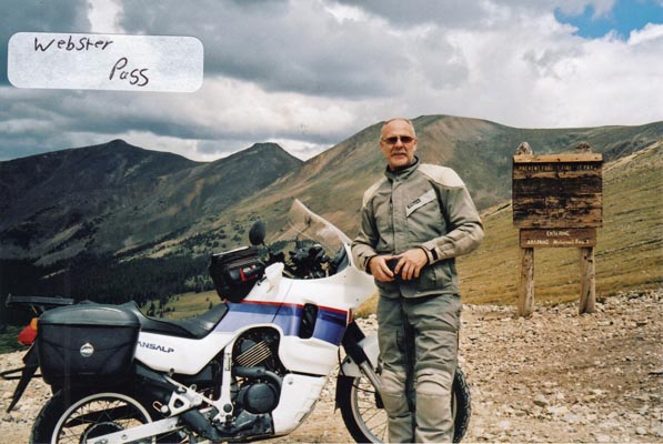
Webster Pass
|
Webster Pass |
Webster Pass - Park / Summit Counties - Colorado - 12,096 feet on Continental Divide
(Other names - Handcart, Montezuma)
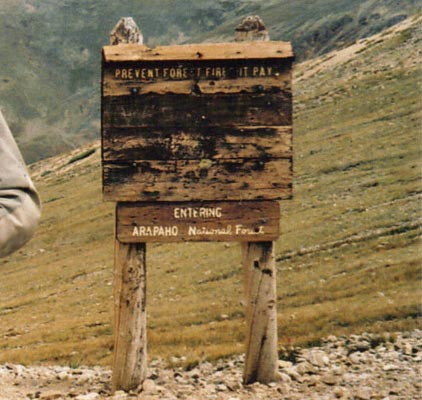
Snake River to north. Handcart Gulch to south.
FR-121 on south, FR-285 on north.
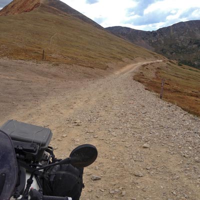
Off-road - dirt bike or dual sport
photo by John Meyer, 7/10/2016
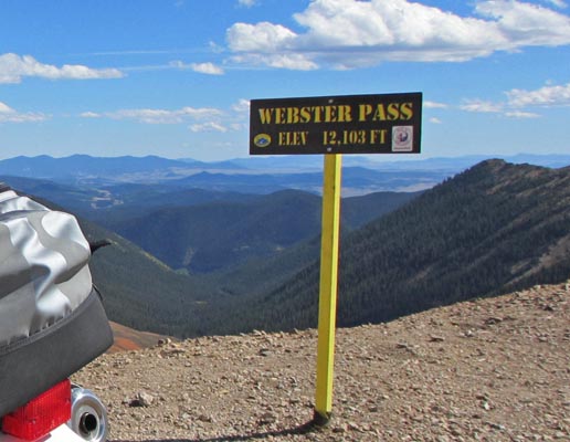
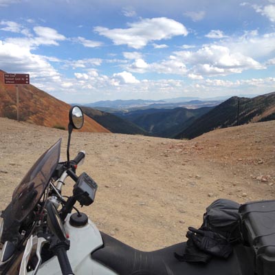
At the summit. |
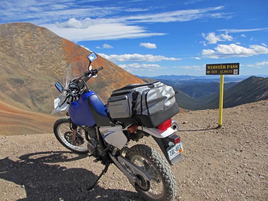
At the summit. |
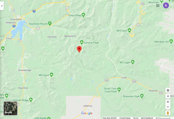
Google Maps |
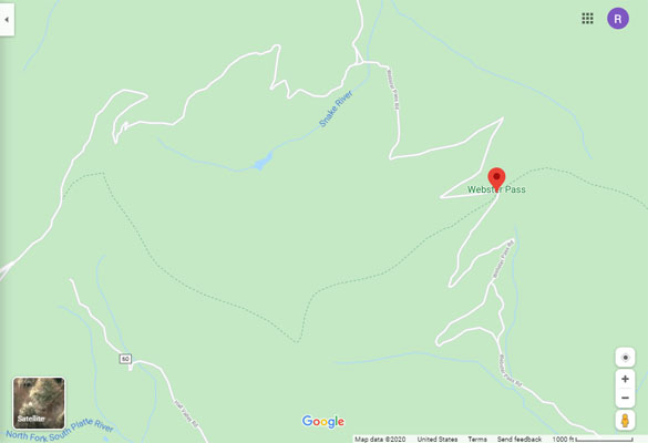
Google Maps |
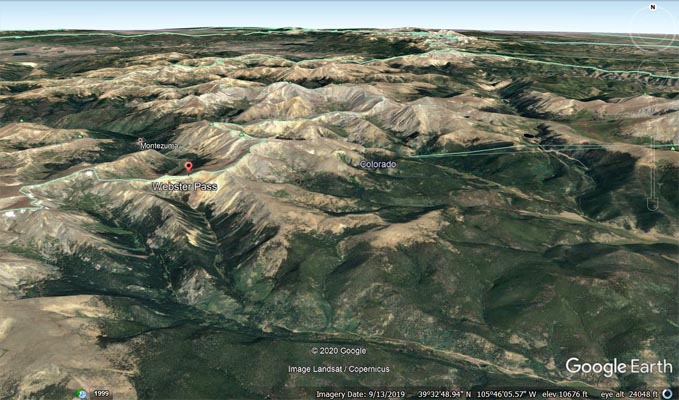
Google Earth, looking north. |
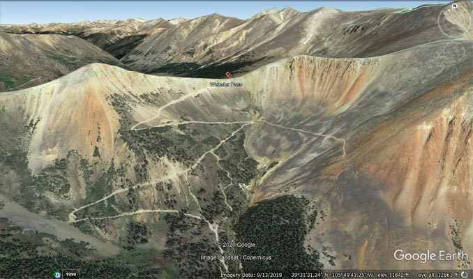
Google Earth, looking north. |
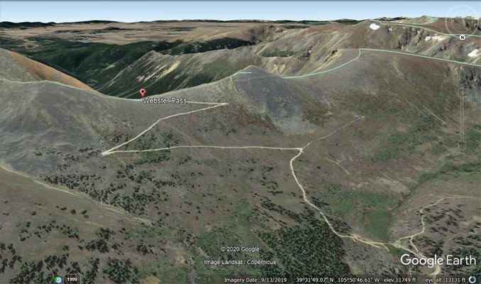
Google Earth, looking south. |
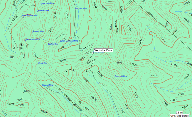
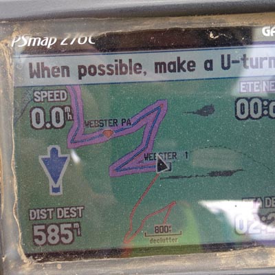
Garmin MapSource |
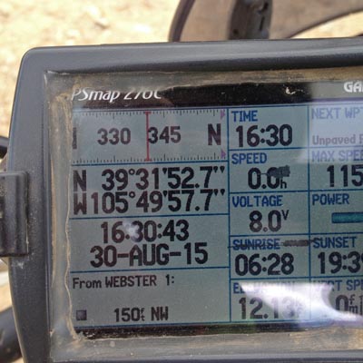
photos by Karst Postma, 8/30/2015
At the summit, looking south. Sign points right to Red Cone, Handcart Gulch Rd and Jefferson |
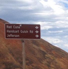
At the summit, looking south. Sign points right to Red Cone, Handcart Gulch Rd and Jefferson |
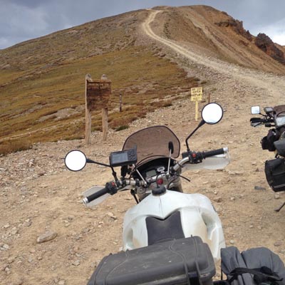
At the summit, looking southwest up Red Cone Mtn. |
At the summit, looking southwest up Red Cone Mtn. |
At the summit, looking west down FS-285, the approach from the north. |
At the summit, looking north toward Montezuma. |
At the summit. |
At the summit. |
photo by Roamin Carloski
At the summit. |
At the summit. |
Notes from Karst and Shu:
Shu and I finally rode up and down Webster Pass yesterday north to south. It is 5 miles from Montezuma to
the summit. The last 2 miles going up were continuously rough and rocky. One creek crossing with about
axle deep water (August 2015).
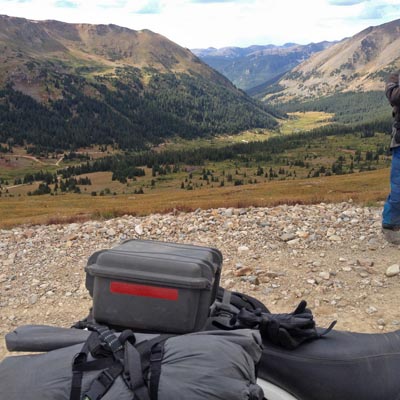
Going down on the south side was steeper but it seemed generally a little bit better. However, there were
a few sections that were worse with softball-sized rocks covering the road. The south side is a lot less
forgiving. It is narrow with steep drop offs. If you make a mistake it will be a long way down. This steep
difficult section on the south side was probably 2 miles, before it more or less leveled out. Total distance
from the summit to US-285 is about 7 miles.
I was glad we were on lighter 650 bikes. I would say it requires better than average skills to do this pass,
considering the risks on the south side. It requires comfort riding on loose large rocks.
Curtis pointed me to an excellent website
http://bushducks.com/tripreps/passopen.htm
that is full of good and current condition information. It will be my go-to website from here on out.
| Feature Name | ID | Class | County | State | Latitude | Longitude | Ele(ft) | Map | BGN Date | Entry Date |
| Webster Pass | 182389 | Gap | Summit | CO | 393152N | 1054958W | 12103 | Montezuma | - | 13-OCT-1978 |