
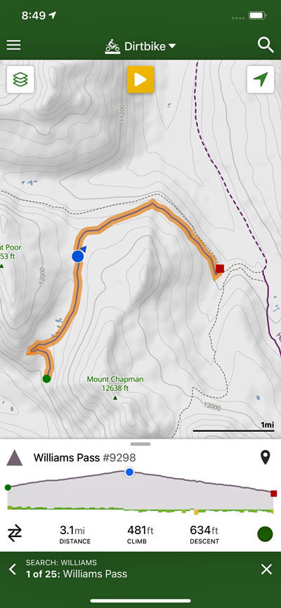
Williams Pass
|
Williams Pass |
Williams Pass - Chaffee / Gunnison Counties - Colorado - 11,781 feet - on the Continental Divide
Tunnel Gulch to north. Middle Quartz Creek to south.
East of Pitkin off FR-839 (Alpine Tunnel Road) near The Palisades.
Trail is open only during the month of August.
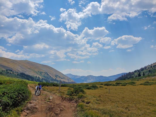
mud - dirt bike
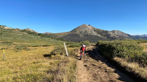
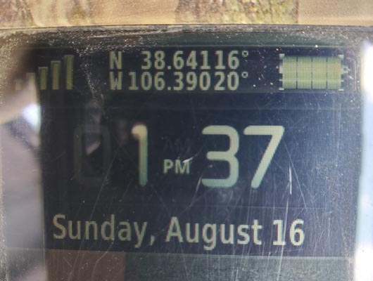
photos by John Meyer, 8/28/2021
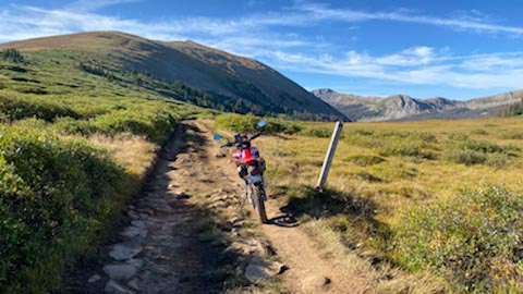
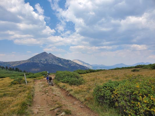
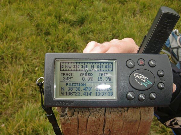
At the summit. |
At the summit. |
At the summit. |
At the summit. |
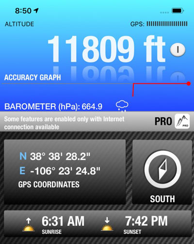
At the summit. |
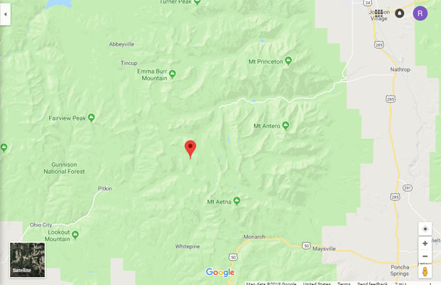
Google Maps |
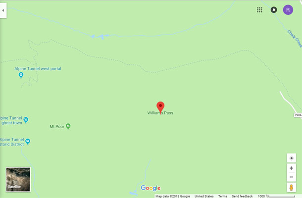
Google Maps |
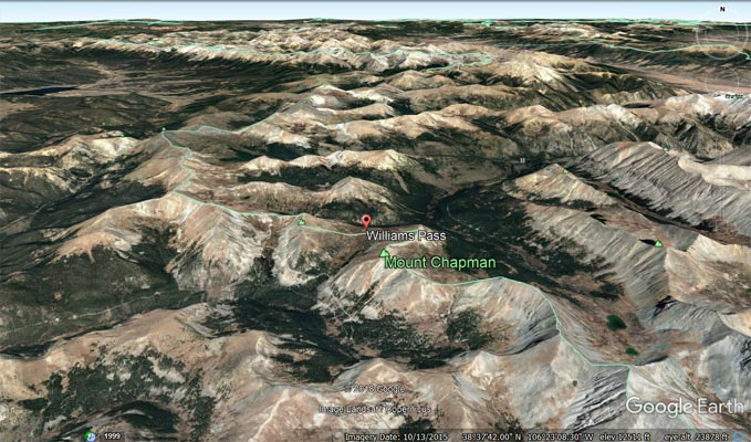
Google Earth, looking north. |
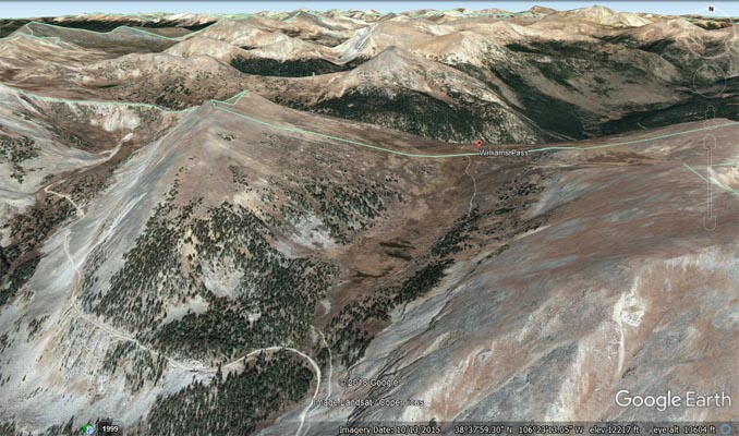
Google Earth, looking north. |
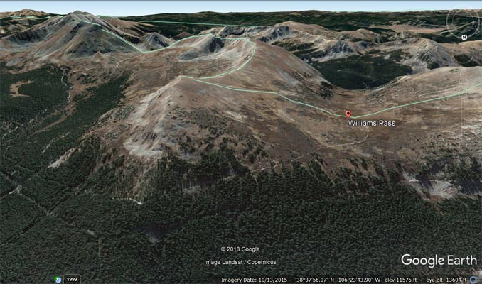
Google Earth, looking south. |
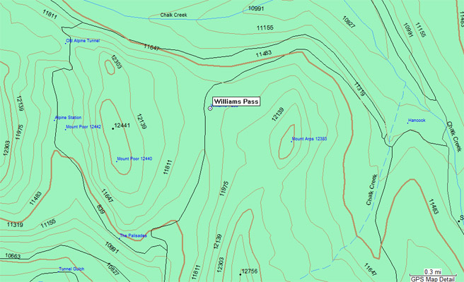
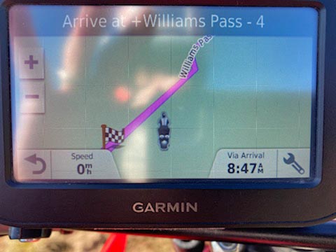
Garmin MapSource |
Notes from 8/28/2021:
I finally bagged my nemesis, Williams Pass this morning. It was a beautiful day and
I am glad I was out early to get ahead of the crowd. Also, I am loving my little Honda CRF300L.
photos by Dave Vining, 8/16/2020
At the summit. |
At the summit. |
At the summit. |
photos by John Meyer, 9/18/2018
Approach from the north. |
Approach from the south. |
Approach from the south. |

Approach from the south. |
Approach from the south. |
Notes from 9/18/2018:
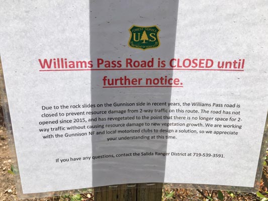
On the approach from the north, on USFS sign: Due to the rock slides on the Gunnison side in recent years, the Williams
Pass road is closed to prevent resource damage from 2-way traffic on this route. The road has not opened since 2015, and
has revegetated to the point there is no longer space for 2-way traffic without causing resource damage to the new
vegetation growth. We are working with the Gunnison NF and local motorized clubs to design a solution, so we appreciate
your understanding at this time.
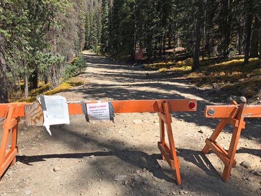
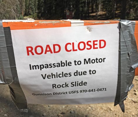
On approach from the south, on USFS sign: Road closed. Impassible to motor vehicles due to rock slide.
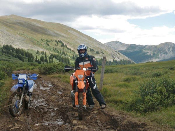
photos by Chris Wilder and Brandi N., 8/24/2014
At trailhead near The Palisades. |
At the summit. |
At the summit. |
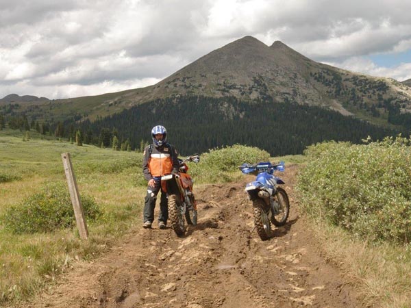
At the summit. |
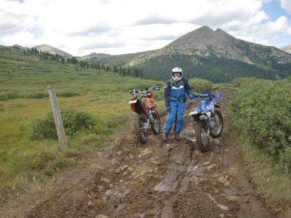
At the summit. |
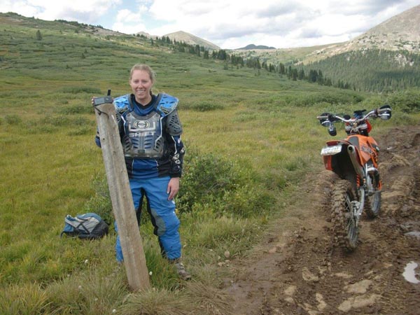
At the summit. |
At the summit. |
Chris Wilder's notes on 4/9/2020 in response to the question, "Why is Willams Pass one of your favorites?"
Back in 2002 I had camped for a night outside St. Elmo and the next day rode my KTM 200. My plan was to explore
all the roads in the area to see it in the summer since I rode sleds there quite often in the winter. When I ended
up on Williams Pass the weather had closed in and was starting to rain. The road was barely a road and had puddles
that were almost deeper than the 21” inch front wheel on the KTM. It was a little unnerving being in that situation
by myself and knowing there wasn’t a chance anyone was coming along to save me if something went wrong. I’m pretty
sure I made it to the top of the pass before I turned around.
Fast forward to 2011 and Brandi and I discover the BMW Motorcycle Club and the Pass Bagger program. I start talking
to people about passes and Williams comes up. I’m told it’s a hiking trail and not a road. Really I said but I’ve
been on it and it is a road. That was met with “Oh you were probably on Hancock and didn’t know it”. So the research
began and I found that Williams had been closed by the forest service for 12 years and reopened in 1997. The Blue
Mesa Wheelers had cut a deal with the Forest service to rehab the trail and make it passable. Even then it was only
open Aug 1 through Aug 30 and only if it was clear of snow and dry enough.
August of 2014 comes along and Brandi and I decide to go see if it’s open. We camped in Taylor park and dealt with
RZR’s everywhere. It was the last weekend of some week long RZR jamboree. The next morning I went to get the bikes
out of the trailer and prepped for the ride only to discover a flat front tire on Brandi’s Yamaha. I ended up putting
a new tube in and all was good. I had been told that the St. Elmo side was usually still under snow in the trees in
August and may not be passable so we decided to hit it from the Pitkin side. Once we were past the town of Tincup and
headed up Cumberland Pass most of the RZR traffic was gone and we were on our way.
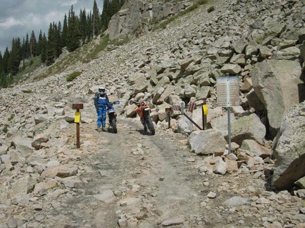
The entrance to Williams is somewhat intimidating. It is VERY rocky and using a kickstand while opening the gate can
prove to be a challenge. After the first 50 yards from the gate it became just like any other 4wd road in Colorado,
dirt 2 track with random rocks sticking out and an occasional water crossing. After about a mile it comes out of the
woods and you find yourself in what appears to be a creek with no way to ride on the sides since they are straight up.
This is where the fun began as we crawled up and over and around all the solid rock obstacles. As we continued it
became muddier and very slick. At the top it’s pretty much thawed tundra but still has boulder sections. The post that
I put the GPS on is all that marks the top, it probably had a sign at one point.
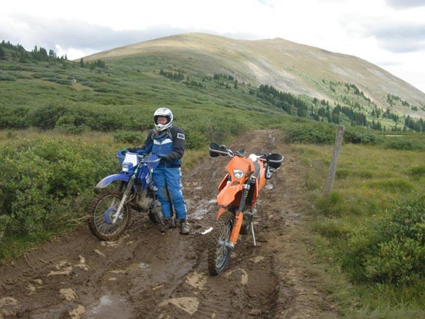
The view from the top is awesome. Everything was so lush and green it was beautiful!
Then came the trip back down, we knew what was ahead now, we had to control our speed and did I mention it was slick?
We made it down but not without a derailed and jammed chain on Brandi’s Yamaha and a broken kickstand bolt on the KTM.
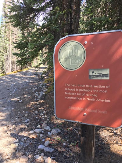
We then continued to the Alpine tunnel and checked out all the stuff there. Pretty cool!
I have heard that the gate hasn’t been opened since 2015 which is to bad but considering how fragile the landscape is
and how dumb people can be I understand.
| Feature Name | ID | Class | County | State | Latitude | Longitude | Ele(ft) | Map | BGN Date | Entry Date |
| Williams Pass | 189337 | Gap | Chaffee | CO | 383830N | 1062322W | 11781 | Cumberland Pass | - | 13-OCT-1978 |