
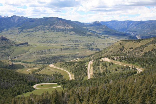
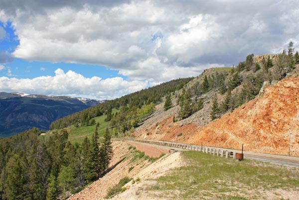
Dead Indian Pass
|
Dead Indian Pass |
Dead Indian Pass - Park County - Wyoming - 8,000 feet
On WY-296 about 30 miles northwest of Cody, WY,
and about 32 miles southeast of the intersection with US-12, the Beartooth Pass Highway.
paved - road bike
WY-296 is a super motorcycling road!
photos by Randy Bishop, 6/30/2014
At the summit. |
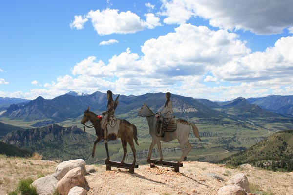
At the summit, looking northwest. |

At the summit, looking northwest. |
At the summit, looking northwest. |
At the summit, looking north. |
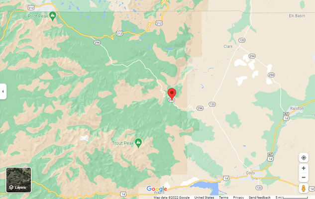
Google Maps |
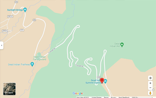
Google Maps |

Google Maps |
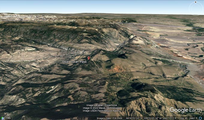
Google Earth |
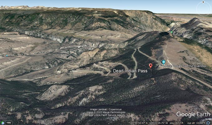
Google Earth |
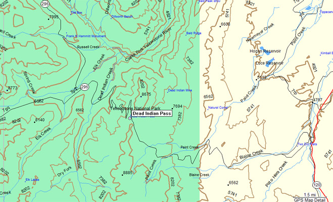
Garmin MapSource |
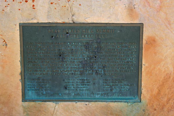
The plaque reads:
Dead Indian Hill Summit, alitude 8,000 feet. This pass is the summit of
Dead Indian Hill. Through this portal great herds of wild game seasonally migrated from the
mountains to the plains. This high pass was the gate way for countless Indian hunting and war
parties, and through this portal Chief Joseph, in 1877, led his Nez Perce Indian in a
strategic and defensive retreat, persued by U.S. Army soldiers. Over this one and only
opening of the valleys to the west traveled a vast army of miners to seek the wealth of
Cooke City. And down this steep hill the early settlers of Sunlight Basin braved its dangers.
The first road improvement was made possible in 1909, by dwellers of Sunlight Valley whose
names are here inscribed.
Adolphus J. Beam, Wm. V Campbell, Siras J. Davis, Wade W. McClung, Augustus A LaFond,
Oliver Whitney, Hervey G. Marvin, Samuel Thompson, John R. Painter, Evelyn T. Painter,
Mary E. Painter, Wm. T. Painter, Marguerite M. Painter, John K. Rollinson, Willard D. Ruscher.
This historical marker dedicated 1940.
One of the story boards at the summit reads:
The ridge you are standing on was the last significant barrier for more than 600 Nez Perce
Indians and their 2,000 horses as they fled the pursuing U.S. Cavalry. After the battle of
the Big Hole a month earlier, they knew the Army did not intend to leave any survivors. This
became a "flight for their lives."
Now on the run for more than 60 days, they had hoped that by crossing this pass and reaching
the plains they could join their old allies, the Crows, or hasten on to join Sitting Bull
in Canada. They began climbing to this point from the valley below. By this time, all were
exhausted and heartbroken from the long journey and aiding their sick and wounded. But they
also knew that winter was closing in. If they could make it over this mountain fast enough,
they just might escape the Army and regain their freedom.
Accounts tell us that the Nez Perce left a wounded warrior on this mountain. He was
discovered and killed by the Army scouts. Thus this site became known as "Dead Indian Pass."
| Feature Name | ID | Class | County | State | Latitude | Longitude | Ele(ft) | Map | BGN Date | Entry Date |
| Dead Indian Pass | 1587418 | Gap | Park | WY | 444437 | 1092306 | 7874 | Dead Indian Meadows | 05-JUN-1979 | 29-FEB-2020 |