
Resources
|
Resources |
Navigating rides on major paved roads around the mountains is easy. All that is really needed is a Colorado state highway map and a relatively short
planning session.
Navigating rides on unpaved roads is a little more complex because many of them aren't shown on the normal highway maps and sometimes they are poorly marked.
Unpaved roads can include smooth well-treated surfaces, gravel, deep gravel, sand, rock, bigger rock, gradual rises, and steep climbs.
Quite a variety, requiring more planning time and more detailed maps and other resources.
Listed here, in order of usefulness, are some of our favorite travel aids. Most of them can be found at your local book store or at Amazon.com.
Newer versions of many of the books are available.
 "The Passes of Colorado, An Encyclopedia of Watershed Divides", by Ed Helmuth & Gloria Helmuth, Pruett Publishing Company, 1994,
ISBN 0-87108-841-X, 315 pages, 6x9. Contains information about 469 passes around the state, including elevation, county, watershed
divides, description of location, and history.
"The Passes of Colorado, An Encyclopedia of Watershed Divides", by Ed Helmuth & Gloria Helmuth, Pruett Publishing Company, 1994,
ISBN 0-87108-841-X, 315 pages, 6x9. Contains information about 469 passes around the state, including elevation, county, watershed
divides, description of location, and history.Our number one resource for the Pass Bagger 50. |
 "Colorado Road & Recreation Atlas", Regional Maps (10 pages), Recreation Guides (30), Landscape Maps (93) with geographic coordinates,
and Metro Area Maps (5), Benchmark Maps, 2018, ISBN 0-929591-12-7, 142 pages, 10.5x15.5. Like the Gazetteer, but highlights recreational roads more than hiking trails.
"Colorado Road & Recreation Atlas", Regional Maps (10 pages), Recreation Guides (30), Landscape Maps (93) with geographic coordinates,
and Metro Area Maps (5), Benchmark Maps, 2018, ISBN 0-929591-12-7, 142 pages, 10.5x15.5. Like the Gazetteer, but highlights recreational roads more than hiking trails.
|
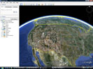 Google Earth, used to map locations, to get a birds-eye view of a site, and to rotate the direction, angle
and elevation of the view point. Very handy for getting an idea of how the road or trail will look when approaching the site from different directions.
Google Earth, used to map locations, to get a birds-eye view of a site, and to rotate the direction, angle
and elevation of the view point. Very handy for getting an idea of how the road or trail will look when approaching the site from different directions.
|
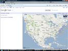 Google Maps, used to map locations and to show directions from one site to another.
|
 Garmin's MapSource United States TOPO. Features digital topographic maps for the U.S., including
Alaska and Hawaii, that are comparable to the U.S. Geological Survey's 1:100,000 scale paper
maps.
Garmin's MapSource United States TOPO. Features digital topographic maps for the U.S., including
Alaska and Hawaii, that are comparable to the U.S. Geological Survey's 1:100,000 scale paper
maps.
|
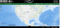 USGS, The National Map (TNM), Your Source for Topographic Information.
From the USGS: TNM Advanced Viewer has a wide range of functions. Here are the primary areas: Download Client link — Links to our application for downloading National Map GIS data, TNM Download Client. Help Pages link — Links to these Help pages covering the Advanced Viewer. Widget Panel—Contains tools to add layers and manipulate map data. |
 "Guide to Colorado Backroads & 4-Wheel-Drive Trails", 4th Edition, by Charles A. Wells & Matt Peterson, FunTreks, Inc., 2019, ISBN 978-1-934838-26-6. 100 trails west of I-25 and south of I-70.
"Guide to Northern Colorado Backroads & 4-Wheel-Drive Trails", 4th Edition, by Charles A. Wells & Matt Peterson, FunTreks, Inc., 2019, ISBN 978-1-934838-27-3. 90 trails west of I-25 and north of I-70. |
 "Colorado Trails, Southwest Region", by Peter Massey, Jeanne Wilson and Angela Titus, Adler Publishing, 2007.
"Colorado Trails, Central Region", by Peter Massey, Jeanne Wilson and Angela Titus, Adler Publishing, 2015. "Colorado Trails Front Range Region: Backroads & 4-Wheel Drive Trails", Adler Publishing, Paperback, 2013. |
 "Crossing the High Divide, a Guide to 81 Passes 12,000 Feet & Higher in the Colorado Rockies", by Sallie Varner, Earthbound Sports, 2010,
ISBN 0-9643698-9-4, 373 pages, 6x9. There are 129 Colorado mountain passes at 12,000 foot elevation or more. This book describes 81 passes that are not in
Bob Martin's book, including 20 4WD and 59 trail accessible passes. For each pass, Varner lists the distance from trailhead to pass, elevation, and difficulty,
describes the route to the trailhead and then on to the pass, and in most cases provides a map. She also includes a "Sallie's Hike" narrative of the hike,
highlights and reflections. An excellent book that describes the routes to some rideable passes, and might even encourage us to hike from Taylor Pass to nearby
Difficult, Bowman and New York Passes.
Check highpasses.com for more photos.
"Crossing the High Divide, a Guide to 81 Passes 12,000 Feet & Higher in the Colorado Rockies", by Sallie Varner, Earthbound Sports, 2010,
ISBN 0-9643698-9-4, 373 pages, 6x9. There are 129 Colorado mountain passes at 12,000 foot elevation or more. This book describes 81 passes that are not in
Bob Martin's book, including 20 4WD and 59 trail accessible passes. For each pass, Varner lists the distance from trailhead to pass, elevation, and difficulty,
describes the route to the trailhead and then on to the pass, and in most cases provides a map. She also includes a "Sallie's Hike" narrative of the hike,
highlights and reflections. An excellent book that describes the routes to some rideable passes, and might even encourage us to hike from Taylor Pass to nearby
Difficult, Bowman and New York Passes.
Check highpasses.com for more photos.
|
 "Hiking the Highest Passes of Colorado", by Bob Martin, Pruett Publishing Company, 1984, 1988,
ISBN 0-87108-756-1, 226 pages, 5.5x8.5. A guide to fifty of Colorado's best hiking passes, with hikes that range from Rocky Mountain National Park
in the north to the San Juans in the south. Includes hiking distances and difficulty, maps and photos. The passes are 4WD and/or trail accessible.
"Hiking the Highest Passes of Colorado", by Bob Martin, Pruett Publishing Company, 1984, 1988,
ISBN 0-87108-756-1, 226 pages, 5.5x8.5. A guide to fifty of Colorado's best hiking passes, with hikes that range from Rocky Mountain National Park
in the north to the San Juans in the south. Includes hiking distances and difficulty, maps and photos. The passes are 4WD and/or trail accessible.
|
|
|
 "The Complete Guide to Motorcycling Colorado", by Steve Farson, Whitehorse Press, 2011, ISBN 978-1-884313-92-9, 448 pages, 6x9. Contains colorful in-depth descriptions,
including historical background, of 172 different rides that can be combined in a variety of ways to create motorcycle journeys ranging from half a day to several days.
Many maps and color photos are included.
"The Complete Guide to Motorcycling Colorado", by Steve Farson, Whitehorse Press, 2011, ISBN 978-1-884313-92-9, 448 pages, 6x9. Contains colorful in-depth descriptions,
including historical background, of 172 different rides that can be combined in a variety of ways to create motorcycle journeys ranging from half a day to several days.
Many maps and color photos are included.
|
 "Colorado Above Timberline, Scenic Drives, 4WD Trips & Classic Hikes", by Jeremy Agnew, Westcliffe Publishers, 2005, ISBN-10 1-56579-498-2, 204 pages, 6x9. Includes
information about ten scenic drives and ten 4WD trips, each with directions, maps, and excellent color photos.
"Colorado Above Timberline, Scenic Drives, 4WD Trips & Classic Hikes", by Jeremy Agnew, Westcliffe Publishers, 2005, ISBN-10 1-56579-498-2, 204 pages, 6x9. Includes
information about ten scenic drives and ten 4WD trips, each with directions, maps, and excellent color photos.
|
 "John Fielder's Best of Colorado", by John Fielder, Westcliffe Publishers, 2002, ISBN 1-56579-429-X, 464 pages, 8x11. More general in nature but with its
469 pages, the book contains a lot of information, maps, and of course, John Fielder's most excellent photographs.
"John Fielder's Best of Colorado", by John Fielder, Westcliffe Publishers, 2002, ISBN 1-56579-429-X, 464 pages, 8x11. More general in nature but with its
469 pages, the book contains a lot of information, maps, and of course, John Fielder's most excellent photographs.
|
 "The Colorado Pass Book, A Guide to Colorado's Backroad Mountain Passes", by Don Koch, Pruett Publishing, 1987, ISBN 0-87108-728-6, 162 pages, 9x11. Has information
about 82 Colorado backcountry pass roads.
"The Colorado Pass Book, A Guide to Colorado's Backroad Mountain Passes", by Don Koch, Pruett Publishing, 1987, ISBN 0-87108-728-6, 162 pages, 9x11. Has information
about 82 Colorado backcountry pass roads.
|
 "Backroads of Colorado", by Boyd and Barbara Norton, Rand McNally and Co., 1983, ISBN 0-528-88220-1, 205 pages, 8.5x11. Has information about 44 back roads.
|
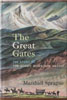 "The Great Gates, The Story of the Rocky Mountain Passes", by Marshall Sprague, Little, Brown & Company (Canada) Limited, 1964, Library of Congress Catalog
Card No. 64-13189, 468 pages, 6x8.5. A classic history of passes in the Rocky Mountains in the US and Canada. Includes a roster of passes in the Canadian Rockies
and Selkirk Range, and in Colorado, Montana, Northern New Mexico, Utah and Wyoming. Highly recommended by the Helmuths.
"The Great Gates, The Story of the Rocky Mountain Passes", by Marshall Sprague, Little, Brown & Company (Canada) Limited, 1964, Library of Congress Catalog
Card No. 64-13189, 468 pages, 6x8.5. A classic history of passes in the Rocky Mountains in the US and Canada. Includes a roster of passes in the Canadian Rockies
and Selkirk Range, and in Colorado, Montana, Northern New Mexico, Utah and Wyoming. Highly recommended by the Helmuths.
|
 "Mountain Passes, Adventure Roads in Colorado", by Clyde and Chloe Edmundson, 1963, Library of Congress Catalog Card Number 63-3913, 68 pages, 5.5x8.5. Location
and information about mountain passes, including adventure roads, scenic drives and places of interest in Colorful Colorado. Includes maps, photos of the authors'
Volkswagen on high passes, and a list of 214 Colorado mountain passes. This book was one of the source documents for the Helmuth's book.
"Mountain Passes, Adventure Roads in Colorado", by Clyde and Chloe Edmundson, 1963, Library of Congress Catalog Card Number 63-3913, 68 pages, 5.5x8.5. Location
and information about mountain passes, including adventure roads, scenic drives and places of interest in Colorful Colorado. Includes maps, photos of the authors'
Volkswagen on high passes, and a list of 214 Colorado mountain passes. This book was one of the source documents for the Helmuth's book.
|
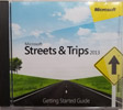 Microsoft Streets & Trips 2013. Can be used to easily prepare routes to passes on paved highways. And sometimes surprisingly provides
some easy-to-follow back country routes.
Microsoft Streets & Trips 2013. Can be used to easily prepare routes to passes on paved highways. And sometimes surprisingly provides
some easy-to-follow back country routes.
|
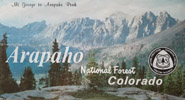
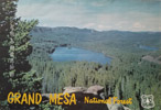
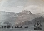
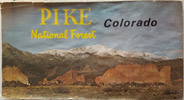
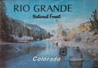
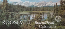
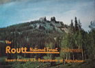
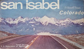
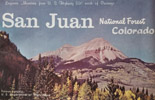
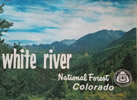
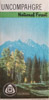
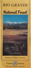
U.S. Forest Service maps. Arapahoe National Forest 1979, Grand Mesa 1976, Gunnison 1983, Pike 1970, Rio Grande 1975, Roosevelt 1974, Routt 1975, San Isabel 1972, San Juan 1974, White River 1979. Uncompaghre 1978, Rio Grande 1991, Roosevelt 1997. |
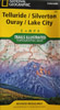 National Geographic Trail Illustrated Topographic Map, Telluride / Silverton / Ouray / Lake City, 1992. Many others are available.
|
More resources are listed on the Colorado Mountain Passes spreadsheet.