
Colorado's SW Corner - AZ-CO-NM-UT Quadripoint
|
Colorado's SW Corner - AZ-CO-NM-UT Quadripoint |
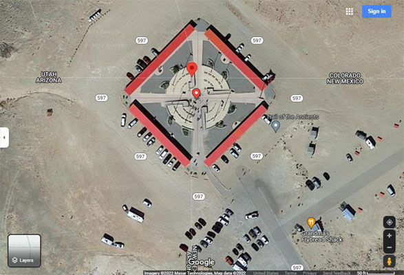
Quadripoint of Arizona, Colorado, New Mexico and Utah
Northeast corner of Arizona - Apache County - Arizona - 4,870 feet
Southwest corner of Colorado - Montezuma County - Colorado
Northwest corner of New Mexico - San Juan County - New Mexico
Southeast corner of Utah - San Juan County - Utah
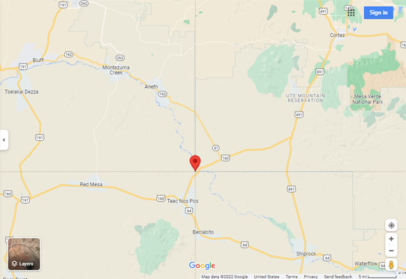
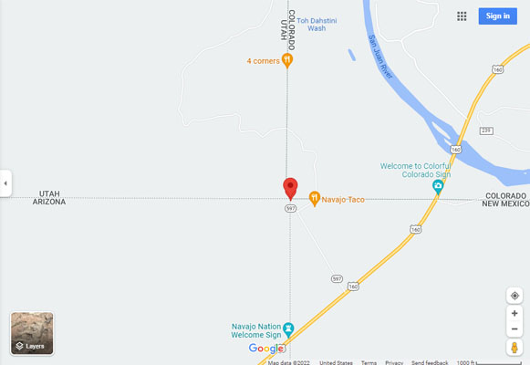
About 39 miles southwest of Cortez, CO, via US-160 and NM-597 (4 Corners Rd).
About 6 miles northeast of Teec Nos Pos, AZ, via US-160 and NM-597 (4 Corners Rd).
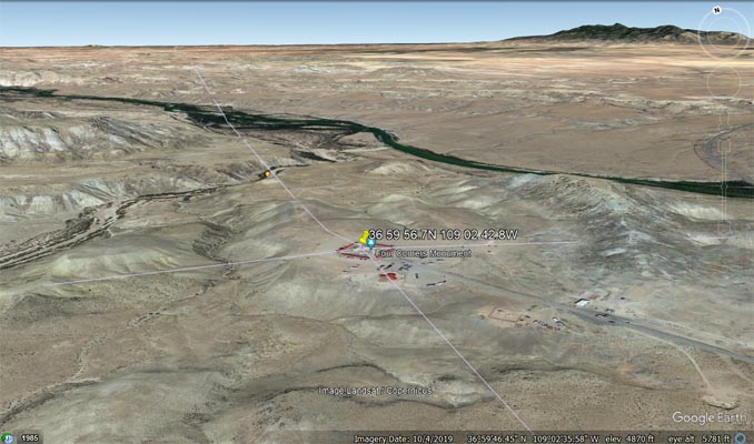
36°59'56.7"N 109°02'42.8"W == 36.999085N 109.045225W
paved - road bike
photos by Randy Bishop, 09/28/2013
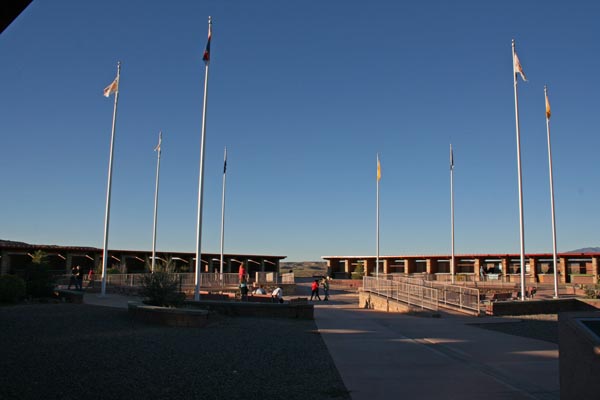
Flags of the 4 states and the Navajo and Ute Mountain Ute Nations. |
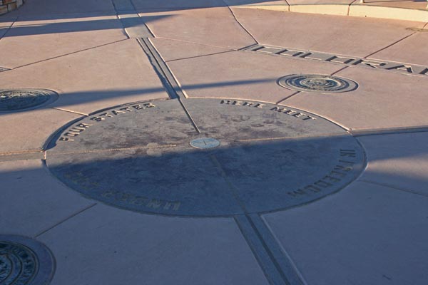
Four States Meet Here In Freedom Under God. |
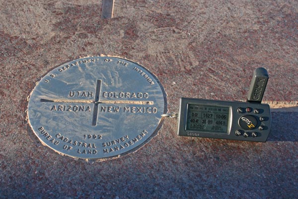
Cadastral Survey marker |
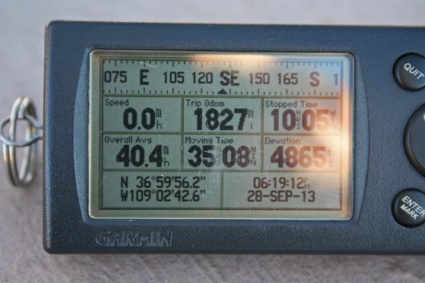
N 36 59 56.2 W 109 02 42.6 Read surveying history, below. |
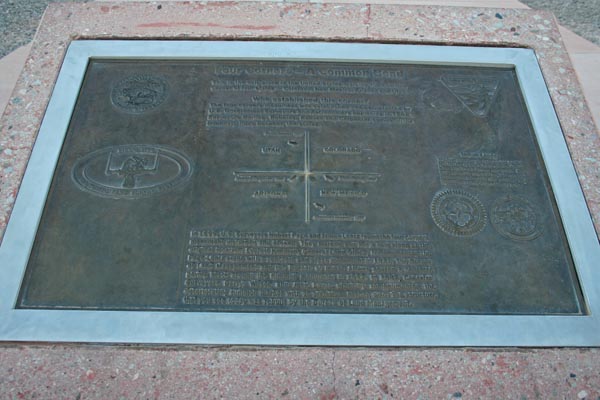
Four Corners - A Common Bond |
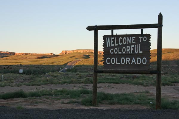
Colorado |
New Mexico |
Arizona |
Utah |
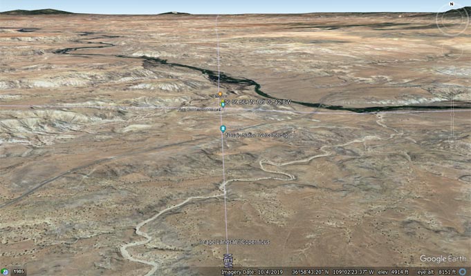
1 mile east of Four Corners |
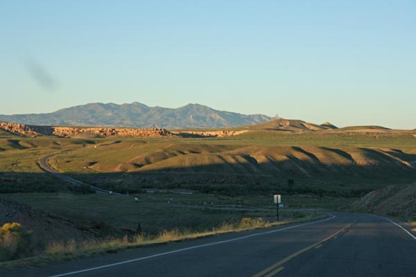
looking northeast toward Sleeping Ute Mountain |
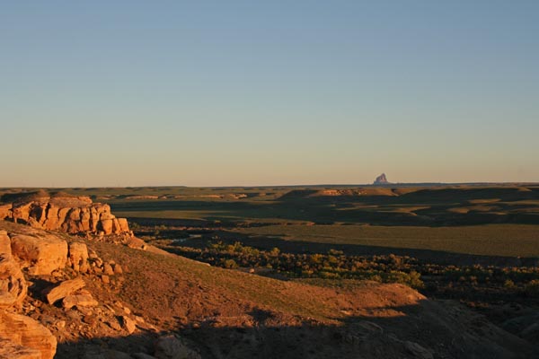
looking southeast about 25 miles to Ship Rock |
Google Maps |
Google Maps |
Google Maps |
Google Earth |
Google Earth |
Garmin MapSource |
Four Corners - A Common Bond
This is the only place in the United States marking the common corner of four states - Colorado, New Mexico,
Arizona and Utah. Who established this corner? The four corners monument was established and perpetuated by
U.S. Government Surveyors and Astronomers beginning in 1868. Surveyors Darling, Robbins, Reeves and Carpenter
surveyed the boundary lines between the states. In 1899, U.S. Surveyors Hubert Page and James Lentz found the
four corners monument disturbed and broken. They marked and set a new stone at the original location. Everett
Kimmell, General Land Office, remonumented the Page-Lentz stone with a concrete and brass monument in 1931.
The Bureau of Land Management and the Bureau of Indian Affairs poured a concrete paving block around the Kimmell
monument in 1962. In 1992, Cadastral Surveyors Darryl Wilson and Jack Eaves officially remonumented the
deteriorating Kimmell marker with an aluminum bronze disc. The structure that you see today was rebuilt by the
Bureau of Land Management. Indian Lands. The four corners area is surrounded by Indian lands. The Navajo Nation
lies in New Mexico, Arizona and Utah. The Ute Mountain Ute Nation is located in Colorado. Respect the culture
and traditions of the four corners area.
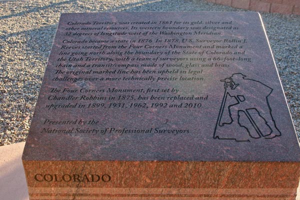
Colorado
Colorado Territory was created in 1861 for its gold, silver and other mineral resources. Its western boundary was
designated as 32 degrees of longitude west of the Washington Meridian. Colorado became a state in 1876. In 1878,
U.S. Surveyor Rollin J. Reeves started from the Four Corners Monument and marked a line going north along the boundary
of the State of Colorado and the Utah Territory with a team of surveyors using a 66-foot-long chain and a transit/compass
made of wood, glass and brass. The original marked line has been upheld in legal challenges over a more technically
precise location. The Four Corners Monument, first set by Chandler Robbins in 1875, has been replaced and upgraded
in 1899, 1931, 1962, 1992 and 2010. Presented by the National Society of Professional Surveyors.
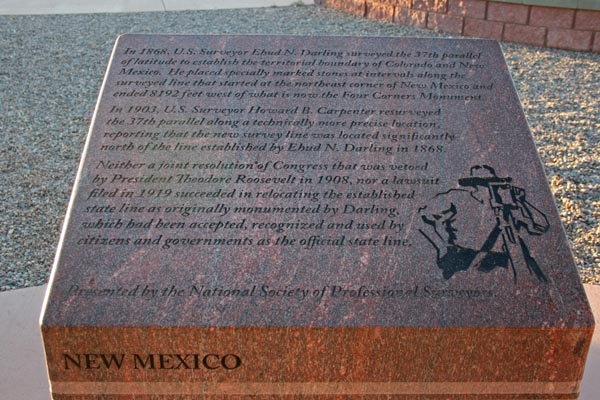
New Mexico
In 1868, U.S. Surveyor Ehud N. Darling surveyed the 37th parallel of latitude to establish the territorial boundary
of Colorado and New Mexico. He placed specially marked stones at intervals along the surveyed line that started at
the northeast corner of New Mexico and ended 8192 feet west of what is now the Four Corners Monument. In 1903, U.S.
Surveyor Howard B. Carpenter resurveyed the 37th parallel along a technically more precise location, reporting that
the new survey line was located significantly north of the line established by Ehud N. Darling in 1868. Neither a
joint resolution of Congress that was vetoed by President Theodore Roosevelt in 1908, nor a lawsuit filed in 1919
succeeded in relocating the established state line as originally monumented by Darling, which had been accepted,
recognized and used by citizens and governments as the official state line. Presented by the National Society of
Professional Surveyors.
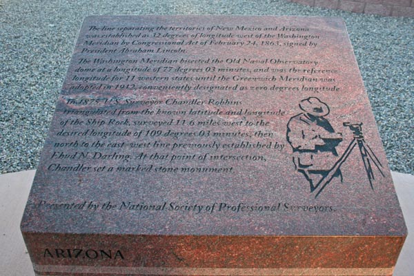
Arizona
The line separating the territories of New Mexico and Arizona was established as 32 degrees of longitude west of the
Washington Meridian by Congressional Act of February 24, 1863, signed by President Abraham Lincoln. The Washington
Meridian bisected the Old Naval Observatory dome at a longitude of 77 degrees 03 minutes, and was the reference longitude
for 11 western states until the Greenwich Meridian was adopted in 1912, conveniently designated as zero degrees longitude.
In 1875, U.S. Surveyor Chandler Robbins triangulated from the known latitude and longitude of the Ship Rock, surveyed
11.6 miles west to the desired longitude of 109 degrees 03 minutes, then north to the east-west line previously established
by Ehud N. Darling. At that point of intersection, Chandler set a marked stone monument. Presented by the National Society
of Professional Surveyors.
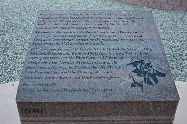
Utah
Prior to surveyors setting the Four Corners Monument, this boundless land was inhabited by the Ancestral Puebloans, followed
by the Dine, Ute and other indigenous people. Over time, this land was claimed by Spain, taken in the war by Mexico, ceded to
the U.S. by treaty and organized into territories. Mormon settlers declared the Provisional State of Deseret in 1849. The
congressional Compromise of 1850 created the territories of Utah and New Mexico, separating the free North from the slave
South along the 37th parallel of latitude. U.S. Surveyor Howard B. Carpenter established the territorial line between Arizona
and Utah in 1901, running from West to East, ending the survey at the Four Corners Monument. Today, the Four Corners Monument
marks the point where the Navajo Nation, the Ute Mountain Ute Reservation, and the States of Arizona, Colorado, New Mexico and
Utah meet in peace. Presented by the Society of Professional Surveyors.