
Summit Lake Pass
|
Summit Lake Pass |
Summit Lake Pass - British Columbia, Canada - 1,267 m (4,157 ft)
MacDonald Creek to west. Tetsa River to east.
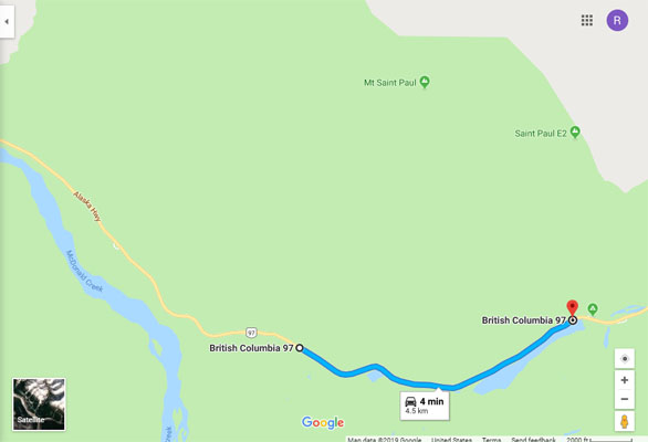
On BC-97 (Alaska Highway) west of Fort Nelson and east of Toad River, British Columbia.
Alaska Highway crossing: 58 39 05.4N 124 39 29.1W
Official location: 58 39 00N 124 41 00W
paved - road bike
photos by Randy Bishop, 6/24/2018
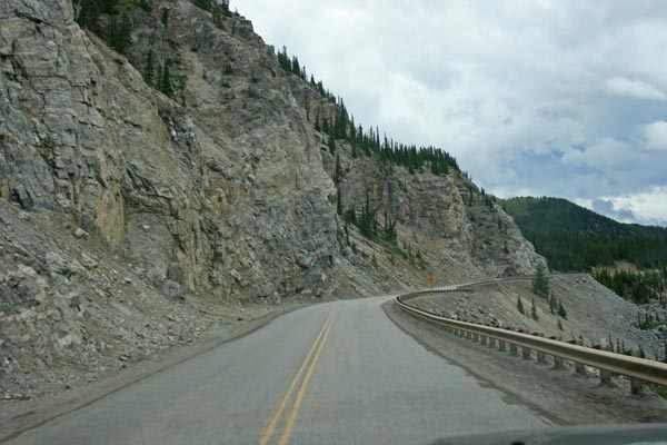
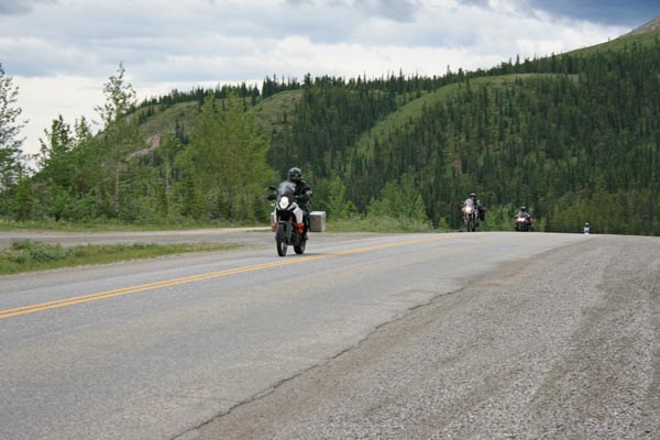
Southbound on BC-97, a few miles west of the summit. |
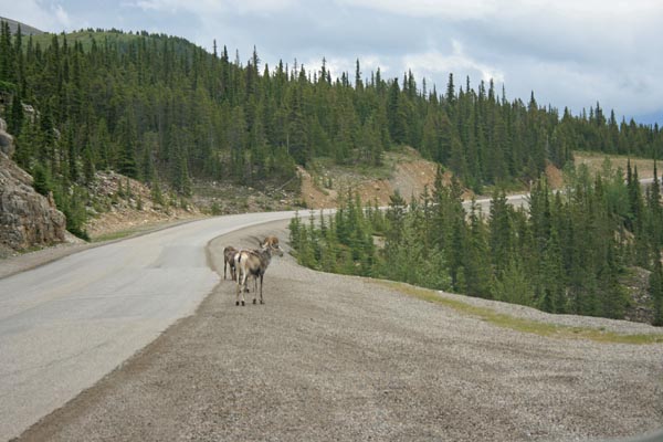
Stone's sheep, a few miles west of the summit. |
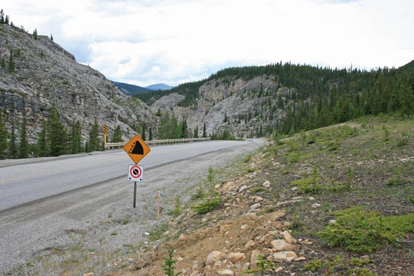
A few miles west of the summit. |
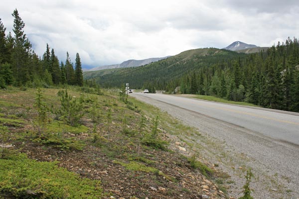
A few miles west of the summit. |
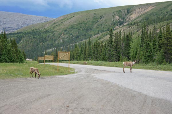
Caribou, a few miles west of the summit. |
At the summit. |
At the summit. |
At the summit. |
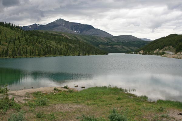
At the summit, Summit Lake. |
At the summit. |
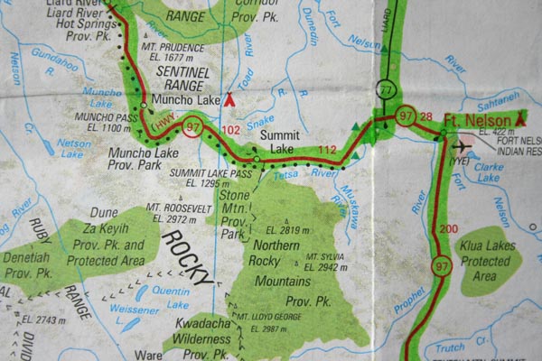
Note BC-77, my route to Ft. Laird, NWT. |
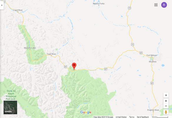
Google Maps |
Google Maps |
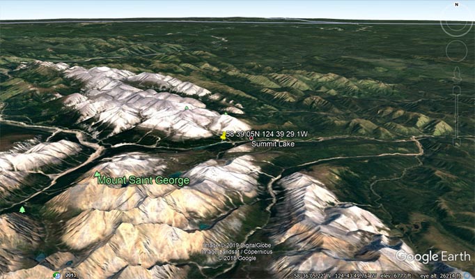
Google Earth |
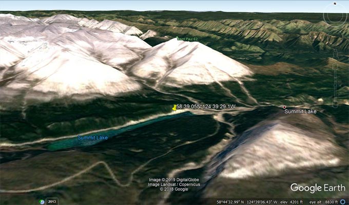
Google Earth |
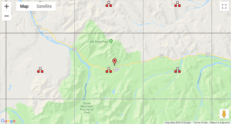
BC Topographic Maps |
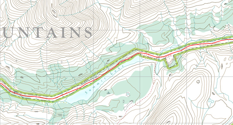
BC Topographic Map 094K067 |
See British Columbia Topographic Map Viewer.
From The Milepost:
Alaska’s Highest Highway Passes
Atigun Pass, elev. 4,800 feet, at Milepost J 244.7 Dalton Highway
Maclaren Summit, elev. 4,086 feet, at Milepost P 36.7 Denali Highway
Eagle Summit, elev. 3,685 feet, at Milepost F 107.3 Steese Highway
Eureka Summit, elev. 3,322 feet, at Milepost A 129.5 Glenn Highway
White Pass, elev. 3,292 feet, at Milepost S 14.3 South Klondike Highway
Isabel Pass, elev. 3,280 feet, at Milepost V 197.7 Richardson Highway
Twelvemile Summit, elev. 3,190 feet, at Milepost F 85.5 Steese Highway
Tahneta Pass, elev. 3,000 feet, at Milepost A 122 Glenn Highway
Thompson Pass, elev. 2,678 feet, at Milepost V 25.9 Richardson Highway
Mentasta Summit, elev. 2,434 feet, at Milepost GJ 79.2 Glenn Highway
Cleary Summit, elev, 2,233 feet, at Milepost F 20.5 Steese Highway
NOTE: Chilkat Pass, elev, 3,510 feet/1,070m, at Milepost H 59 Haines Highway, is located just across the border from Alaska in British Columbia.
The highest summit on the Alaska Highway is Summit Pass, elev. 4,250 feet/1,295m, at Milepost DC 373.6 (Historic Milepost 392) near Summit Lake,
British Columbia. The second highest pass on the Alaska Highway, and the highest point on the Alaska Highway between Whitehorse and Fairbanks. is
Bear Creek Summit, elev. 3,294 feet/1,004m, at Milepost DC 1000.1 in Yukon.
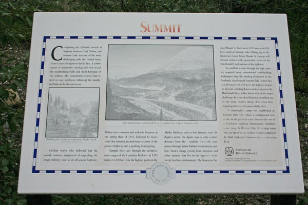
The first sign: SUMMIT. Completing the 100-mile stretch of highway between Fort Nelson and Summit Lake
was one of the more challenging tasks the United States Army Corps of Engineers had to face. A
combination of mountains, muskeg and rock tested the soldiers. The construction convoy had to inch its
way northwest following the muddy trail laid out by the surveyers.
Civilian workers who followed had the equally arduous assignment of upgrading the rough military road
to an all-season highway. Delays were common and setbacks frequent as the spring thaw of 1943, followed
by heavy rains that summer, turned many sections of the pioneer highway into a quaking, heaving bog.
Summit Pass cuts through the northern-most ranges of the Canadian Rockies. At 1295 meters (4,248 feet)
it is the highest point on the Alaska Highway, and at this latitude, over 58 degrees north, the alpine
zone is only a short distance from the roadside. Here the road passes through prime habitat for mountain
cariboo, Stone's sheep, grizzly bear, marmots and other animals that live in the rigorous, wind-swept
treeline environment. The limestone layers of Mount St. Paul rise to 2127 meters (6,979 feet) north of
Summit Lake. Hiking up to the microwave tower below Mount St. George will reward visitors with spectacular
views of the MacDonald Creek section of the highway.
To establish a route through the high country required more conventional roadbuilding techniques than the
muskeg demanded in the lowlands. Just beyond Summit Lake, which lies at 1283 meters (4,210 feet), the
highway begins it descent, winding down a rocky canyon to the MacDonald River valley below. One of the major
challenges here involved blasting a roadbed out of the rocks. Stone's sheep often cross here, requiring
drivers to be particularly alert.
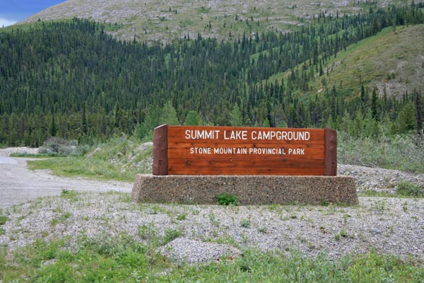
A construction camp was established at Historic Mile 392, where a campground now exists. In the postwar
years, this was the site of a Northwest Highway Maintenance Establishment camp. At Historic Mile 397 a
large camp was set up to house civilian workers employed by Emil Anderson Construction, a contracting firm.
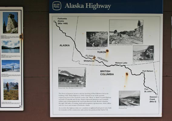
The second sign: The threat of Japanese invasion and the bombing of Pearl Harbor led to the building of
the Alaska Highway in 1942. Claimed as one of the greatest engineering feats of the twentieth century the
"Alcan" or Alaska Canada Highway was built in 8 months and 23 days. Sixteen thousand American and Canadian
soldiers and civilians pushed the road from Dawson Creek, British Columbia, through the 1500 miles of
muskeg, mud and mosquitoes, up mountains, down valleys and over rivers and streams to Fairbanks, Alaska.
As you drive the highway today over a modern straightened and paved route, look for reminders of the
construction and activity that produced this Trail or '42.