
Cedar Point Divide
|
Cedar Point Divide |
Cedar Point Divide - Elbert County - Colorado - 5,712 feet
Beaver Creek (Platte River) to north. Big Sandy Creek (Arkansas River) to south.
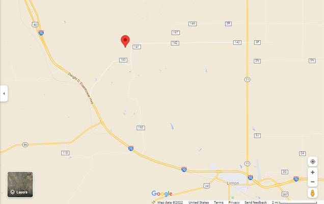
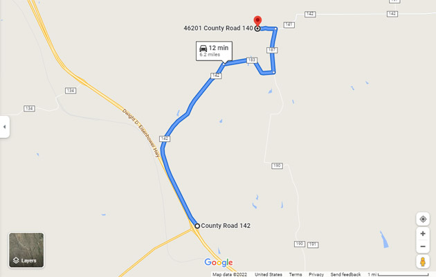
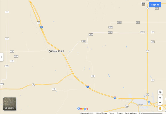
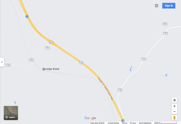
Near CR-142 and CR-183 northwest of Limon.
gravel - dual sport
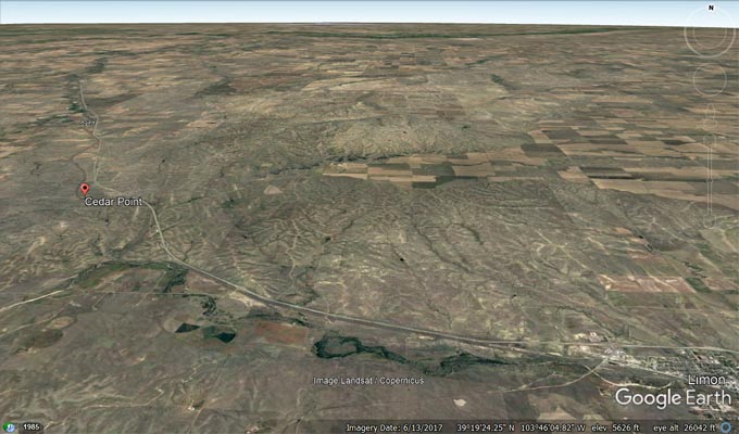
Google Earth view by Scott Westfall, 1/9/2022
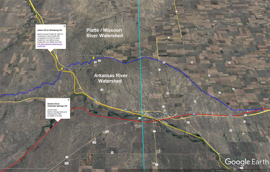
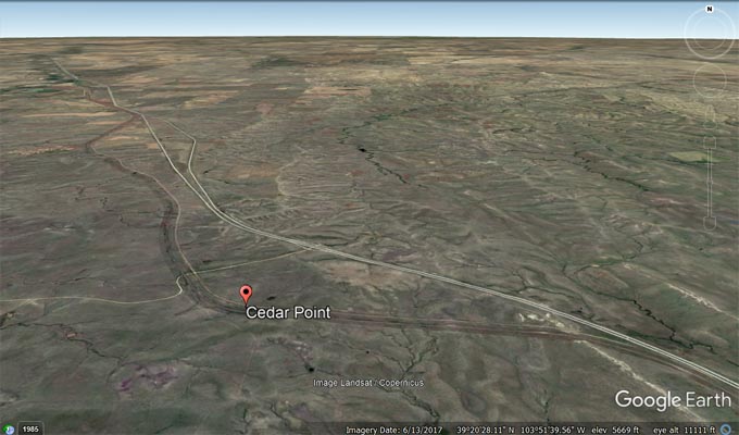
First image:
The blue line shows the divide between the Platte / Missouri River Watershed and the Arkansas River Watershed.
The yellow pushpins show the Cedar Point Divide railway summit and the Cedar Point Divide topographic summit.
The yellow line shows the Kansas Pacific Railway built in 1869-70.
The red line shows the Chicago Kansas & Nebraska Railroad built in 1883.
Second image:
Cedar Point Divide, Google Earth StreetView, looking north from CR-142 to Cedar Point and its comm tower.
Third image:
Cedar Point Divide, Google Earth StreetView, looking northeast from CR-183 to saddle, with Cedar Point summit on right.
Google Earth |
-400.jpg)
Google Earth |

Google Earth |
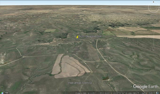
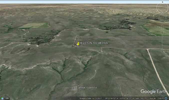
Cedar Point summit - 39°22'12"N 103°48'05"W = 39.369938°N 103.80136°W
Google Maps |
Google Maps |
Google Maps comm tower |
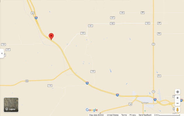
Google Maps exit 352 to summit |
Google Earth |
Google Earth |
Garmin MapSource |
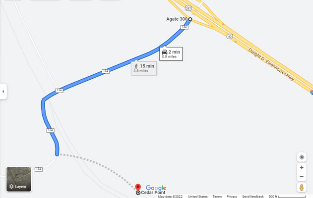
Cedar Point townsite, and Union Pacific railroad crossing of Cedar Point Divide - 39°20'43"N 103°52'14"W = 39.344327°N 103.867394°W
Google Maps |
Google Maps |
Google Maps exit 348 to townsite |
Google Earth |
Google Earth |
Garmin MapSource |
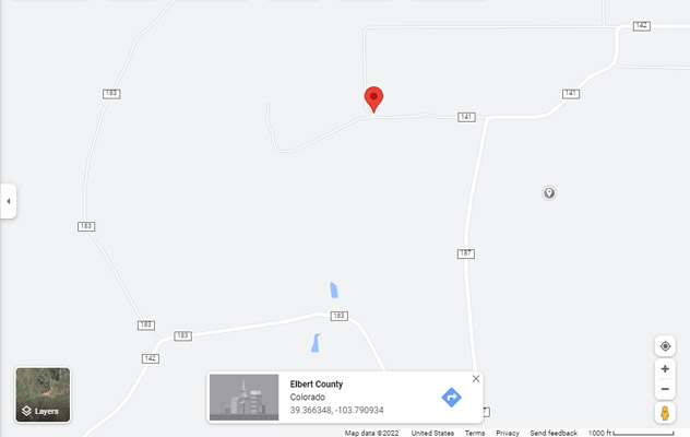
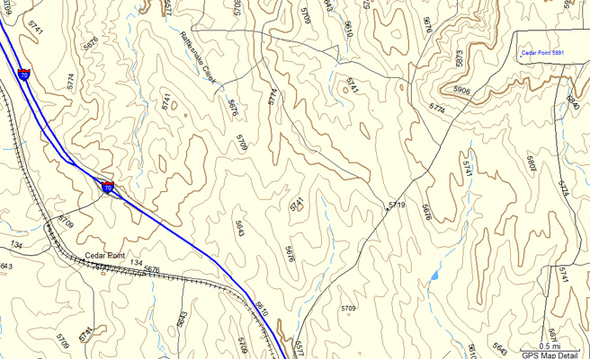
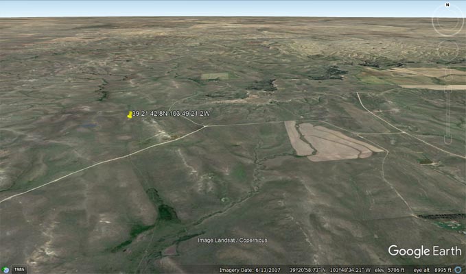
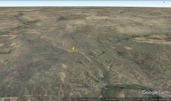
Scott's proposed USGS GNIS location of Cedar Point Divide near County Road 183.
39°21'42.8"N 103°49'21.2"W = 39.361876°N 103.82256°W
Google Maps |
Google Maps |
Google Earth |
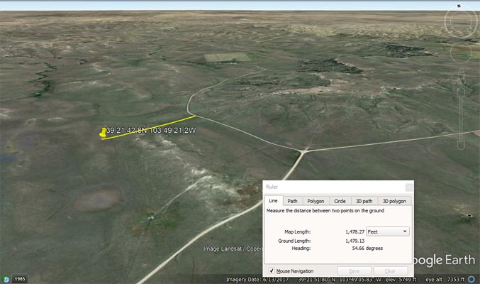
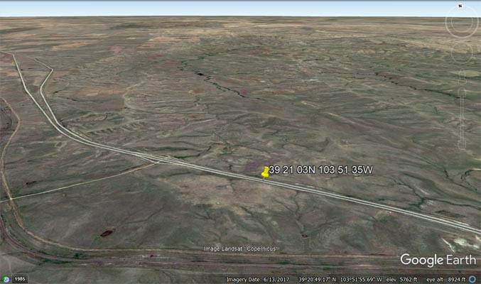
Google Earth, showing 0.3 mile distance to CR-183. |
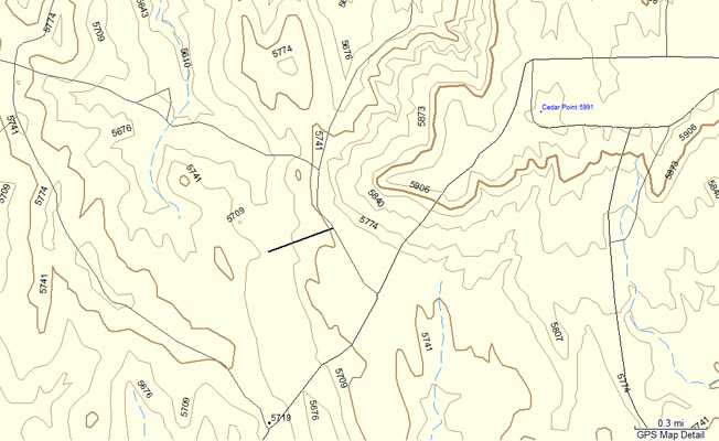
Garmin MapSource, showing 0.3 mile distance to CR-183. |
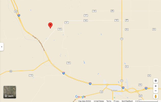
Scott's proposed Cedar Point Divide summit on I-70
39°21'03"N 103°51'35"W = 39.350833°N 103.859722°W
Google Maps |
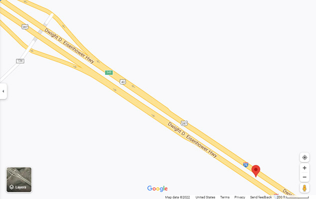
Google Maps |
Google Earth |
Google Earth |
Garmin MapSource |
photos of historical marker by Randy Bishop, 5/15/2008
Sign was located at 39°44'12.9"N 104°23'50.6"W
|
|
|
|
|
|
|
|
Notes from Scott Westfall:
I have been talking to CDOT about putting a Cedar Point highway sign up on I-70 at exit 352 just west of Limon for Cedar Point.
I also pitched the addition of Cedar Point Divide to the USGS. Neither will likely happen, but here's my case.
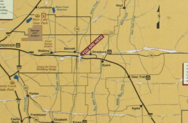
Cedar Point (GNIS 203756, 5722', 39.344327N 103.867394W) was an eastern plains settlement on the Kansas Pacific Railway, situated
at a geographic high point on the line just west of Limon. Named after a geographic feature to the northeast (GNIS 195100, 5991',
39.369938N 103.80136W), it was also listed on a Colorado Historical marker at a now-abandoned CDOT rest stop Exit 302 (north side
of I-70 just east of Bennett). This area hosts several prehistoric settlements of the Dismal River culture, referred to as Cedar Point
Village and first documented by the University of Colorado in 1952. This area was also located along a popular late-1800s wagon route
called the Butterfield Overland Route, which connected Fort Leavenworth and Topeka Kansas with Denver. Of course the problem with this
route was that unlike the southern Santa Fe Trail which followed the Arkansas River, and northern Oregon, California and Mormon Trails
which followed the Platte River, the Butterfield Overland Route followed the Smoky Hill River, which runs dry long before reaching Denver.
That is because the route crossed over one the most prominent watershed divides in the Plains anywhere between the Mississippi and the
Rockies, the Platte Arkansas Divide. The USGS Watershed Boundary Dataset shows this divide line running from Palmer Lake CO east to St Louis.
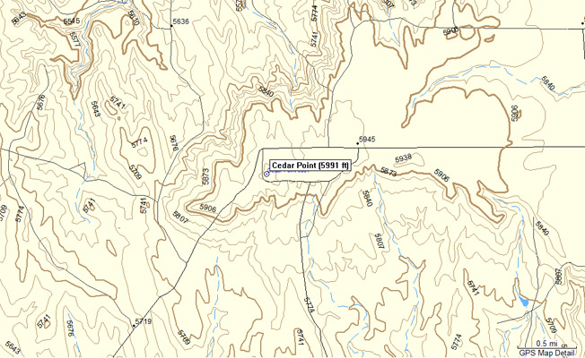
The saddle between the Cedar point settlement and the Cedar Point promontory represents not only a geographically significant pass, but also
a historical one, through which many natives, settlers, trains, and now vehicles traverse. It also represents the eastern terminus of the Palmer
Divide. To me, this should be a named and marked pass called Cedar Point Divide, separating the waters of not only Beaver Creek to the north and
Big Sandy Creek to the south, but also the Platte and Arkansas (respectively).
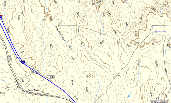
If this were to happen, it might then produce a roadway summit on I-70, a railway summit to the south, a geographic summit to the north,
and a geographic gap in the middle, at 39.361876°N 103.82256°W near County Road 183 at 5712 feet. The location determined using the
"middle of the Pringles chip" method (AKA, the lowest point between the summits, and highest point between the watersheds).
The location was a result of several lines I drew on Google Earth after examining the topo map. Then I looked at their elevation profiles
and chose the spot that was the intersection of lowest spot between the two high points (along the watershed boundary dataset divide, one
on the west just south of the exit, the other on the east at the USGS Cedar Point summit) but the highest spot between the two sloping
watersheds (perpendicular to the divide line, oriented NNW to SSE).
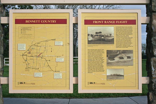
Text from the historical signs:
High-Five Plains Towns. Watkins, Bennett, Strasburg, Byers, Peoria, Deer Trail, Agate, Godfrey, Cedar Point, Riverbend—most of these Colorado
high plains towns were founded around the time when the Kansas Pacific Railroad arrived in 1870. Five of these towns, Watkins, Bennett, Strasburg, Byers,
and Deer Trail, all became busy agricultural shipping centers. Through the first half of the twentieth century these five communities, now along the east
I-70 corridor, were the very picture of Main Street, USA—rural, self-sufficient, and distinctive, with strong local identities. But maintaining those
identities became increasingly difficult after World War II, as Denver’s steady advance threatened to wipe out the line between town and country. In
November 1996, the five time-tested communities launched the High Five Plains Foundation, a joint initiative to promote local economies, manage growth,
and preserve the region’s traditions and quality of life. By integrating their past into the future, the High Five communities hope to keep an important
part of Colorado’s history alive.
Ten Miles a Day.It is no coincidence that the West blossomed just after the Kansas Pacific Railroad's completion in 1870. The next generation
witnessed the heyday of the cattle culture, which depended on Kansas Pacific railheads from Denver to Dodge City; the rush of prairie homesteaders, who
shipped their produce to market in its boxcars; and the rise of industrial mines, whose ores rode the line to eastern factories. Even as it helped construct
a new frontier empire, the Kansas Pacific weakened the old one. The railroad ran through the heart of the Plains Indian nations, dividing their buffalo herds
and expediting wars against them. As an economic pipeline and an engine of conquest, the Kansas Pacific played a central role in the transformation of the West.
| Feature Name | ID | Class | County | State | Latitude | Longitude | Ele(ft) | Map | BGN Date | Entry Date |
| Cedar Point | 195100 | Summit | Elbert | CO | 392212N | 1034805W | 5987 | River Bend | 13-OCT-1978 | 18-SEP-2016 |
| Cedar Point | 203756 | Populated Place | Elbert | CO | 392043N | 1035214W | 5712 | River Bend | - | 13-OCT-1978 |