
Monarch Pass - Original
|
Monarch Pass - Original |
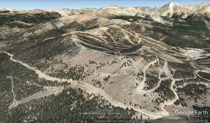
Original Monarch Pass - Chaffee / Gunnison Counties - Colorado - 11,525 feet - On the Continental Divide
Major Creek to west. South Arkansas River to east.
hiking trails - no motorized vehicles
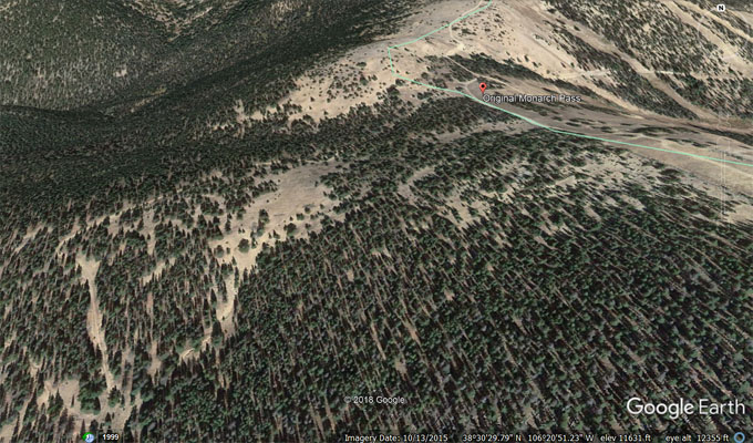
Follow the Continental Divide Trail from the summit of Old Monarch Pass,
or per Helmuths', "...follow the old roadbed up from the west side to the top, which overlooks the very back
and top side of the ski area..." Starts near 38 30 11.3N 106 21 34.5W .
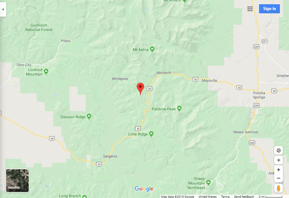
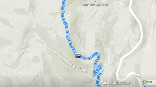
Google Maps |
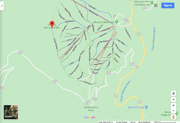
Google Maps |
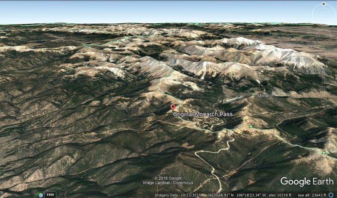
Google Earth |
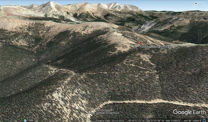
Google Earth, looking northeast. |
Google Earth, looking northwest. |
Google Earth |
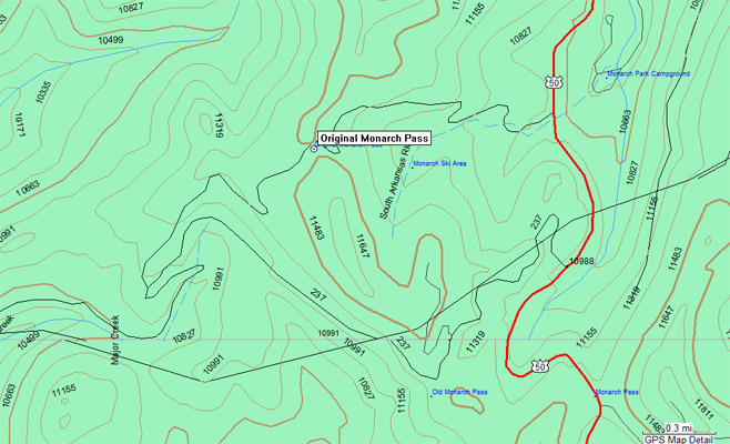
Garmin MapSource |
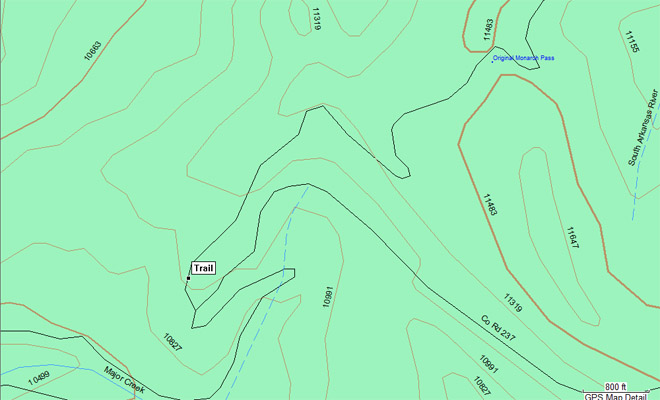
Garmin MapSource |
Continental Divide Trail |
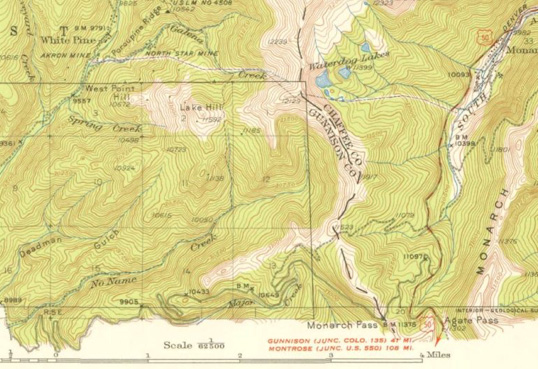
1940s USGS Topographic Map shows current (red/white), old (gray), original (gray dashes) |
Notes from https://www.skimonarch.com/old-old-monarch-pass/:
Below is some info about the original pass over the Continental Divide at Monarch provided by the guest
author credited below.
Article and photos provided by Bruce Bartleson, Professor Emeritus Western Colorado University
The Old, Old Monarch Pass Toll Road was a stage coach road. As mining started to boom in the upper
South Arkansas valley in the late 1870’s a road to provide access to the White Pine and Tomichi mining
areas as well as to the Gunnison country, across the Divide was highly desired. It was opened in 1880,
and in 1881 it became a toll stagecoach road operated by the famous Barlow and Sanderson stage line.
The road ran up the South Arkansas valley through Maysville, Arbourville, Garfield, Monarch and Monarch
Park. From the upper end of Monarch Park, the road took a series of steep, sharp switchbacks and climbed
up from the valley floor and through Monarch Mountain Ski area before crossing the Continental Divide at
the low point on the Great Divide ski run, an elevation of 11,523'. The current ski area maintenance road
from the north end of the ski area parking lot follows the old road to the divide.
There was a toll gate at Maysville on the east side and one at Black Sage Pass on the west side. The road
was only open in the summer months, as the winter snow made the route impassable. Apparently the owners
of the toll road did not keep good care of the road and charged what was thought to be high rates, so in
1887 the county purchased the road for $1400 and took over the maintenance.
In 1919, work began on a new, shorter, less steep and dangerous route which is known today as “Old
Monarch Pass”, elevation 11,375'. This new route was opened to automobiles in 1921, and the older route
was largely abandoned. The new route merged with the old, old road on the west side of the pass at the
top of all the sharp hairpin curves, about 5 miles above the Whitepine Road, and from there the hairpin
curves crisscross the old, old road. The old, old road is now a dirt bike and mountain bike trail at
least in the lower stretches. Monarch Pass on modern HWY 50 is actually the third Monarch Pass, and was
opened in 1939, when the ski area was built.
| Feature Name | ID | Class | County | State | Latitude | Longitude | Ele(ft) | Map | BGN Date | Entry Date |
| Original Monarch Pass | 1675537 | Gap | Chaffee | CO | 383041N | 1062049W | 11532 | Garfield | 01-JAN-1996 | 13-OCT-1978 |
| Feature Name | ID | Class | County | State | Latitude | Longitude | Ele(ft) | Map | BGN Date | Entry Date |
| Monarch Pass | 189720 | Gap | Chaffee | CO | 382948N | 1061932W | 11306 | Pahlone Peak | 01-JAN-1945 | 13-OCT-1978 |
| Old Monarch Pass | 189721 | Gap | Chaffee | CO | 382948N | 1062017W | 11365 | Pahlone Peak | 01-JAN-1945 | 13-OCT-1978 |