
Ride the Divide, New Mexico
|
Ride the Divide, New Mexico |
Continental Divide - New Mexico
Atlantic Ocean to east. Pacific Ocean to west.
paved - road bike
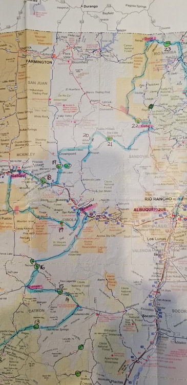
"Ride the Divide - New Mexico" was organized by Karl Zuercher and was run 4/27-28/2019. The paved route
started in Deming, NM, and crossed the Continental Divide 19 times on its way to Chama, NM, and on
to Albuquerque for those particpating in the Iron Butt Association Saddlesore 1000 ride option.
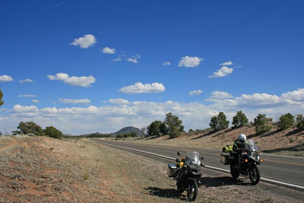
There are also many non-paved crossings of the Continental Divide in New Mexico.
See Iron Butt Association for more information about IBA rides.
photos by Randy Bishop, 4/27-28/2019
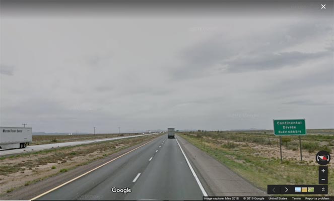
#1, on I-10 west of Deming. Google Map view USGS 32 12 40N 108 12 15W GPS 32 11 52N 108 16 45W Sign: Elevation 4,585 Ft. |
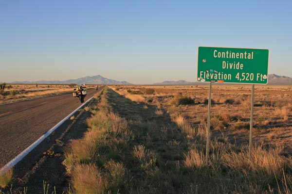
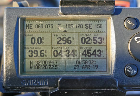
#2, on NM-146 south of I-10, exit 49. USGS 31 59 31N 108 20 32W GPS 30 00 25N 108 20 23W Sign: Elevation 4,520 Ft. |
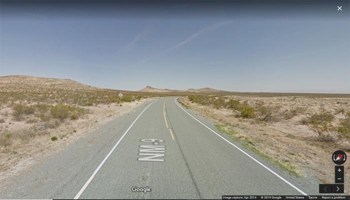
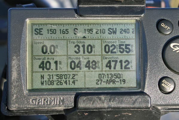
#3, on NM-9 west of Hachita. Google Map view USGS 31 57 27N 108 25 41W GPS n/a No sign. |
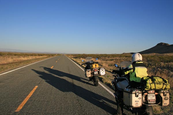
#4, on NM-146 west of Hachita. USGS 31 58 05N 108 26 31W GPS 31 58 07N 108 26 41W No sign. |
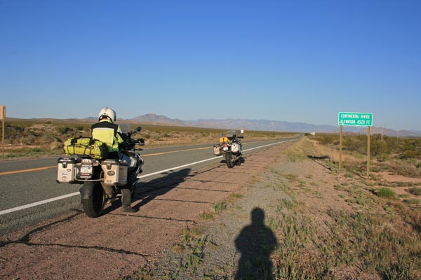
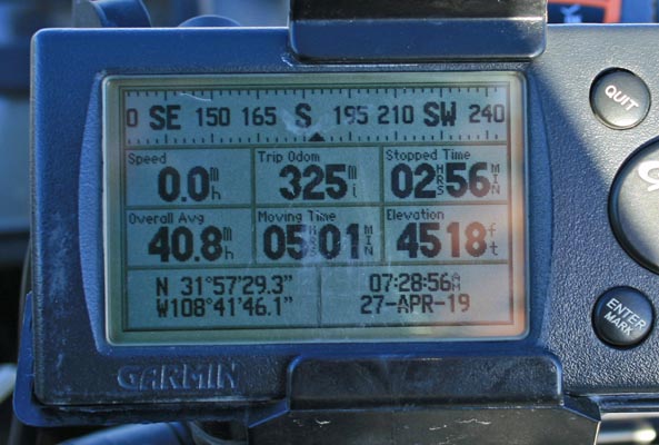
#5, on NM-9 east of Animas. USGS 31 57 29N 108 41 42W GPS 31 57 29N 108 41 46W Sign: Elevation 4,528 Ft. |
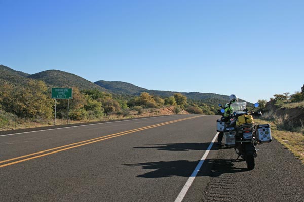
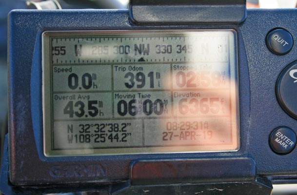
#6, on NM-90 north of Lordsburg. USGS 32 32 39N 108 25 43W GPS 32 32 38N 108 25 44W Sign: Elevation 6,355 Ft. (Skip #7 on spreadsheet. Slighty off route.) |
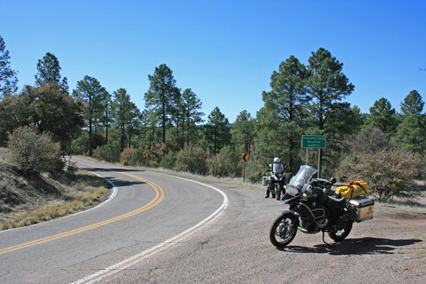
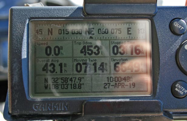
#8, on NM-35 north of Mimbres. USGS 32 58 47N 108 03 18W GPS 32 58 48N 108 03 19W Sign: Elevation 6,600 Ft. |
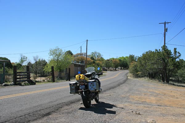
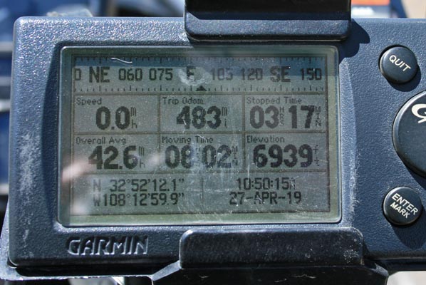
#9, on NM-15 on north side of Pinos Altos. USGS 32 52 16N 108 12 59W GPS 32 52 12N 108 13 00W No sign. |
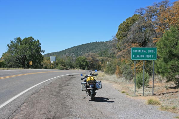
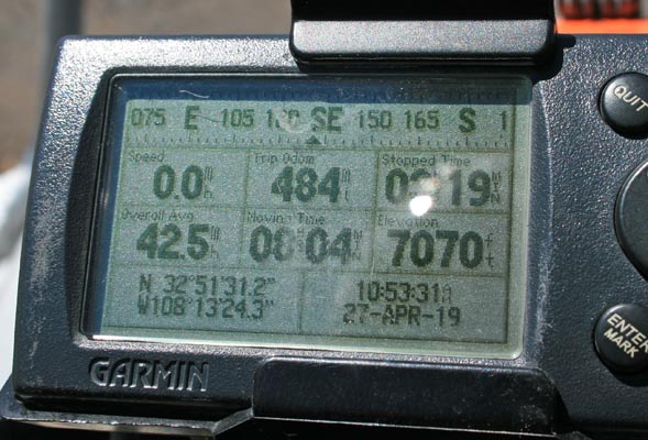
#10, on NM-9 on south side of Pinos Altos. USGS 32 51 47N 108 13 18W GPS 32 51 31N 108 13 24W Sign: Elevation 7,080 Ft. |
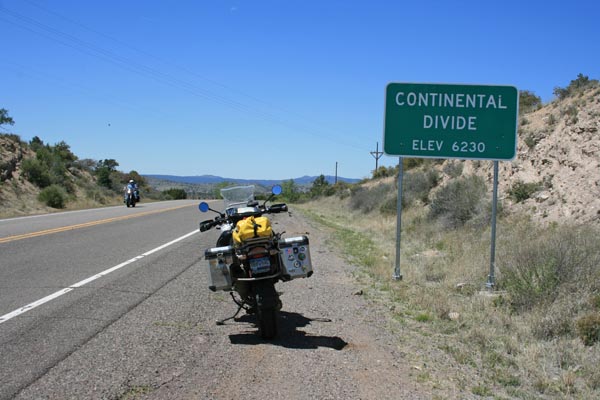
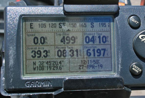
#11, on US-180 west of Silver City. USGS 32 45 20N 108 19 29W GPS 32 45 20N 108 19 30W Sign: Elevation 6,230 Ft. |
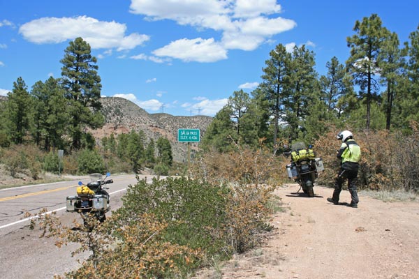
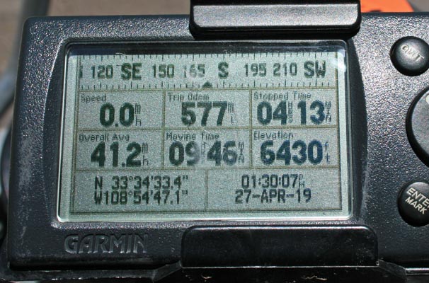
#12, on US-180 north of Alma. USGS 33 34 33N 108 54 47W GPS 33 34 33N 108 54 47W Sign: Elevation 6,436 Ft. Saliz Pass, on route, not on CD. |
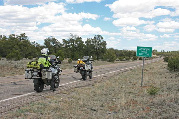
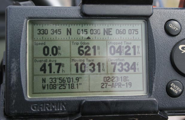
#13, on NM-12 northeast of Reserve. USGS 33 56 01N 108 25 18W GPS 33 56 02N 108 25 18W Sign: Elevation 7,312 Ft. |
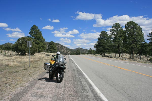
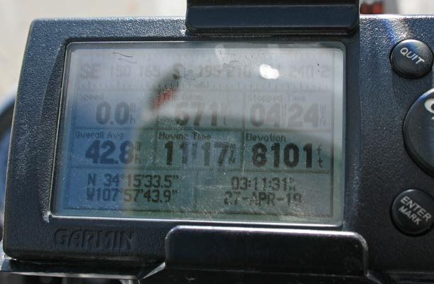
#14, on US-60 west of Datil. USGS 34 15 31N 107 57 37W GPS 34 15 34N 107 57 44W Sign: Elevation 8,101 Ft. West Pass, on route, not on CD. |
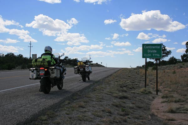
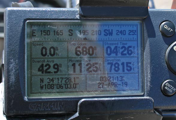
#15, on US-60 west of Ditil. USGS 34 17 27N 108 06 03W GPS 34 17 28N 108 06 03W Sign: Elevation 7,796 Ft. |
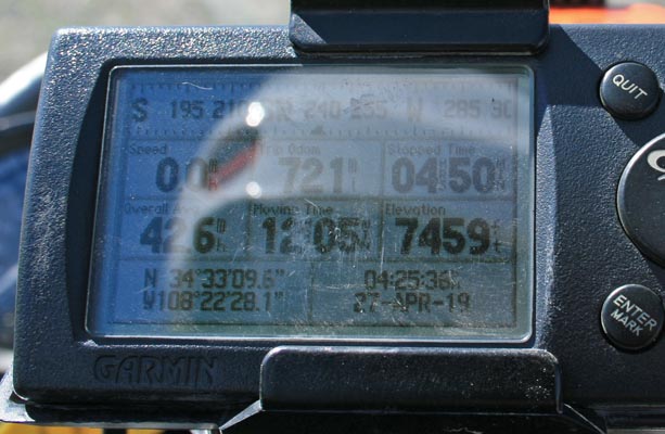
#16, on NM-36 north of Quemado. USGS 34 32 55N 108 22 16W GPS 34 33 10N 108 22 28W No sign. |
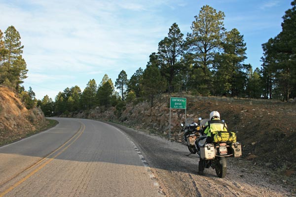
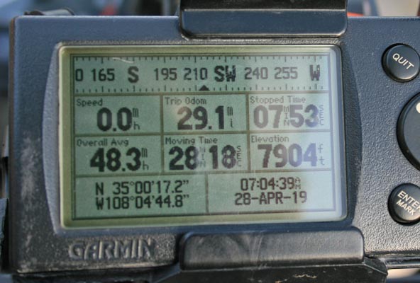
#17, on NM-53 southwest of Grants. USGS 35 00 18N 108 04 52W GPS 35 00 17N 108 04 45W Sign: Elevation 7,882 Ft. |
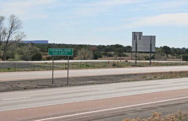
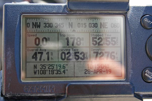
#18, on I-40 at Continental Divide, NM. USGS 35 25 19N 108 18 31W GPS 35 25 20N 108 18 35W Sign: Elevation 7,275 Ft. Campbell Pass, on route, on CD. |
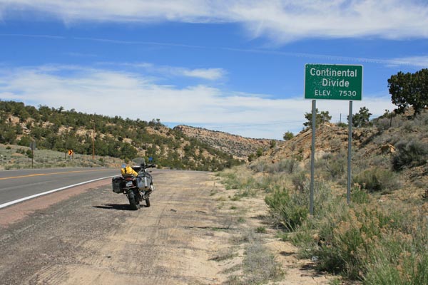
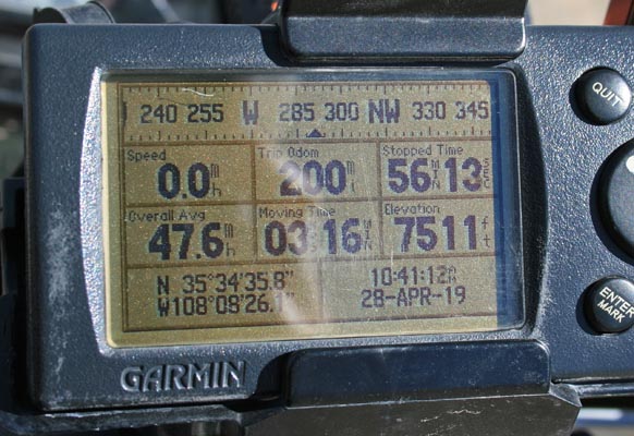
#19, on NM-371 north of Thoreau. USGS 35 34 34N 108 08 25W GPS 35 34 36N 108 08 26W Sign: Elevation 7,530 Ft. Satan Pass, on route, on CD. |
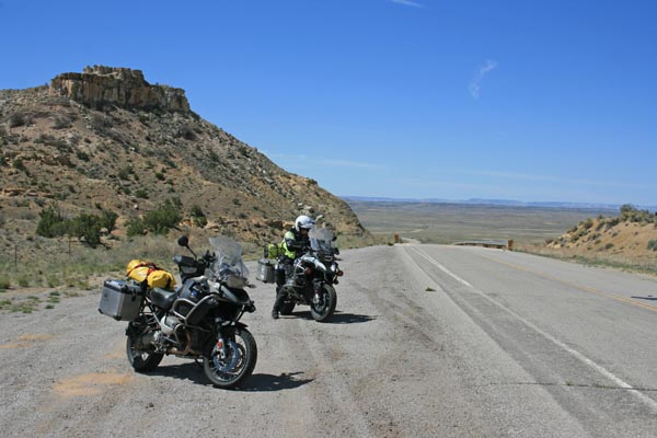
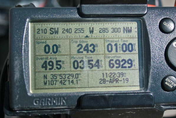
#20, on BIA-9 northeast of Crown Point. USGS 38 53 28N 107 42 14W GPS 35 53 29N 107 42 14W No sign. Tucker Gap, on route, not on CD. |
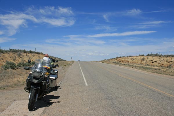
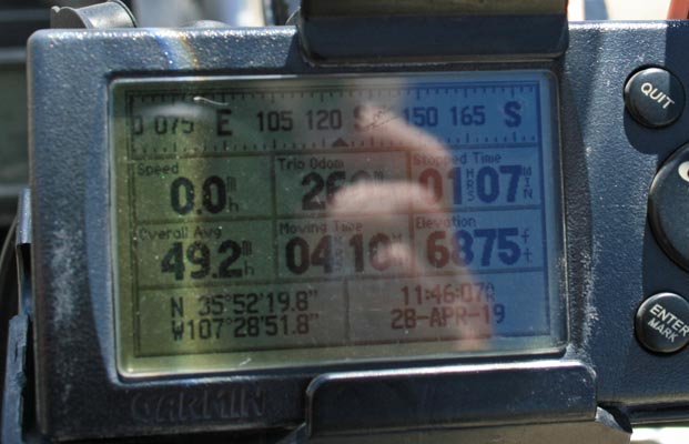
#21, on NM-197 northeast of Crown Point. USGS 35 52 21N 107 28 54W GPS 35 52 20N 107 28 52W No sign. |
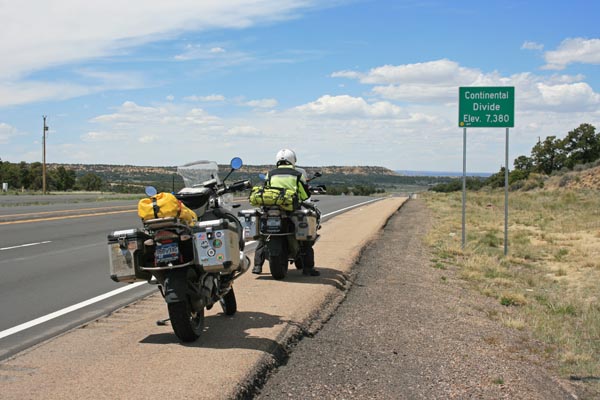
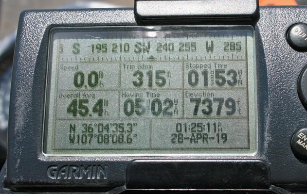
#22, on US-550 northwest of Cuba. USGS 36 04 35N 107 08 08W GPS 36 04 35N 107 08 09W Sign: Elevation 7,380 Ft. |
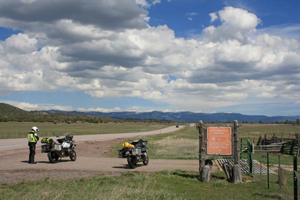
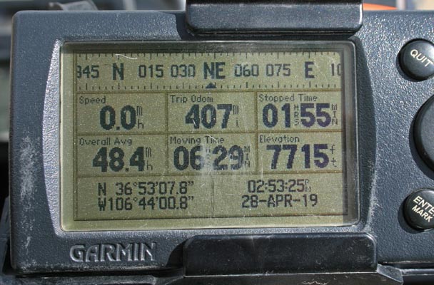
#23, on US-64/US-84 east of Dulce. USGS 36 53 08N 106 44 00W GPS 36 53 08N 106 44 01W Sign: Elevation 7,275 Ft. |
New Mexico map |
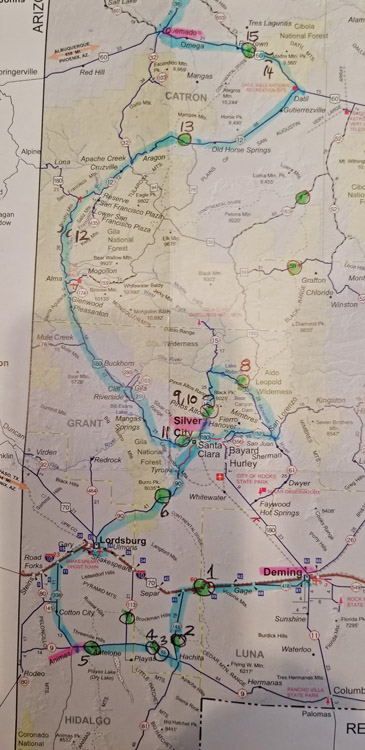
New Mexico map, Deming to Quemado. |
New Mexico map, Aragon to Chama. |
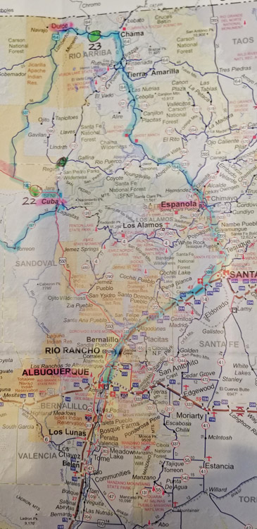
New Mexico map, Dulce to Albuquerque. |
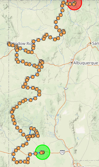
Data from SPOT Gen3 satellite tracker. |
Note: The USGS coordinates were provided by Scott Westfall who did an excellent job of finding the coordinates
of the intersections of the Continental Divide and the paved highways. The GPS coordinates were as displayed
on my Garmin GPS V where we stopped at the signs, or in the case where there was not a sign, as close to the
USGS coordinates as was feasible. Usually the signs are well-placed by the highway department but sometimes they
are some distance from the location provided by the USGS data.
| Feature Name | ID | Class | County | State | Latitude | Longitude | Ele(ft) | Map | BGN Date | Entry Date |
| Satan Pass | 897564 | Gap | McKinley | NM | 353435N | 1080826W | 7500 | Hosta Butte | 01-JAN-1990 | 01-MAR-1990 |
| Saliz Pass | 910567 | Gap | Catron | NM | 333433N | 1085446W | 6443 | Saliz Pass | - | 13-NOV-1980 |
| Tucker Gap | 895877 | Gap | McKinley | NM | 355331N | 1074200W | 6922 | Pueblo Pintado | - | 13-NOV-1980 |
| West Pass | 912617 | Gap | Catron | NM | 341530N | 1075732W | 8110 | Madre Mountain | 01-JAN-1982 | 31-AUG-1992 |