
Old Alpine Tunnel, west portal
|
Old Alpine Tunnel, west portal |
Old Alpine Tunnel, west portal - Gunnison County - Colorado - 11,555 feet
Middle Quartz Creek to south.
FR-839 northeast of Pitkin
gravel - dual sport
photos by Randy Bishop, 7/7/2007 during the BMWMCC Dirty Dozen ride
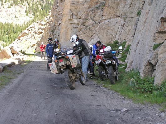
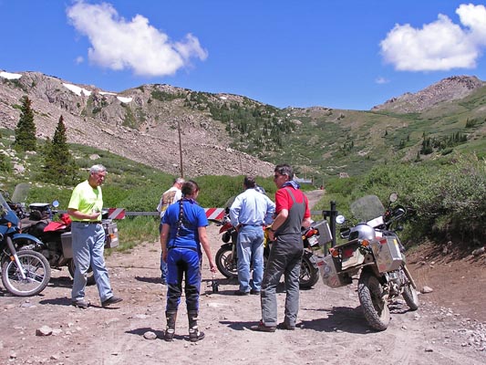
At The Pallisades. |
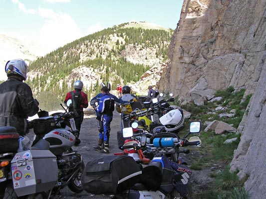
At The Pallisades. |
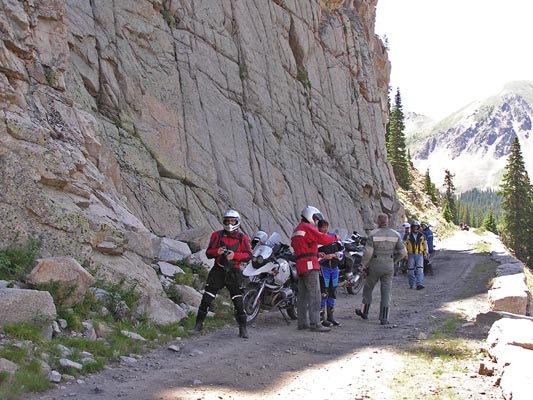
At The Pallisades. |
At The Pallisades. |
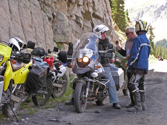
At Alpine Station. |
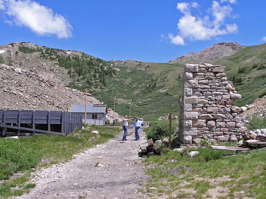
At Alpine Station. |
At Alpine Station. |

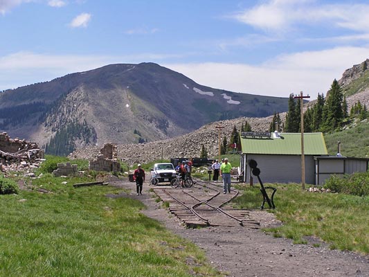
At the caved-in west portal of the tunnel. |
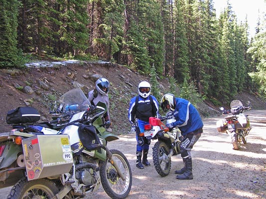
Refueling on the way to Pitkin. |

Google Maps |
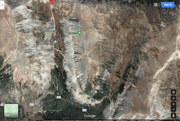
Google Maps |
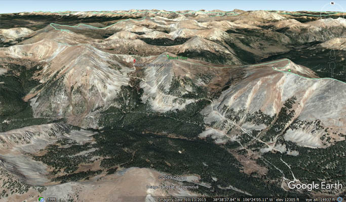
Google Earth |
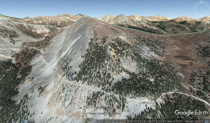
Google Earth |
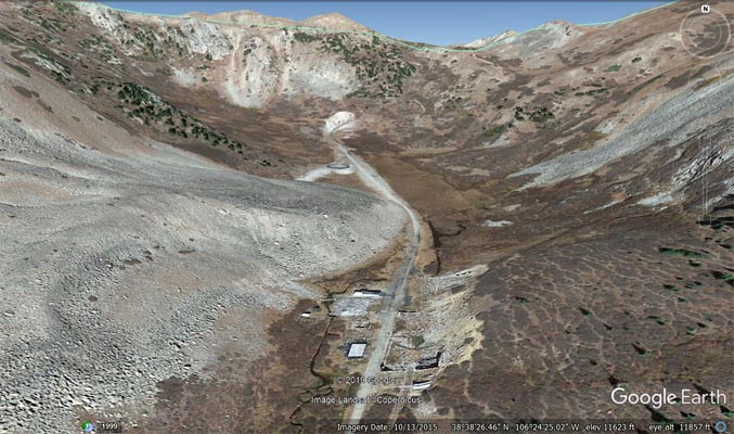
Google Earth |
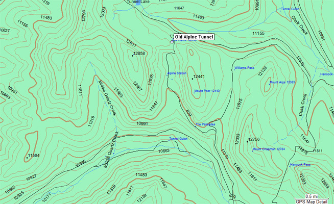
Garmin MapSource |
| Feature Name | ID | Class | County | State | Latitude | Longitude | Ele(ft) | Map | BGN Date | Entry Date |
| Old Alpine Tunnel (historical) | 203901 | Tunnel | Chaffee | CO | 383852N | 1062424W | 11939 | Cumberland Pass | - | 13-OCT-1978 |
| Feature Name | ID | Class | County | State | Latitude | Longitude | Ele(ft) | Map | BGN Date | Entry Date | |
| Alpine Station | 197491 | Locale | Gunnison | CO | 383826N | 1062429W | 11555 | Cumberland Pass | - | 01-JUL-1992 | |
| The Palisades | 197488 | Cliff | Gunnison | CO | 383746N | 1062401W | 11424 | Cumberland Pass | - | 01-JUL-1992 | |
| Williams Pass | 189337 | Gap | Chaffee | CO | 383830N | 1062322W | 11781 | Cumberland Pass | - | 13-OCT-1978 |