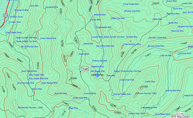
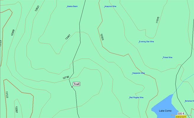
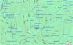
Poughkeepsie Pass - San Juan Counties - Colorado - 12,740 feet
Uncompahgre River to north. Cement Creek to south.
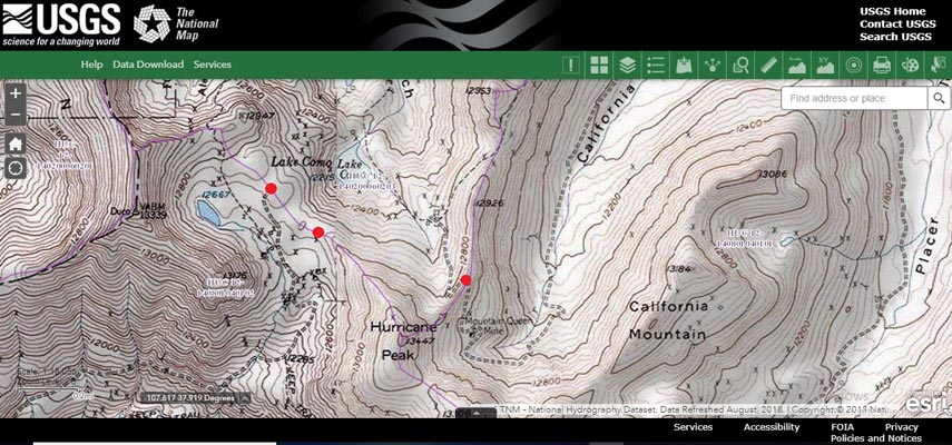
North of Silverton and 1-2 miles northwest of Hurricane Pass.
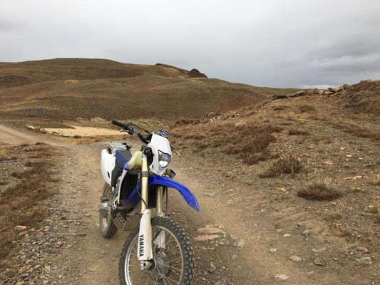
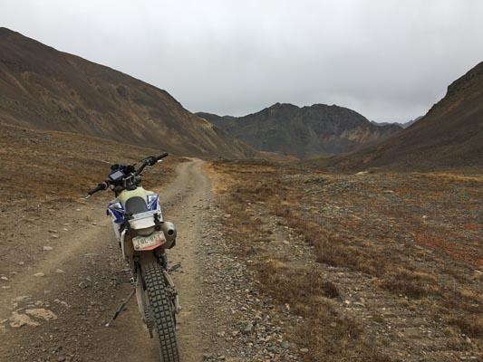
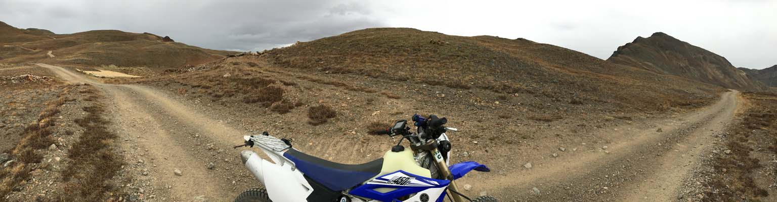
off-road - dirt bike or dual sport
Note from Randy: See information below concerning “The California/Hurricane/Poughkeepsie Pass Conundrum”.
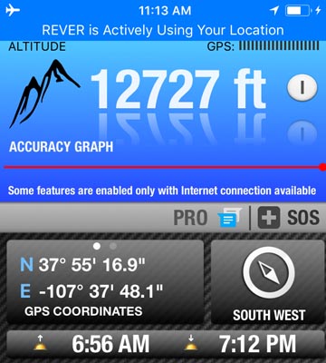
Per the spreadsheet, per Bob Bump in 2006, Poughkeepsie Pass summit = 37 55 18N 107 37 48W.
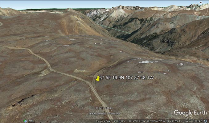
"south summit, below" = 37 55 16.9N 107 37 48.1W, per display of John's GPS.
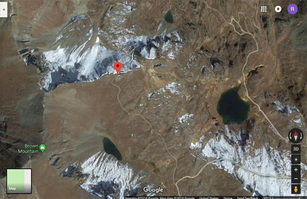
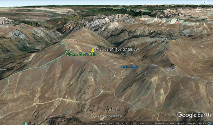
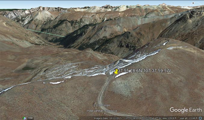
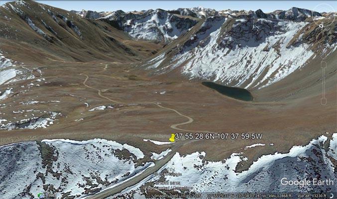
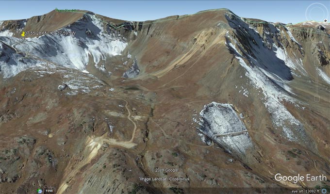
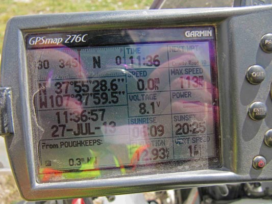
"north summit, below" = 37 55 28.6N 107 37 59.5W, per photo of Karst's GPS display.
photos by John Meyer, 9/19/2018

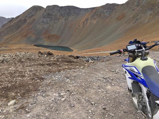
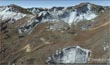
At the south summit, looking north.
|

At the south summit, looking south.
|
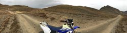
At the south summit, looking west.
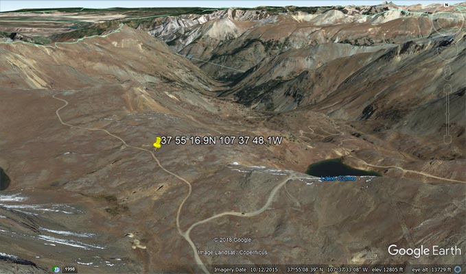
Per spreadsheet. 37 55 16.9N 107 37 48.1W
|

At the south summit.
|
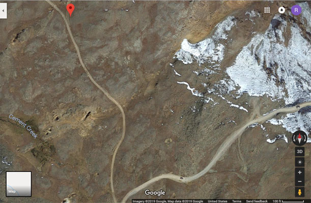
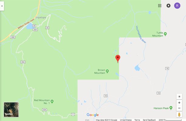
Google Maps, south summit.
|

Google Maps, south summit.
|
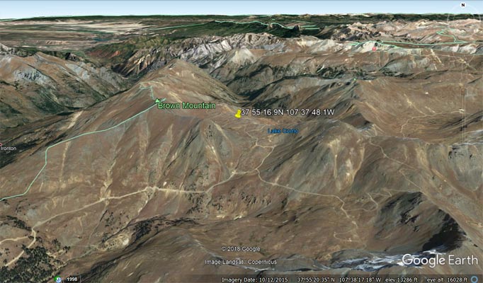
Google Earth, looking north toward south summit.
|
Google Earth, looking north toward south summit.
|
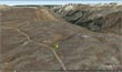
Google Earth, looking north at south summit.
|

Garmin MapSource, south summit.
|

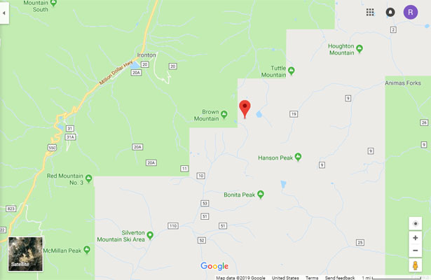
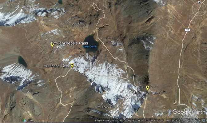
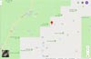
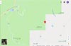
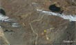
Google Maps. Green pointer at California Pass, white dot at Hurricane Pass, red pointer at Poughkeepsie Pass (south summit).
|

Google Maps. Green pointer at California Pass, white dot at Hurricane Pass, red pointer at Poughkeepsie Pass (south summit).
|

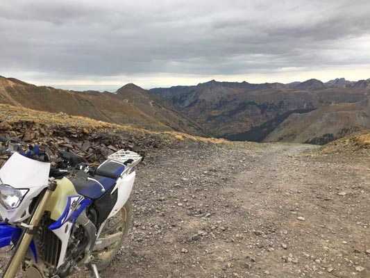
At the north summit, looking south.
|

At the north summit, looking north.
|
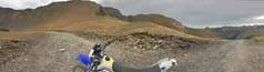
At the north summit, looking west.
37 55 28.6N 107 37 59.5W
|
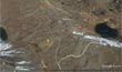
Google Maps, north summit.
|
Google Maps, north summit
|
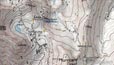
Garmin MapSource 2002, north summit.
Notice, road to Hurricane Pass is not shown.
|
Garmin MapSource, north summit.
|
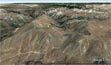
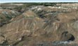
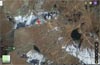
Google Earth, looking north toward north summit.
|
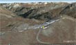
Google Earth, looking north from north summit.
|

Google Earth, looking south from north summit.
|
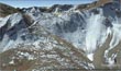
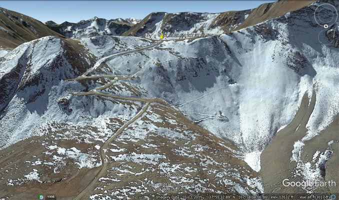
Google Earth, looking south toward north summit and "narrow shelf road...is extremely rugged and steep and has sheer drop-offs."
|
Google Earth, looking south toward north summit. Adelpheh and Alpha mines in forground? Hurricane Road in upper left.
|

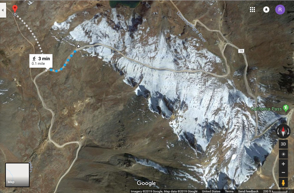
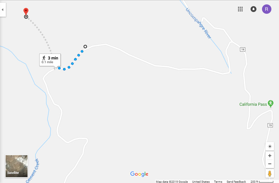
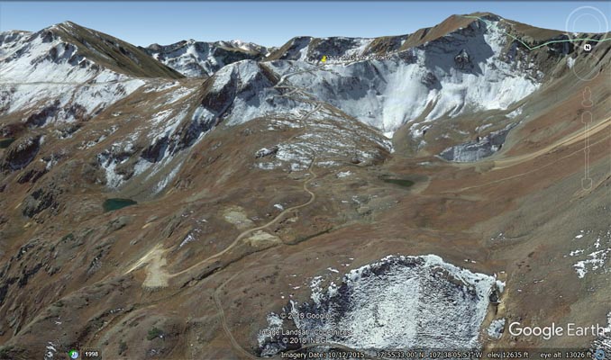
Google Earth, looking southeast toward north summit. Road/trail to right leads to Alaska Basin, Silver Creek and Uncompahgre River
|
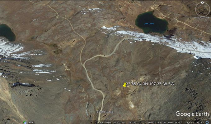
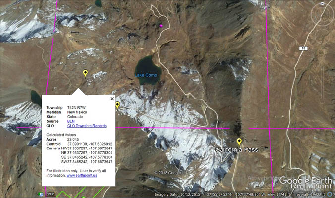
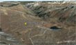
Google Earth. According to the BLM Archaeologist for the Gunnison Field Office, the Adelpheh and Alpha mines are 1700'
southwest of Como Lake, which puts them at 37 55 04.3N 107 37 38.7W. Hurricane Pass is directly north.
|
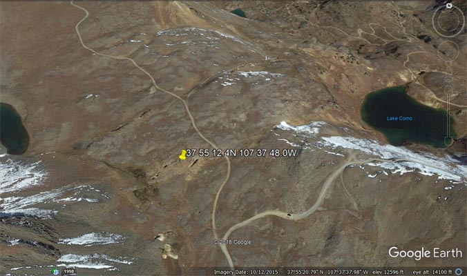
Google Earth. Or maybe these are the mines, also 1700' in the southwestern direction from Como Lake, at
37 55 12.4N 107 37 48.0W, the Poughkeepsie townsite as described by Scott.
|

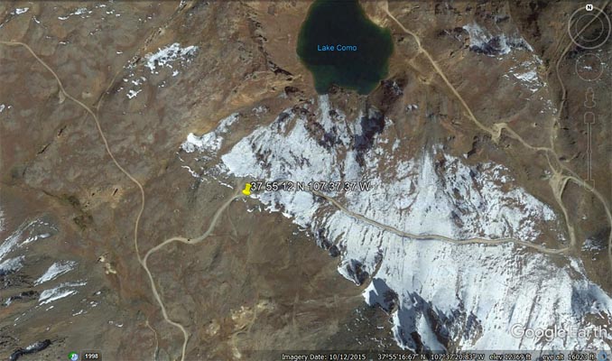
Google Earth. Hurricane Pass at 37 55 12 N 107 37 37 W, with the mine tailings to the south and west of the summit. It again
is looking like Helmuth's description of Poughkeepsie Pass and the BLM "Hurricane Pass" signage are the same place.
|
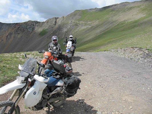
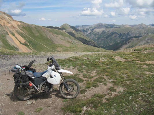
photos by Karst Postma, 7/27/2013

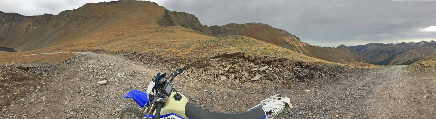
At the north summit, looking south.
|

At the north summit, looking north.
|

At the north summit.
37 55 28.6N 107 37 59.5W
|
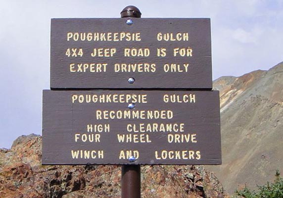
Note from Karst: A mile North of Hurricane Pass. That mile section is pretty easy.
From everything I hear, going down Poughkeepsie Gulch is impossible for bikes.

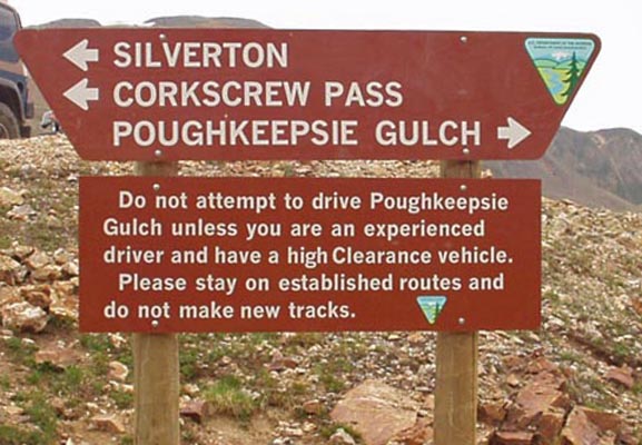
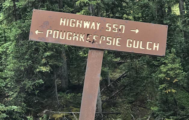
Sign for nearby Poughkeepsie Gulch.
|

Sign for nearby Poughkeepsie Gulch.
|

Sign for nearby Poughkeepsie Gulch.
|
The summit of Poughkeepsie Pass is located at 37 55 18N 107 37 48W, per the spreadsheet, per Bob Bump in 2006.
Recognized in "The Passes of Colorado, An Encylopedia of Watershed Divides" by Ed Helmuth & Gloria Helmuth.
Is not included in United States Board on Geographic Names.
Other geographic features in the area, from United States Board on Geographic Names:
| Feature Name |
ID |
Class |
County |
State |
Latitude |
Longitude |
Ele(ft) |
Map |
BGN Date |
Entry Date |
| Poughkeepsie Gulch |
187201 |
Valley |
San Juan |
CO |
375753N |
1073734W |
10151 |
Ironton |
- |
13-OCT-1978 |
| Poughkeepsie Mine |
1734769 |
Mine |
San Juan |
CO |
375625N |
1073731W |
11148 |
Handies Peak |
- |
14-MAY-1997 |
“The California/Hurricane/Poughkeepsie Pass Conundrum”
(The term used by Sallie Varner in her book, “Crossing the High Divide, A Guide to 81 Passes 12,000
Feet & Higher in the Colorado Rockies”, page 273.)
| Author |
California Pass |
Hurricane Pass |
Poughkeepsie Pass |
USGS Geographic Names
Information System (GNIS), 2019 |
No, but does list
California Gulch. |
No, but does list
Hurricane Peak. |
No, but does list
Poughkeepsie Gulch and Mine. |
| BLM Sign |
Yes, as early as 2010. |
Yes, as early as 2006. |
No. |
Coordinates on spreadsheet
from Bob Bump, 2006. |
Not included. |
37 54 53 N
107 37 15 W |
37 55 18 N
107 37 48 W |
Coordinates on current
spreadsheet per
personal observation. |
Added 11/27/2010
Updated 12/29/2018
37 55 04 N
107 37 03 W |
Updated 12/11/2013
37 55 12 N
107 37 37 W |
Deleted 1/8/2019
Added as alias to Hurricane. |
Clyde & Chloe
Edmondson, 1963 |
No |
No |
No |
| Marshall Sprague, 1964 |
No |
No |
No |
Ed Helmuth & Gloria
Helmuth, 1994 |
No |
Yes, with description
of current California Pass. |
Yes |
| Charles A. Wells, 1998 |
Yes |
Yes |
No |
Peter Massey & Jeanne
Wilson, 1999 |
Yes |
Yes |
No |
| Sallie Varner, 2010 |
Yes |
Yes |
No |
For more information about the authors’ books, check Pass Bagger resources.
From Scott Westfall, 1/30/2019:Awesome! The description of the two mines’ location places them co-located with
the short-lived mining town of Poughkeepsie, which was southwest of Lake Como and just west/northwest of the current
Hurricane Pass sign. I’m curious if the path over the mini-saddle to the north of that spot into Alaska Basin would
serve as a third pass? I still can’t find any other geographic passes along the two pack trails in that area — now
designated as county roads.
From Kristi Murphy, BLM Gunnison Field Office, 1/29/2019:The BLM Archaeologist for the Gunnison Field Office
dug up some information that might help you. "All three passes show on the 1897 Silverton Topo map as pack trails.
The pass names are not given but all of the associated geographic names (CA Gulch, CA Mtn, Hurricane Mtn, Poughkeepsie
gulch...) are there. It can only be assumed that early miners named each pass based on the saddle of mtn the pass
traversed over but the names were never officially recognized by the USGS. The Adelpheh and Alpha mines are located
approx 1700' SW of Lake Como along County Road 10."
From Randy, 1/11/2019: After much discussion we came to the conclusion (maybe) that Poughkeepsie Pass as
described in Helmuth's is actually another name for Hurricane Pass. After updating much on this page, now I am
thinking Poughkeepsie Pass's coordinates should be those shown above as the "north summit" rather than the ones
shown above as the "south summit". I am also wondering if CR-10 over Hurricane Pass was constructed, or significantly
widened, sometime after 1994 when Helmuth's was published. And maybe at that time the BLM placed the signs for Hurricane
Pass and California Pass. I will contact the BLM office in Montrose and the San Juan County road department in
Silverton to see if we can get some background from them.
From Scott Westfall, 1/7/2018: I feel like I've had this discussion before--maybe sometime last year. But I've drank
and slept since then so who knows. Fact is, there are several sources directly contradicting each other on the naming and
locations of California, Hurricane and Poughkeepsie Passes in the San Juans. My assessment is that there are three names for
only two distinct passes. Explanations below....
California Pass
Varner: 37° 55.068' N 107° 37.048' W, 12930'
Helmuth: NA
PB SS: 37° 55' 03"N 107° 37' 03"W, 12930' Handies Peak Topo
There is a wooden sign that adorns (and thereby popularly labels) California Pass as we now know it. I haven't found any other
reference that calls this location California Pass. That sign has some clout now, as everyone that goes over the pass knows it
as California (see also: cyclepass.com/t_p_California.html). So regardless of prior published works, I can't see how a prominent
sign is going to get overruled via overwhelming photographic evidence. Seems like this spot just needs to keep its coordinates
in the spreadsheet and just get an alias assigned.
Hurricane Pass
Varner: 37° 55.221' N 107° 37.625' W 12745'
Helmuth: T42N R7W, 12850' Handies Peak Topo Quad
PB SS: 37° 55' 12"N 107° 37' 37"W 12850'
Helmuth basically describes California Pass to a T, but refers to it as Hurricane Pass based on Gregory and Smith's 1987 book
"Mountain Mysteries". Unfortunately, the same phenomenon happens here as at California Pass--there is a wooden sign at Varner's
location that everyone now identifies as Hurricane Pass regardless of Helmuth's statements to the contrary. So again it seems
like Hurricane needs to keep its coordinates in the spreadsheet, get the topo map changed to Ironton, and add Poughkeepsie as an
alias (see below).
Poughkeepsie Pass
Varner: NA
Helmuth: T42N R7W, 12740' Ironton Topo Quad
PB SS: 37° 55' 18" N 107° 37' 48" W 12740' Ironton Topo Quad
Sally Varner addresses the Poughkeepsie Pass issue on page 273 of her 2010 book "Crossing the High Divide: A Guide to Passes 12,000
& Higher in the Colorado Rockies". She does not present a profound conclusion as to where Poughkeepsie Pass actually sits. Her
hypothesis is that there are only two passes up there and that both Hurricane and California Passes (now well-known and marked with
signs) have each taken on the name Poughkeepsie over the years. She cites Helmuth in this final assessment, but I find that Helmuth
gives more clues as to its true location.
Helmuth's source for Poughkeepsie is an 1880 book called "Colorado: A Historical, Descriptive and Statistical Work on the Rocky Mountain
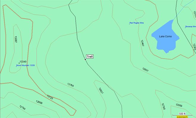
Gold and Silver Mining Region" by Frank Fossett. In this book, Poughkeepsie Pass is listed as being atop a pack route that runs north
from Silverton along Cement Creek up to the pass, and being along a ridge that divides the Cement Creek and Uncompaghre River watersheds.
Using the watershed boundary dataset overlay on the topo map (below), we can see that California Pass divides Uncompaghre and Animas
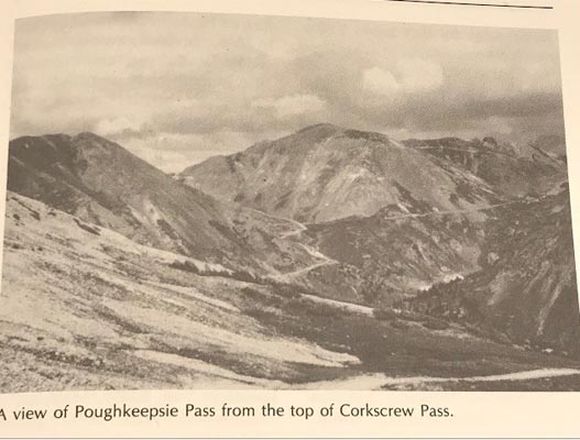
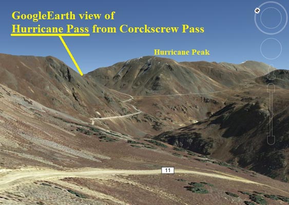
watersheds east-west, and is not along the Silverton-Ouray pack route. Helmuth provides a photo of Poughkeepsie's location in photograph on
page 169, looking east from Corkscrew Pass towards Hurricane Peak, with Hurricane Pass just visible in the saddle to the left (book and
Google Earth comparisons, below). Helmuth also says that Poughkeepsie is in the Ironton topo quad which is true also of Hurricane Pass,
but not California Pass which falls within the Handies Peak topo quad. Helmith further mentions that H.A.W. "Silver Dollar" Tabor's Adelpheh
and Alpha mines are at the pass summit. These mines' locations are not shown on the topo maps, but Hurricane Pass is co-located with more
than a dozen mine sites, while California Pass shows no mines atop that spot. In my opinion California Pass' location is completely eliminated
as an alias for Poughkeepsie, which is most likely located where the current Hurricane Pass sign is situated. I think Poughkeepsie should be
removed from the PB spreadsheet as a unique location and added as an alias for what is now known as Hurricane Pass (where the sign is, on the
west side of Hurricane Peak).
Additional supporting photos and screenshots:

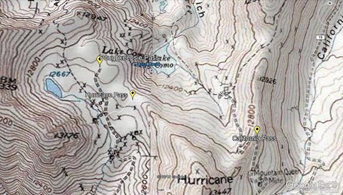
Google Earth, terrain, California, Hurricane and Poughkeepsie Passes
|
Google Earth, topo, California, Hurricane and Poughkeepsie Passes.
|
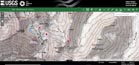
USGS Topo showing watershed boundaries.
|

Photo from Helmuth's.
|

Same view from Google Earth.
|

Google Earth, terrain, with PLSS overlay showing Hurricane and Poughkeepsie in T42N R7W Ironton quad.
|
From John Meyer, 1/6/2018: It is interesting that you should ask about Poughkeepsie since we ran into a local who was driving a “tour
Jeep” in the area and he was not familiar with it. He and another local talked about a difficult descent beyond California Pass that was not
suitable for a motorcycle which where they thought I might find it, however when I descended that area and could not see where a “pass” would
be I thought I should stop and referred to Helmuth’s description & the coordinates on your website which is where I believe the pass is located.
The reason I had 2 locations was one is on the high point of a currently used road that accessed a lake on the other side (this may be where
Karst recorded his coordinates). The second photo is just SE along the same road which was a spur off the road that had large boulders blocking
an obvious old road which I believe is where the original road crested the top. (Please see the above photos of the spot with the old spur and
large rocks.) Since both Hurricane & California are marked with signs, I believe they are correct.
From Karst Postma, 7/27/13: Poughkeepsie Pass is a mile north of Hurricane Pass. That mile section is pretty easy. From everything I hear
going down Poughkeepsie Gulch is impossible for bikes. The spreadsheet needs a minor fix for the location of this pass.
From Leif Rudd, 12/13/2013:So if we go by the Forest Service signage, California and Hurricane are distinct. Now that I've had this
revelation, I checked my GPS and indeed I had it along for California, and marked a waypoint of 37.91750 -107.61760 at the sign. That is
(correctly) distinct from Hurricane at 37.92005556 -107.6270556 (per your DMS coords).
So... wow, a lot of corrections to make, plus I simply don't have California in my list, which I'm a bit embarrassed about. I believe (watch me
squirm) that I didn't add it, thinking that Hurricane was its more official name. Now that we have proof I think we're well on our way toward
straightening this out. Please have a look at one more photo, and let me know if my label is correct. I think I have a photo of Hurricane, from
California. I circled and highlighted what I think is a likely candidate.
From Karst Postma, 5/14/dd/2012: Where you show Hurricane Pass I have California Pass. See also attached for where I believe Hurricane is
located. Clicking around on Google Earth also show California and Hurricane this way. I looked in “Guide to Colorado Backroads & 4 Wheel Drive Trails.
See below. It puts Hurricane pass just a bit east from where I believe it is. I put it on the high point in the road at N37 55 12.2 W107 37 37.4.
This is supported by Google Earth as well. Lastly, I have as photo of me on Hurricane with the sign in the background. The elevation is supported
by the topo location I have. I agree with you that Helmuth places it at where California Pass I shown. I am inclined to think Helmuths is not correct
in this case. However, I do not have hardcopy topo to refer to.
From Leif Rudd, 4/15/2012:Hi guys. Here's what I know, or have researched. Hurricane Pass, which the Helmuths put on the NE flank of Hurricane
Peak, is indeed a bit further NE than the 37°54'53" -107°37'15" I have in my spreadsheet. It should be 37.917456,-107.617564 per my click in Google,
which makes it 37° 55' 2.842'' 107° 37' 3.23''. I have made that correction on my local master, and will get it on my site list at some point.
Virtual Earth satellite (will get to this in a minute) clearly shows a small parking lot / turnabout at 37.917657 -107.617575, which is 23 meters
off (north-south) from Google. I'm not sure if this discrepancy is due to my error (clicking), error on one or heck both of the sites, or perhaps
they use different coordinate systems. I'm betting it is related to my clicking. For the Virtual Earth view, I used the super-useful GMapCatcher
software, which I just discovered last night. If you don't already have it, I highly recommend it. Every host's maps at every zoom level that you
view in it are permanently cached for offline use. It also supports GPS device input, and to that end I just ordered this one from Amazon yesterday.
The USGS features list (from 2009-Oct-02) doesn't list Hurricane Pass.