
Sierra Madre Pass
|
Sierra Madre Pass |
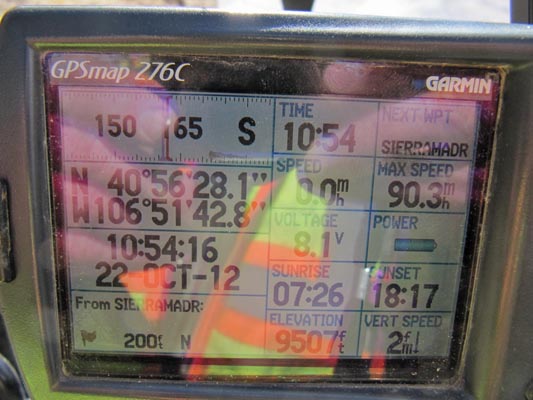
Sierra Madre Pass - Routt / Jackson Counties - Colorado - 9,507 feet - on the Continental Divide
Middle Fork Little Snake River to west. South Fork Hog Park Creek to east.
On FR-500 north of Steamboat Springs, and northeast of Columbine.
In the Sierra Madre Mountains. Mount Zirkel Wilderness is on the east side of the Divide.
gravel, dirt - dual sport
photos by Karst Postma, 10/22/2012
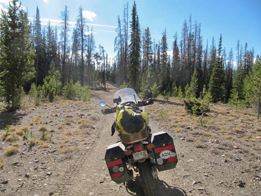
Near the summit. |
At the summit. |
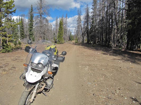
At the summit. |
At the summit. |
Near the summit. |
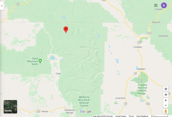
Google Maps |
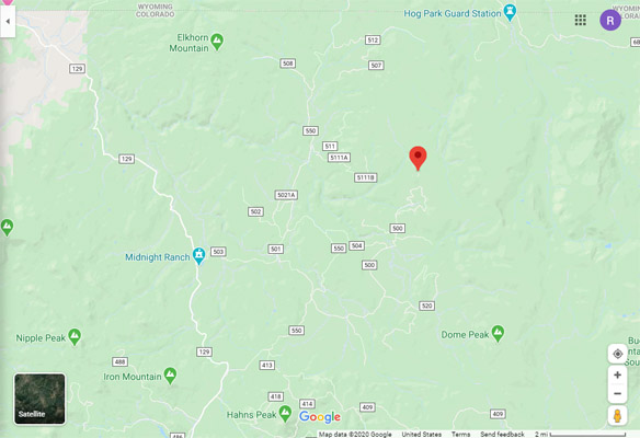
Google Maps |
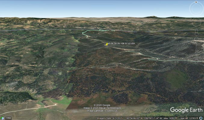
Google Earth |
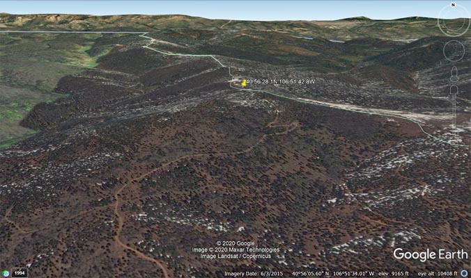
Google Earth |
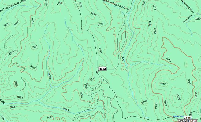
Garmin MapSource |
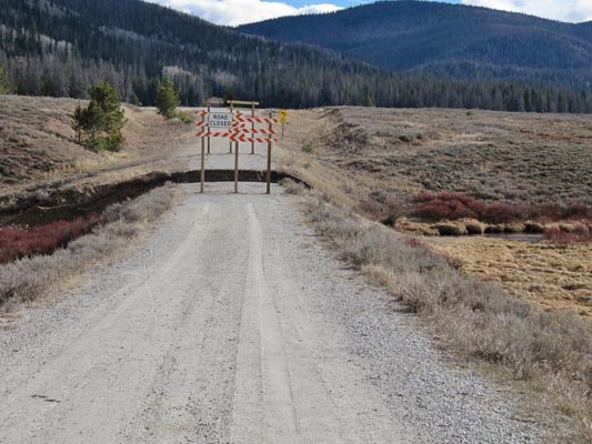
Notes from Karst: I first tried to come in from the north, coming from Hog Park West. That did not work for
me, so I came in from the south on FR-550 to FR-500. The first couple of miles on FR-500 were good, until I
got the sign in the attached picture: road washed out at King Solomon Creek. Fortunately there was a bypass
and, yippee, a water crossing. You don’t find many of those in Colorado. The situation reminded me of
Kyrgyzstan, except that there were signs warning you of the washout. Minor detail. After the washout and
the water crossing the road got bad quickly and got worse as it goes along. Rutted, rocky, muddy, you name
it. Good fun, but one needs to pay attention. I took one wrong turn about a half mile from the pass which
led me up a steep slope with deep loose dirt. I could not get any traction and it would have turned into a
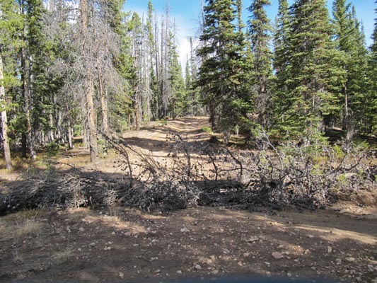
clutch smoker, if not a clutch burner. I got off and walked around and found a better way. However, lots of
trees across the roads the last half mile.
The topo shows quit a few nonexistent or long abandoned roads, but FR-500 is pretty much self guiding until
the last half mile. I made it on the R1150GS without too much trouble.
| Feature Name | ID | Class | County | State | Latitude | Longitude | Ele(ft) | Map | BGN Date | Entry Date |
| Middle Fork Little Snake River | 169887 | Stream | Routt | CO | 405936N | 1070251W | 7001 | Shield Mountain | 13-OCT-1978 | 13-AUG-2019 |
| South Fork Hog Park Creek | 169919 | Stream | Carbon | WY | 410123N | 1065043W | 8284 | Dudley Creek | - | 06-MAY-1979 |
| Sierra Madre | 169920 | Range | Carbon | WY | 411121N | 10702501W | 10961 | Bridger Peak | 13-OCT-1978 | 11-MAR-2011 |