
Yellowjacket Pass
|
Yellowjacket Pass |
Yellowjacket Pass - Rio Blanco County - Colorado - 7,540 feet
(other names - Yellow Jacket)
Milk Creek to north. Coal Creek to south.
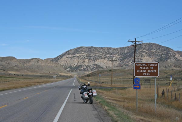
On CR-15 northeast of Meeker.
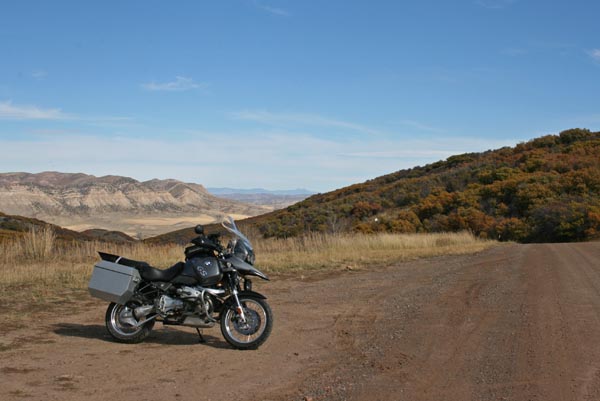
gravel - dual sport
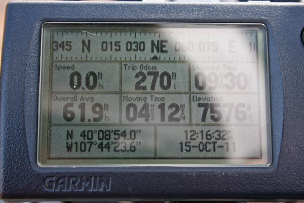
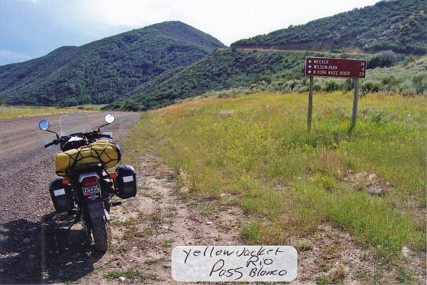
#135 - photos by Randy Bishop, 11/15/2011
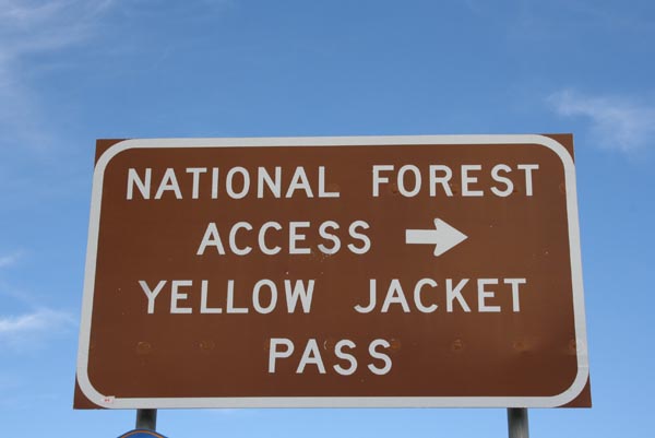
On CO-13 northeast of Meeker. |
On CO-13 northeast of Meeker. |
At the summit, looking north. |
At the summit, looking south. |
At the summit. |
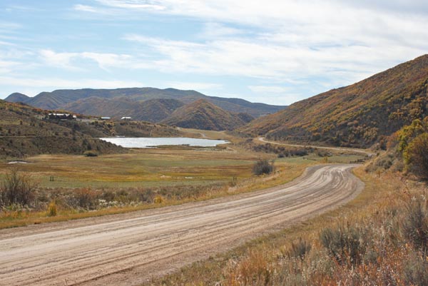
South of the summit, looking south. |
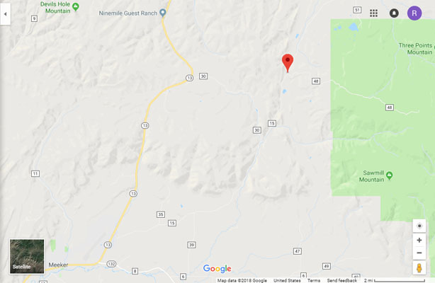
Google Maps |

Google Maps |
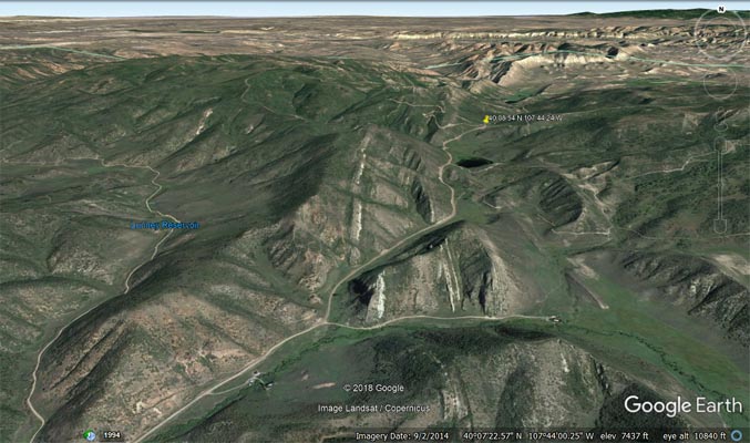
Google Earth |
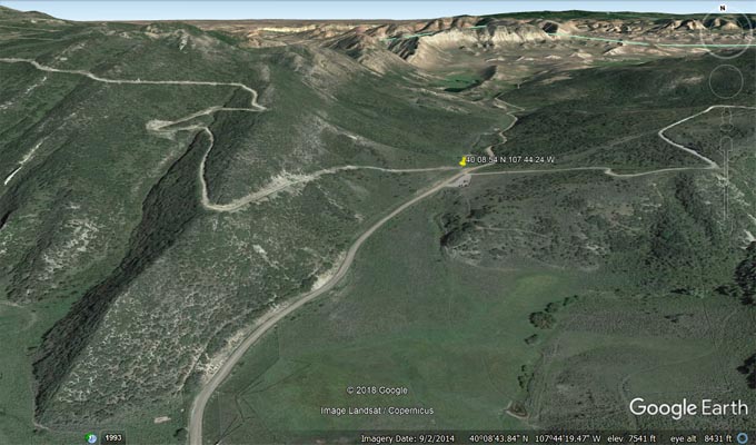
Google Earth |
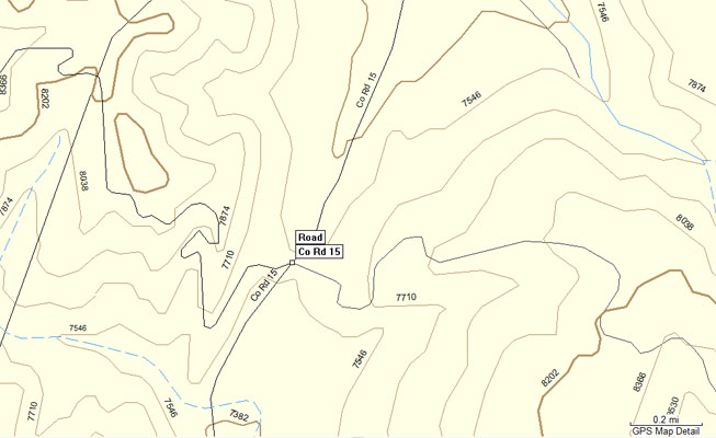
Garmin Mapsource |
Garmin Mapsource |
USFS White River National Forest |
Maps from Scott Westfall
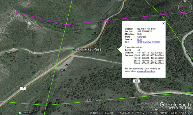
PLSS |
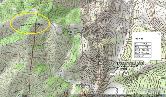
Topographic Map |
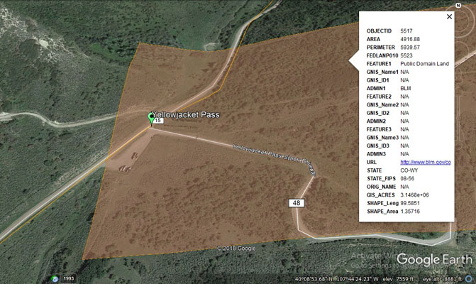
BLM overlay |
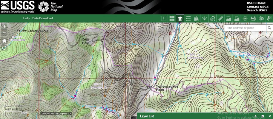
TNM with watershed boundary |
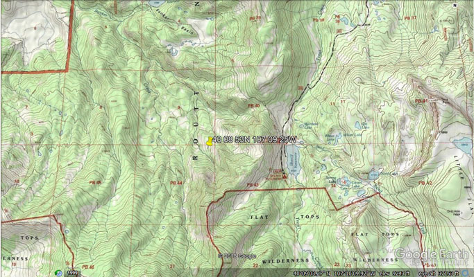
Topo showing location of incorrect GNIS coordinates. |
photo by Roamin Carloski
At the summit, looking south. |
| Feature Name | ID | Class | County | State | Latitude | Longitude | Ele(ft) | Map | BGN Date | Entry Date |
| Yellowjacket Pass | 173308 | Gap | Rio Blanco | CO | 400854N | 1070925W | 9950 | Dunkley Pass | - | 13-OCT-1978 |
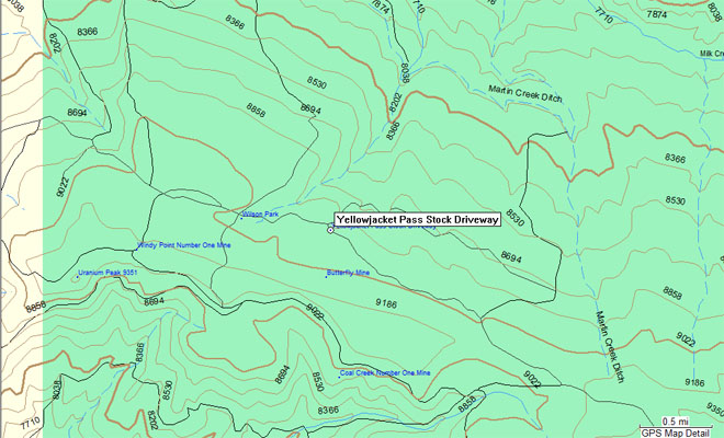
| Yellowjacket Pass Stock Driveway | 202143 | Trail | Rio Blanco | CO | 400800N | 1074012W | 8842 | Thornburgh | - | 13-OCT-1978 |
Notes from Scott Westfall:
The pass does have two spellings. Three different USGS sources (two maps and the GNIS database) spell it as one word, and a BLM road originating at the
the pass is named 'Yellowjacket Pass Stock Driveway.' Helmuth spells it with two words based on the 1873 origins of the pass name, which come from Yellow
Jacket Peak (1.4 miles WNW of the pass). The brown BLM access signon State Hwy 15 also uses two words. I think it should appear in the spreadsheet as
"Yellowjacket" with "Yellow Jacket" listed as an alias in the notes.
As for the location, the GNIS and actual location values are very close when put next to each other:
GNIS 40 08 53N 107 09 25W
Actual 40 08 53N 107 44 25W
All the values are the same except for the longitude minutes value. This error causes the GNIS coordinates to be incorrect, and I assume the elevation
and quad map were slaved to the coords. While the GNIS coords do happen to be at 9550' elevation, there are no geographic features within reasonable
distance of the GNIS coords that resemble a pass or gap, nor is there a watershed boundary going across that spot. The GNIS coords also are within the
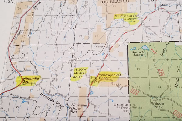
Routt National Forest boundaries, which conflicts with Helmuth's reference to public road through private lands. Helmuth also correctly identifies the
correct USGS quad map as Thornburgh, where the Berthoud Salt Lake Wagon Road went between Craig and Meeker.
My two cents: Yellowjacket Pass (Rio Blanco County) is on County Road 15, surrounded by BLM public lands, in the USGS Thornburgh quad,
in NE 1/4 of NW 1/4 of Section S17 T2N R92W, at 7540' elevation at coordinates 40°08'53"N 107°44'25"W.
Helpful mapping tools:
PLSS = Public Land Survey System, ArcGIS,(commonly referred to as Township and Range)
TNM = The National Map, USGS