
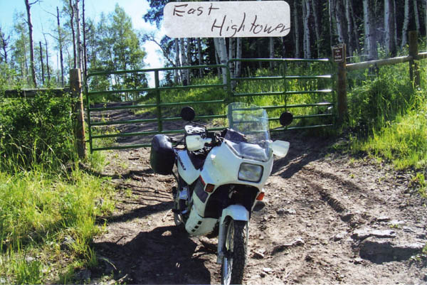
East Hightower Mountain Pass
|
East Hightower Mountain Pass |
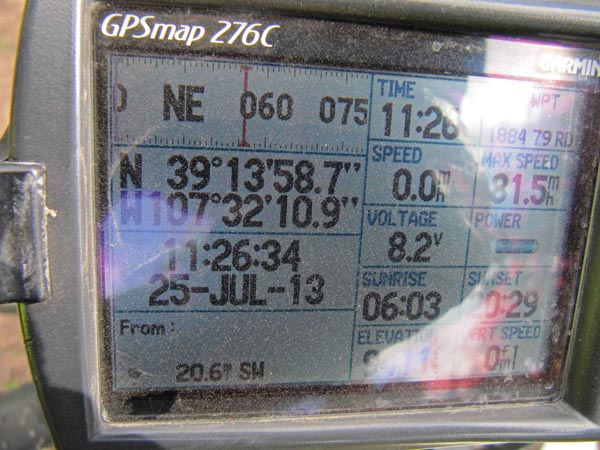
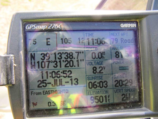
East Hightower Mountain Pass - Mesa County - Colorado - 9,390 feet
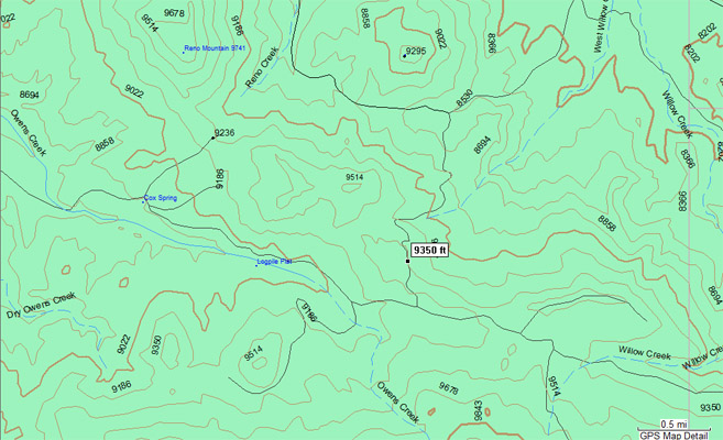
Owens Creek to west. West Willow Creek to east.
About 41 miles south of Silt on County and Forest Roads.
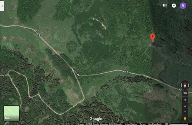
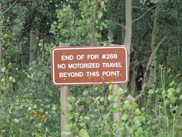
Last 7 miles on FR-268 (P E Road) and FR-841.
East of Hightower Mountain and south of Van Mountain.
Dirt - dual sport
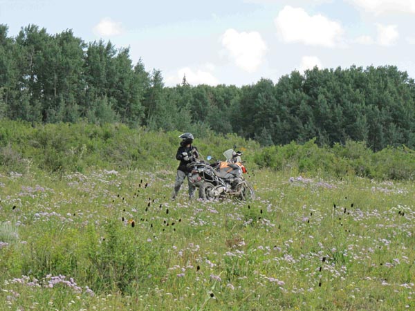
photos by Karst Postma, 7/25/2013
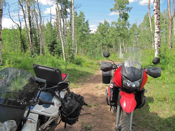
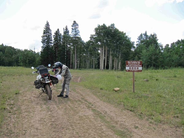
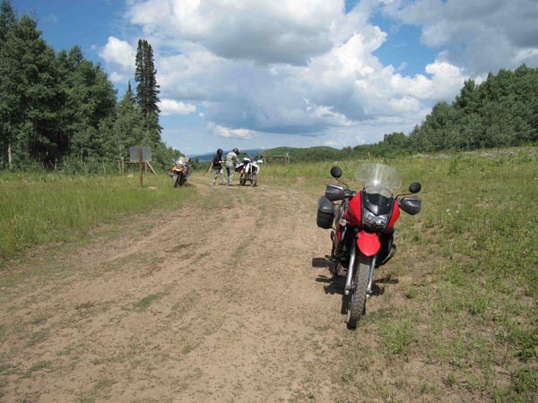
At the summit on FR-841. |
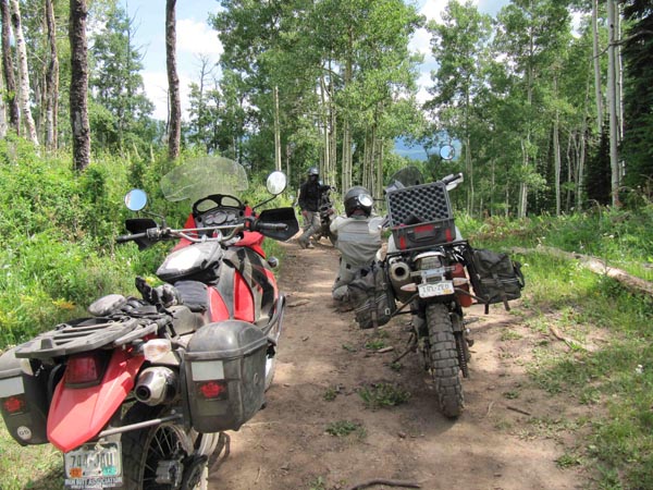
At the summit on FR-841. |
At the summit on FR-841. |
At the summit on FR-841. |
At the summit on FR-841. |
At the summit on FR-841. |
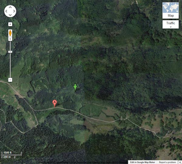
Google Maps. Green arrow at summit. |
Google Maps. Green arrow at summit. |
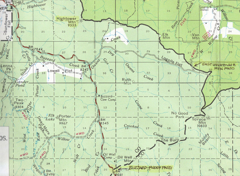
White River National Forest map |
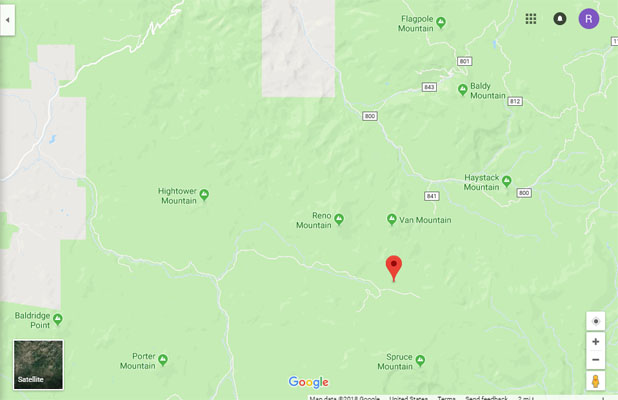
Google Maps |
Google Maps |
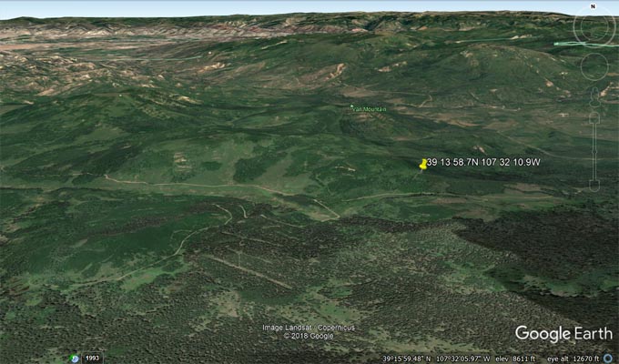
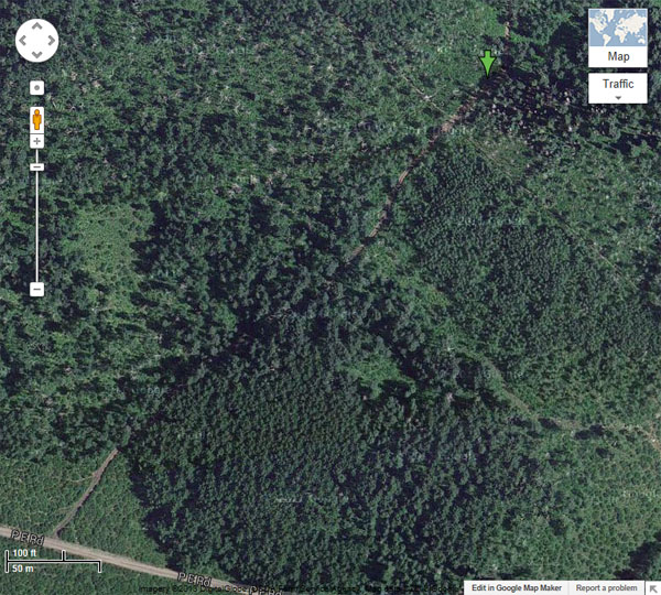
Google Earth |
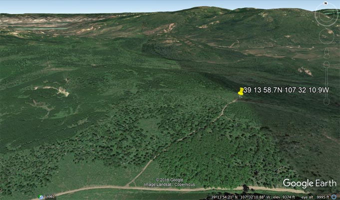
Google Earth |
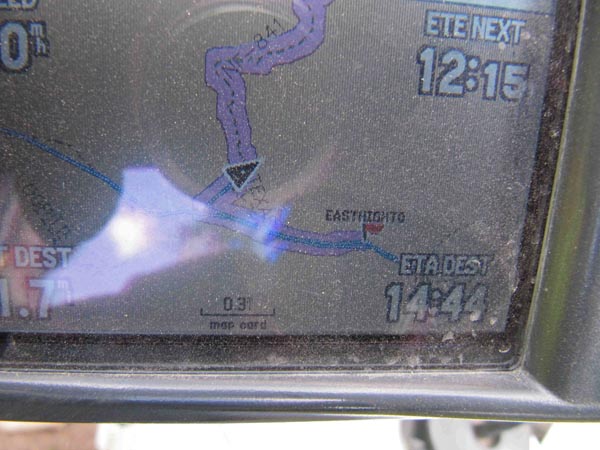
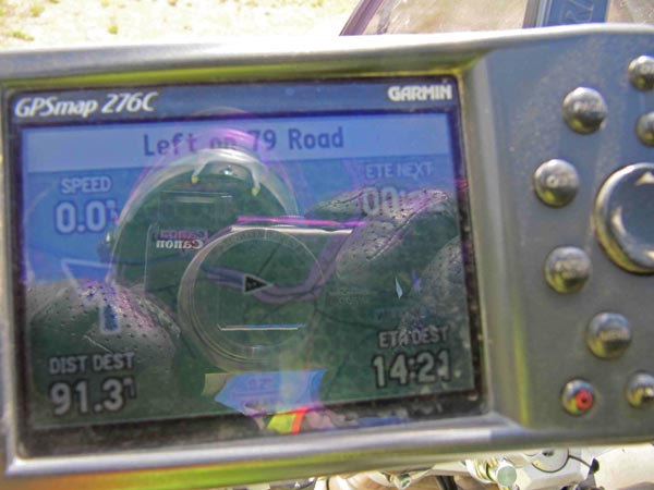
Garmin MapSource |
Continuing east on FR-268 leads to high point with Owens Creek to west and Willow Creek to east.
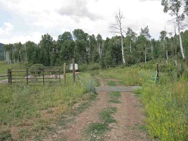
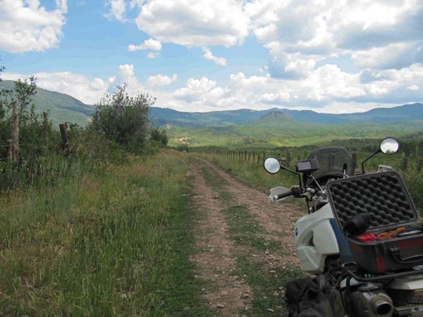
At the summit on FR-268. |
At the summit on FR-268. |
At the summit on FR-268. |
At the summit on FR-268. |
At the summit on FR-268. |
At the summit on FR-268. |
At the summit on FR-268. |
photo by Roamin Carloski
At the summit. |
Notes from Karst: This pass can be easily reached form the west over FR-268 and can be
accessed with big bikes with only moderate skills.
For a shortcut from East Hightower Mountain Pass to Haystack Gate, continue north on
FR-841. It will go up for less than a mile to a ridge and then wind down on a very narrow
wooded road. Lots of fun to be had. When you get to FR-800 turn east to get to Haystack Pass.
No place to be when wet. It can be done on big bikes but will require solid moderate to
intermediate skills. Much easier on smaller bikes. The road is steep in places and will
require picking a path carefully as you go along.
You will pass a few gates that are only there to keep the cattle in place. You go thru these
gates as long as you close them again behind you. You will also pass thru some private property,
but the road is for public access.
Notes:
From Helmuths': The pass is not named on forest service or topo maps. It was identified by Koch in
The Colorado Pass Book.
Excerpting from Don Koch’s The Colorado Pass Book, Second Edition, Pruett Publishing Company, 1987:
A Sampler of Additional Pass Roads. … Hightower Mountain Passes … This set of two pass roads, one
little-known and the other utterly obscure, was suggested to me by Will Davis. … they both start from
the west on Buzzard Creek and travel around opposite sides of Hightower Mountain … West Hightower
Mountain Pass, if we may call it that, is the more readily traveled of the two roads … Starting from
the west, the road to East Hightower Mountain Pass … continues southeast along Buzzard Creek to a less
well-traveled road at Owens Creek, ascending … easterly. About a mile from the boundary of White River
National Forest, a rough side road to the north (left) crosses a nearby divide and then it descends by
a four-wheel-drive route along West Willow Creek to a road juncture several miles below the pass summit.
The north-south road along Buzzard Creek is FR-265. The road heading east along Owens Creek is FR-268.
The rough road heading north to the pass is FR-841 which descends somewhat along West Willow Creek and
intersects FR-800 several miles away.
Koch's West Hightower Mountain Pass is more commonly called Buzzard Pass.