
CO-NM-OK Tripoint
|
CO-NM-OK Tripoint |
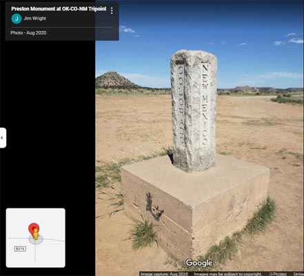
Tripoint of Colorado, New Mexico, and Oklahoma
Southern border of Colorado - Baca County - Colorado - 4,444 feet
Northeast corner of New Mexico - Union County - New Mexico
Northwest corner of Oklahoma - Cimarron County - Oklahoma
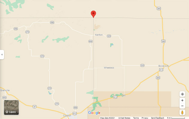
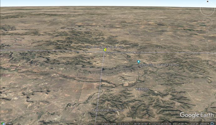
About 10 miles north of Kenton, OK, via OK-325, the Black Mesa Road, and Rd-A.
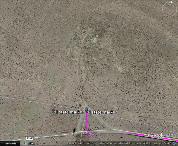
37°00'00.4"N 103°00'07.9"W == 37.000111N 103.002194W
paved, gravel - dual sport or street bike
photos and maps by Eric Marshall
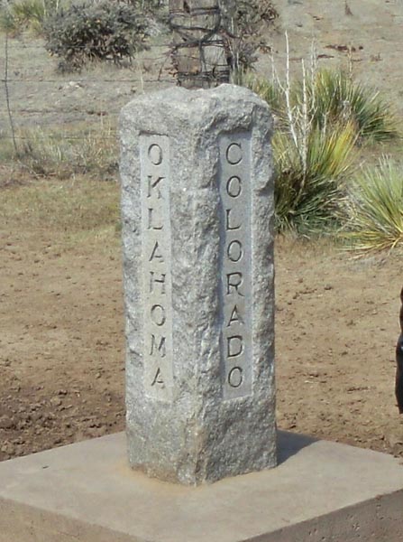
At the tripoint. |
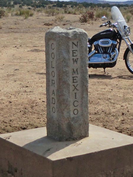
At the tripoint. |
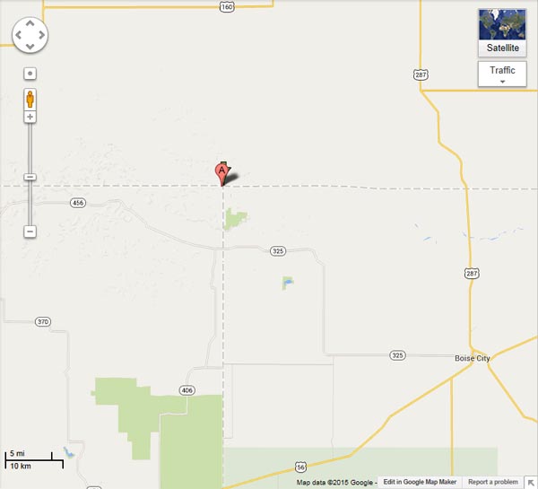
Google Maps |
Google Maps |

Google Maps |
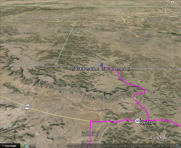
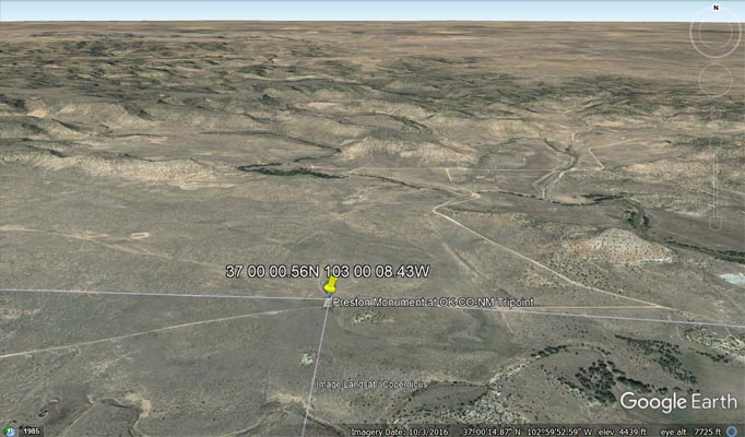
Google Earth |
Google Earth, 1881 loop to north. |
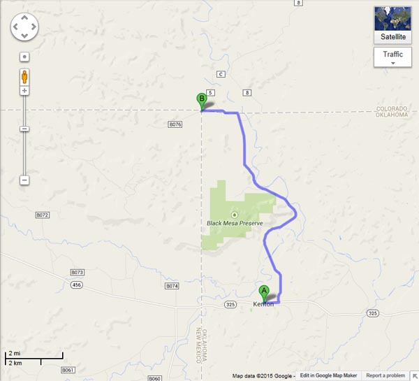
Notes from Eric: Photos taken during the Five State Poker Run. We only visit Colorado by heading on the road going north about a 1/2 mile
east of Kenton, OK. It winds around the eastern side of the Black Mesa and to the area known as the Blacksmith Canyon. This is my favorite
part of the ride. Once the road turns to the west for the most part, one side of the road in Colorado, the other side is Oklahoma. The punch
stop here for the poker run is about 1/4 mile from the tri-state marker. Access is via a gravel road. I always make the run up this way to
pay a visit. If you look closely in Google Earth, due north of the tri state corners is a dirt road that goes for some 325 yards to a small
loop. This was the original surveyed marker location back in 1881.
photo at the CO-NM-OK tripoint, from Google Maps
Google Maps |
Google Maps |

Google Maps |

Google Maps |
Google Earth |
Google Earth |

Garmin MapSource |